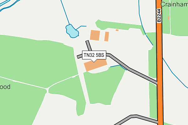
TN32 5BS is located in the Northern Rother electoral ward, within the local authority district of Rother and the English Parliamentary constituency of Bexhill and Battle. The Sub Integrated Care Board (ICB) Location is NHS Sussex ICB - 97R and the police force is Sussex. This postcode has been in use since December 2014.


GetTheData
Source: OS OpenMap – Local (Ordnance Survey)
Source: OS VectorMap District (Ordnance Survey)
Licence: Open Government Licence (requires attribution)
| Easting | 576901 |
| Northing | 123807 |
| Latitude | 50.986481 |
| Longitude | 0.519067 |
GetTheData
Source: Open Postcode Geo
Licence: Open Government Licence
| Country | England |
| Postcode District | TN32 |
➜ See where TN32 is on a map | |
GetTheData
Source: Land Registry Price Paid Data
Licence: Open Government Licence
Elevation or altitude of TN32 5BS as distance above sea level:
| Metres | Feet | |
|---|---|---|
| Elevation | 10m | 33ft |
Elevation is measured from the approximate centre of the postcode, to the nearest point on an OS contour line from OS Terrain 50, which has contour spacing of ten vertical metres.
➜ How high above sea level am I? Find the elevation of your current position using your device's GPS.
GetTheData
Source: Open Postcode Elevation
Licence: Open Government Licence
| Ward | Northern Rother |
| Constituency | Bexhill And Battle |
GetTheData
Source: ONS Postcode Database
Licence: Open Government Licence
| Cross Inn (Cripp's Corner Road) | Staplecross | 1,878m |
| K&esr Station (Bodiam Road) | Bodiam | 1,881m |
| Cross Inn (Cripp's Corner Road) | Staplecross | 1,885m |
| K&esr Station (Bodiam Road) | Bodiam | 1,909m |
| Bodiam (Kent & East Sussex Railway) | Bodiam | 1,850m |
| Robertsbridge Station | 3.5km |
GetTheData
Source: NaPTAN
Licence: Open Government Licence
GetTheData
Source: ONS Postcode Database
Licence: Open Government Licence


➜ Get more ratings from the Food Standards Agency
GetTheData
Source: Food Standards Agency
Licence: FSA terms & conditions
| Last Collection | |||
|---|---|---|---|
| Location | Mon-Fri | Sat | Distance |
| Brasses | 16:45 | 09:15 | 1,264m |
| Staplecross Post Office | 17:00 | 10:45 | 1,856m |
| Bodiam | 16:30 | 09:30 | 2,190m |
GetTheData
Source: Dracos
Licence: Creative Commons Attribution-ShareAlike
| Risk of TN32 5BS flooding from rivers and sea | Medium |
| ➜ TN32 5BS flood map | |
GetTheData
Source: Open Flood Risk by Postcode
Licence: Open Government Licence
The below table lists the International Territorial Level (ITL) codes (formerly Nomenclature of Territorial Units for Statistics (NUTS) codes) and Local Administrative Units (LAU) codes for TN32 5BS:
| ITL 1 Code | Name |
|---|---|
| TLJ | South East (England) |
| ITL 2 Code | Name |
| TLJ2 | Surrey, East and West Sussex |
| ITL 3 Code | Name |
| TLJ22 | East Sussex CC |
| LAU 1 Code | Name |
| E07000064 | Rother |
GetTheData
Source: ONS Postcode Directory
Licence: Open Government Licence
The below table lists the Census Output Area (OA), Lower Layer Super Output Area (LSOA), and Middle Layer Super Output Area (MSOA) for TN32 5BS:
| Code | Name | |
|---|---|---|
| OA | E00107201 | |
| LSOA | E01021104 | Rother 003D |
| MSOA | E02004394 | Rother 003 |
GetTheData
Source: ONS Postcode Directory
Licence: Open Government Licence
| TN32 5XB | Junction Road | 319m |
| TN32 5RJ | 1209m | |
| TN32 5PR | Church Lane | 1285m |
| TN32 5RA | 1321m | |
| TN32 5RL | Rock Hill | 1365m |
| TN32 5NB | Redlands Lane | 1451m |
| TN32 5RG | 1628m | |
| TN32 5UP | Knowle Hill Cottages | 1688m |
| TN32 5QD | 1719m | |
| TN32 5QW | Weald View | 1727m |
GetTheData
Source: Open Postcode Geo; Land Registry Price Paid Data
Licence: Open Government Licence