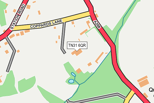
TN31 6QR is located in the Northern Rother electoral ward, within the local authority district of Rother and the English Parliamentary constituency of Bexhill and Battle. The Sub Integrated Care Board (ICB) Location is NHS Sussex ICB - 97R and the police force is Sussex. This postcode has been in use since January 1980.


GetTheData
Source: OS OpenMap – Local (Ordnance Survey)
Source: OS VectorMap District (Ordnance Survey)
Licence: Open Government Licence (requires attribution)
| Easting | 583537 |
| Northing | 125857 |
| Latitude | 51.002824 |
| Longitude | 0.614516 |
GetTheData
Source: Open Postcode Geo
Licence: Open Government Licence
| Country | England |
| Postcode District | TN31 |
➜ See where TN31 is on a map ➜ Where is Northiam? | |
GetTheData
Source: Land Registry Price Paid Data
Licence: Open Government Licence
Elevation or altitude of TN31 6QR as distance above sea level:
| Metres | Feet | |
|---|---|---|
| Elevation | 20m | 66ft |
Elevation is measured from the approximate centre of the postcode, to the nearest point on an OS contour line from OS Terrain 50, which has contour spacing of ten vertical metres.
➜ How high above sea level am I? Find the elevation of your current position using your device's GPS.
GetTheData
Source: Open Postcode Elevation
Licence: Open Government Licence
| Ward | Northern Rother |
| Constituency | Bexhill And Battle |
GetTheData
Source: ONS Postcode Database
Licence: Open Government Licence
| Coppards Lane (Station Road) | Northiam | 273m |
| Coppards Lane (Station Road) | Northiam | 281m |
| K&esr Station (Station Road) | Northiam | 719m |
| K&esr Station (Station Road) | Northiam | 733m |
| Goddens Gill (Station Road) | Northiam | 946m |
| Northiam (Kent & East Sussex Railway) | Northiam | 743m |
GetTheData
Source: NaPTAN
Licence: Open Government Licence
GetTheData
Source: ONS Postcode Database
Licence: Open Government Licence


➜ Get more ratings from the Food Standards Agency
GetTheData
Source: Food Standards Agency
Licence: FSA terms & conditions
| Last Collection | |||
|---|---|---|---|
| Location | Mon-Fri | Sat | Distance |
| Station Road | 16:45 | 09:00 | 792m |
| Main Street | 16:30 | 09:15 | 1,364m |
| Northiam Post Office | 17:00 | 10:30 | 1,369m |
GetTheData
Source: Dracos
Licence: Creative Commons Attribution-ShareAlike
The below table lists the International Territorial Level (ITL) codes (formerly Nomenclature of Territorial Units for Statistics (NUTS) codes) and Local Administrative Units (LAU) codes for TN31 6QR:
| ITL 1 Code | Name |
|---|---|
| TLJ | South East (England) |
| ITL 2 Code | Name |
| TLJ2 | Surrey, East and West Sussex |
| ITL 3 Code | Name |
| TLJ22 | East Sussex CC |
| LAU 1 Code | Name |
| E07000064 | Rother |
GetTheData
Source: ONS Postcode Directory
Licence: Open Government Licence
The below table lists the Census Output Area (OA), Lower Layer Super Output Area (LSOA), and Middle Layer Super Output Area (MSOA) for TN31 6QR:
| Code | Name | |
|---|---|---|
| OA | E00107262 | |
| LSOA | E01021114 | Rother 002B |
| MSOA | E02004393 | Rother 002 |
GetTheData
Source: ONS Postcode Directory
Licence: Open Government Licence
| TN31 6QN | Coppards Lane | 127m |
| TN31 6QU | Whitebread Lane | 161m |
| TN31 6QX | Quickbourne Cottages | 309m |
| TN31 6QS | Station Road | 374m |
| TN31 6QL | Station Road | 414m |
| TN31 6QY | Quickbourne Lane | 537m |
| TN31 6PS | Dixter Lane | 630m |
| TN31 6QT | Station Road | 640m |
| TN31 6QH | Goddens Close | 666m |
| TN31 6QJ | Station Road | 677m |
GetTheData
Source: Open Postcode Geo; Land Registry Price Paid Data
Licence: Open Government Licence