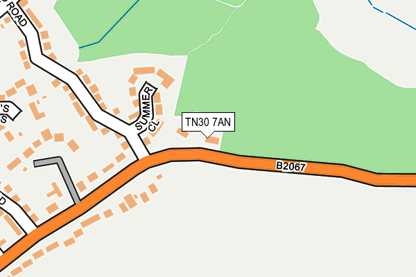
TN30 7AN lies on Woodchurch Road in Tenterden. TN30 7AN is located in the Tenterden South electoral ward, within the local authority district of Ashford and the English Parliamentary constituency of Ashford. The Sub Integrated Care Board (ICB) Location is NHS Kent and Medway ICB - 91Q and the police force is Kent. This postcode has been in use since January 1980.


GetTheData
Source: OS OpenMap – Local (Ordnance Survey)
Source: OS VectorMap District (Ordnance Survey)
Licence: Open Government Licence (requires attribution)
| Easting | 589414 |
| Northing | 134023 |
| Latitude | 51.074266 |
| Longitude | 0.702479 |
GetTheData
Source: Open Postcode Geo
Licence: Open Government Licence
| Street | Woodchurch Road |
| Town/City | Tenterden |
| Country | England |
| Postcode District | TN30 |
➜ See where TN30 is on a map ➜ Where is Tenterden? | |
GetTheData
Source: Land Registry Price Paid Data
Licence: Open Government Licence
Elevation or altitude of TN30 7AN as distance above sea level:
| Metres | Feet | |
|---|---|---|
| Elevation | 60m | 197ft |
Elevation is measured from the approximate centre of the postcode, to the nearest point on an OS contour line from OS Terrain 50, which has contour spacing of ten vertical metres.
➜ How high above sea level am I? Find the elevation of your current position using your device's GPS.
GetTheData
Source: Open Postcode Elevation
Licence: Open Government Licence
| Ward | Tenterden South |
| Constituency | Ashford |
GetTheData
Source: ONS Postcode Database
Licence: Open Government Licence
WOODBINE, WOODCHURCH ROAD, TENTERDEN, TN30 7AN 2013 12 MAR £581,500 |
LIBERTY BELL, WOODCHURCH ROAD, TENTERDEN, TN30 7AN 1997 30 APR £175,000 |
WOODBINE, WOODCHURCH ROAD, TENTERDEN, TN30 7AN 1995 30 MAY £45,000 |
GetTheData
Source: HM Land Registry Price Paid Data
Licence: Contains HM Land Registry data © Crown copyright and database right 2025. This data is licensed under the Open Government Licence v3.0.
| Lime Hill (Woodchurch Road) | Tenterden | 489m |
| Appledore Road | Tenterden | 538m |
| Appledore Road | Tenterden | 549m |
| Homewood School (Ashford Road) | Tenterden | 614m |
| Turners Avenue (Ashford Road) | Tenterden | 636m |
| Tenterden Town Rail Station (Kesr) | Tenterden | 1,294m |
GetTheData
Source: NaPTAN
Licence: Open Government Licence
| Percentage of properties with Next Generation Access | 100.0% |
| Percentage of properties with Superfast Broadband | 100.0% |
| Percentage of properties with Ultrafast Broadband | 0.0% |
| Percentage of properties with Full Fibre Broadband | 0.0% |
Superfast Broadband is between 30Mbps and 300Mbps
Ultrafast Broadband is > 300Mbps
| Percentage of properties unable to receive 2Mbps | 0.0% |
| Percentage of properties unable to receive 5Mbps | 0.0% |
| Percentage of properties unable to receive 10Mbps | 0.0% |
| Percentage of properties unable to receive 30Mbps | 0.0% |
GetTheData
Source: Ofcom
Licence: Ofcom Terms of Use (requires attribution)
GetTheData
Source: ONS Postcode Database
Licence: Open Government Licence


➜ Get more ratings from the Food Standards Agency
GetTheData
Source: Food Standards Agency
Licence: FSA terms & conditions
| Last Collection | |||
|---|---|---|---|
| Location | Mon-Fri | Sat | Distance |
| Tenterden Sorting Office | 17:30 | 11:30 | 929m |
| Henley Meadows | 16:30 | 09:00 | 1,060m |
| The Dairy | 16:00 | 09:00 | 1,219m |
GetTheData
Source: Dracos
Licence: Creative Commons Attribution-ShareAlike
The below table lists the International Territorial Level (ITL) codes (formerly Nomenclature of Territorial Units for Statistics (NUTS) codes) and Local Administrative Units (LAU) codes for TN30 7AN:
| ITL 1 Code | Name |
|---|---|
| TLJ | South East (England) |
| ITL 2 Code | Name |
| TLJ4 | Kent |
| ITL 3 Code | Name |
| TLJ45 | Mid Kent |
| LAU 1 Code | Name |
| E07000105 | Ashford |
GetTheData
Source: ONS Postcode Directory
Licence: Open Government Licence
The below table lists the Census Output Area (OA), Lower Layer Super Output Area (LSOA), and Middle Layer Super Output Area (MSOA) for TN30 7AN:
| Code | Name | |
|---|---|---|
| OA | E00121975 | |
| LSOA | E01024026 | Ashford 014C |
| MSOA | E02005009 | Ashford 014 |
GetTheData
Source: ONS Postcode Directory
Licence: Open Government Licence
| TN30 7AR | Summer Close | 89m |
| TN30 7AE | Woodchurch Road | 195m |
| TN30 7AP | Knockwood Road | 218m |
| TN30 7AZ | Vineys Gardens | 255m |
| TN30 7AL | Woodchurch Road | 287m |
| TN30 7AH | Eastgate Road | 325m |
| TN30 7AG | Mount Pleasant | 355m |
| TN30 7AS | Chestnut Close | 367m |
| TN30 7DR | Woodchurch Road | 387m |
| TN30 7AJ | Martins Close | 394m |
GetTheData
Source: Open Postcode Geo; Land Registry Price Paid Data
Licence: Open Government Licence