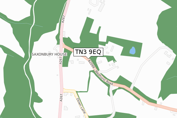
TN3 9EQ is located in the Frant & Wadhurst electoral ward, within the local authority district of Wealden and the English Parliamentary constituency of Wealden. The Sub Integrated Care Board (ICB) Location is NHS Sussex ICB - 97R and the police force is Sussex. This postcode has been in use since October 2017.


GetTheData
Source: OS Open Zoomstack (Ordnance Survey)
Licence: Open Government Licence (requires attribution)
Attribution: Contains OS data © Crown copyright and database right 2025
Source: Open Postcode Geo
Licence: Open Government Licence (requires attribution)
Attribution: Contains OS data © Crown copyright and database right 2025; Contains Royal Mail data © Royal Mail copyright and database right 2025; Source: Office for National Statistics licensed under the Open Government Licence v.3.0
| Easting | 558998 |
| Northing | 134615 |
| Latitude | 51.088813 |
| Longitude | 0.268956 |
GetTheData
Source: Open Postcode Geo
Licence: Open Government Licence
| Country | England |
| Postcode District | TN3 |
➜ See where TN3 is on a map | |
GetTheData
Source: Land Registry Price Paid Data
Licence: Open Government Licence
| Ward | Frant & Wadhurst |
| Constituency | Wealden |
GetTheData
Source: ONS Postcode Database
Licence: Open Government Licence
| Sleeches Cross (Wadhurst Road) | Frant | 143m |
| Sleeches Cross (Tunbridge Wells Road) | Frant | 154m |
| Sleeches Cross (Tunbridge Wells Road) | Frant | 205m |
| Abergavenny Arms (Frant Road) | Frant | 855m |
| Abergavenny Arms (Frant Road) | Frant | 933m |
| Frant Station | 2.5km |
| Wadhurst Station | 3.5km |
| Tunbridge Wells Station | 4.6km |
GetTheData
Source: NaPTAN
Licence: Open Government Licence
GetTheData
Source: ONS Postcode Database
Licence: Open Government Licence


➜ Get more ratings from the Food Standards Agency
GetTheData
Source: Food Standards Agency
Licence: FSA terms & conditions
| Last Collection | |||
|---|---|---|---|
| Location | Mon-Fri | Sat | Distance |
| Frant Post Office | 16:45 | 09:15 | 814m |
| Frant Station | 17:00 | 09:00 | 2,473m |
| Bells Yew Green Old P O | 17:00 | 09:00 | 2,478m |
GetTheData
Source: Dracos
Licence: Creative Commons Attribution-ShareAlike
The below table lists the International Territorial Level (ITL) codes (formerly Nomenclature of Territorial Units for Statistics (NUTS) codes) and Local Administrative Units (LAU) codes for TN3 9EQ:
| ITL 1 Code | Name |
|---|---|
| TLJ | South East (England) |
| ITL 2 Code | Name |
| TLJ2 | Surrey, East and West Sussex |
| ITL 3 Code | Name |
| TLJ22 | East Sussex CC |
| LAU 1 Code | Name |
| E07000065 | Wealden |
GetTheData
Source: ONS Postcode Directory
Licence: Open Government Licence
The below table lists the Census Output Area (OA), Lower Layer Super Output Area (LSOA), and Middle Layer Super Output Area (MSOA) for TN3 9EQ:
| Code | Name | |
|---|---|---|
| OA | E00107557 | |
| LSOA | E01021171 | Wealden 002A |
| MSOA | E02004404 | Wealden 002 |
GetTheData
Source: ONS Postcode Directory
Licence: Open Government Licence
| TN3 9EH | Wadhurst Road | 143m |
| TN3 9EG | Mayfield Road | 205m |
| TN3 9HL | Down Lane | 232m |
| TN3 9HN | The Platt | 325m |
| TN3 9HW | Down Lane | 400m |
| TN3 9DL | 400m | |
| TN3 9DH | Mayfield Road | 519m |
| TN3 9DF | Court Cottages | 581m |
| TN3 9DN | The Green | 606m |
| TN3 9HP | Down Lane | 633m |
GetTheData
Source: Open Postcode Geo; Land Registry Price Paid Data
Licence: Open Government Licence