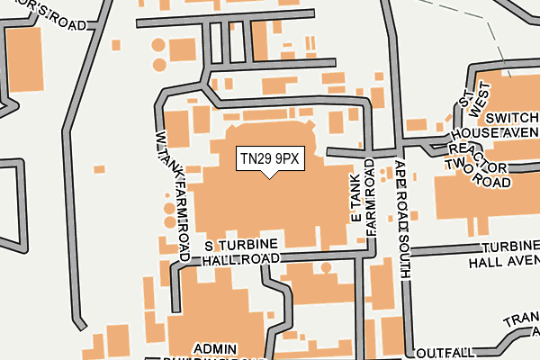
TN29 9PX is located in the Walland & Denge Marsh electoral ward, within the local authority district of Folkestone and Hythe and the English Parliamentary constituency of Folkestone and Hythe. The Sub Integrated Care Board (ICB) Location is NHS Kent and Medway ICB - 91Q and the police force is Kent. This postcode has been in use since January 1980.


GetTheData
Source: OS OpenMap – Local (Ordnance Survey)
Source: OS VectorMap District (Ordnance Survey)
Licence: Open Government Licence (requires attribution)
| Easting | 608149 |
| Northing | 116839 |
| Latitude | 50.913470 |
| Longitude | 0.959677 |
GetTheData
Source: Open Postcode Geo
Licence: Open Government Licence
| Country | England |
| Postcode District | TN29 |
➜ See where TN29 is on a map ➜ Where is Dungeness? | |
GetTheData
Source: Land Registry Price Paid Data
Licence: Open Government Licence
Elevation or altitude of TN29 9PX as distance above sea level:
| Metres | Feet | |
|---|---|---|
| Elevation | 10m | 33ft |
Elevation is measured from the approximate centre of the postcode, to the nearest point on an OS contour line from OS Terrain 50, which has contour spacing of ten vertical metres.
➜ How high above sea level am I? Find the elevation of your current position using your device's GPS.
GetTheData
Source: Open Postcode Elevation
Licence: Open Government Licence
| Ward | Walland & Denge Marsh |
| Constituency | Folkestone And Hythe |
GetTheData
Source: ONS Postcode Database
Licence: Open Government Licence
| Dungeness Station (Rhdr) | Dungeness | 747m |
GetTheData
Source: NaPTAN
Licence: Open Government Licence
GetTheData
Source: ONS Postcode Database
Licence: Open Government Licence


➜ Get more ratings from the Food Standards Agency
GetTheData
Source: Food Standards Agency
Licence: FSA terms & conditions
| Last Collection | |||
|---|---|---|---|
| Location | Mon-Fri | Sat | Distance |
| The Pilot | 16:30 | 09:00 | 1,592m |
| Coast Drive | 16:30 | 09:00 | 3,339m |
| Taylor Road | 16:30 | 09:00 | 3,922m |
GetTheData
Source: Dracos
Licence: Creative Commons Attribution-ShareAlike
The below table lists the International Territorial Level (ITL) codes (formerly Nomenclature of Territorial Units for Statistics (NUTS) codes) and Local Administrative Units (LAU) codes for TN29 9PX:
| ITL 1 Code | Name |
|---|---|
| TLJ | South East (England) |
| ITL 2 Code | Name |
| TLJ4 | Kent |
| ITL 3 Code | Name |
| TLJ44 | East Kent |
| LAU 1 Code | Name |
| E07000112 | Folkestone and Hythe |
GetTheData
Source: ONS Postcode Directory
Licence: Open Government Licence
The below table lists the Census Output Area (OA), Lower Layer Super Output Area (LSOA), and Middle Layer Super Output Area (MSOA) for TN29 9PX:
| Code | Name | |
|---|---|---|
| OA | E00124519 | |
| LSOA | E01024533 | Shepway 013B |
| MSOA | E02005114 | Shepway 013 |
GetTheData
Source: ONS Postcode Directory
Licence: Open Government Licence
| TN29 9NA | Dungeness Road | 515m |
| TN29 9NB | Dungeness Road | 783m |
| TN29 9ND | Dungeness Road | 1069m |
| TN29 9NE | Dungeness Road | 1554m |
| TN29 9NF | Dungeness Road | 1798m |
| TN29 9NH | 1941m | |
| TN29 9NJ | Battery Road | 1944m |
| TN29 9NG | Pleasance Road South | 1998m |
| TN29 9NL | Coast Drive | 2269m |
| TN29 9NP | Pleasance Road Central | 2530m |
GetTheData
Source: Open Postcode Geo; Land Registry Price Paid Data
Licence: Open Government Licence