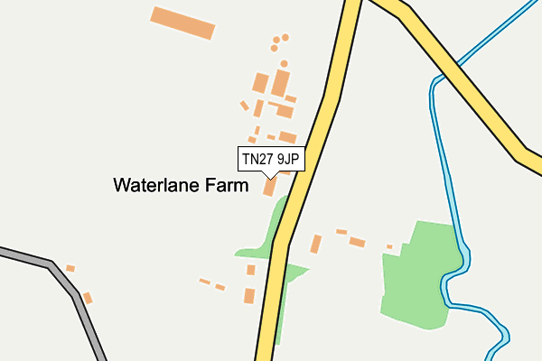
TN27 9JP is located in the Headcorn electoral ward, within the local authority district of Maidstone and the English Parliamentary constituency of Faversham and Mid Kent. The Sub Integrated Care Board (ICB) Location is NHS Kent and Medway ICB - 91Q and the police force is Kent. This postcode has been in use since January 1980.


GetTheData
Source: OS OpenMap – Local (Ordnance Survey)
Source: OS VectorMap District (Ordnance Survey)
Licence: Open Government Licence (requires attribution)
| Easting | 582357 |
| Northing | 143825 |
| Latitude | 51.164602 |
| Longitude | 0.606777 |
GetTheData
Source: Open Postcode Geo
Licence: Open Government Licence
| Country | England |
| Postcode District | TN27 |
➜ See where TN27 is on a map | |
GetTheData
Source: Land Registry Price Paid Data
Licence: Open Government Licence
Elevation or altitude of TN27 9JP as distance above sea level:
| Metres | Feet | |
|---|---|---|
| Elevation | 20m | 66ft |
Elevation is measured from the approximate centre of the postcode, to the nearest point on an OS contour line from OS Terrain 50, which has contour spacing of ten vertical metres.
➜ How high above sea level am I? Find the elevation of your current position using your device's GPS.
GetTheData
Source: Open Postcode Elevation
Licence: Open Government Licence
| Ward | Headcorn |
| Constituency | Faversham And Mid Kent |
GetTheData
Source: ONS Postcode Database
Licence: Open Government Licence
| Bankfields (Mill Bank) | Headcorn | 1,075m |
| Bankfields (Mill Bank) | Headcorn | 1,083m |
| George And Dragon (High Street) | Headcorn | 1,095m |
| George And Dragon (High Street) | Headcorn | 1,104m |
| Railway Station (Station Road) | Headcorn | 1,442m |
| Headcorn Station | 1.5km |
| Staplehurst Station | 4km |
GetTheData
Source: NaPTAN
Licence: Open Government Licence
GetTheData
Source: ONS Postcode Database
Licence: Open Government Licence


➜ Get more ratings from the Food Standards Agency
GetTheData
Source: Food Standards Agency
Licence: FSA terms & conditions
| Last Collection | |||
|---|---|---|---|
| Location | Mon-Fri | Sat | Distance |
| Smarden Road | 16:00 | 09:00 | 2,443m |
| Frittenden Post Office | 16:45 | 09:45 | 2,731m |
| Station Road Post Office | 16:15 | 10:15 | 3,832m |
GetTheData
Source: Dracos
Licence: Creative Commons Attribution-ShareAlike
| Risk of TN27 9JP flooding from rivers and sea | High |
| ➜ TN27 9JP flood map | |
GetTheData
Source: Open Flood Risk by Postcode
Licence: Open Government Licence
The below table lists the International Territorial Level (ITL) codes (formerly Nomenclature of Territorial Units for Statistics (NUTS) codes) and Local Administrative Units (LAU) codes for TN27 9JP:
| ITL 1 Code | Name |
|---|---|
| TLJ | South East (England) |
| ITL 2 Code | Name |
| TLJ4 | Kent |
| ITL 3 Code | Name |
| TLJ45 | Mid Kent |
| LAU 1 Code | Name |
| E07000110 | Maidstone |
GetTheData
Source: ONS Postcode Directory
Licence: Open Government Licence
The below table lists the Census Output Area (OA), Lower Layer Super Output Area (LSOA), and Middle Layer Super Output Area (MSOA) for TN27 9JP:
| Code | Name | |
|---|---|---|
| OA | E00123685 | |
| LSOA | E01024364 | Maidstone 017A |
| MSOA | E02005084 | Maidstone 017 |
GetTheData
Source: ONS Postcode Directory
Licence: Open Government Licence
| TN27 9JN | Water Lane | 130m |
| TN27 9JR | Water Lane | 735m |
| TN27 9JL | Newhouse Lane | 814m |
| TN27 9NR | Church Walk | 867m |
| TN27 9NU | Moat Road | 897m |
| TN27 9NS | Gooseneck Lane | 936m |
| TN27 9JT | Black Mill Lane | 944m |
| TN27 9QY | Bankfields | 955m |
| TN27 9NP | Church Walk | 959m |
| TN27 9NT | Moat Road | 985m |
GetTheData
Source: Open Postcode Geo; Land Registry Price Paid Data
Licence: Open Government Licence