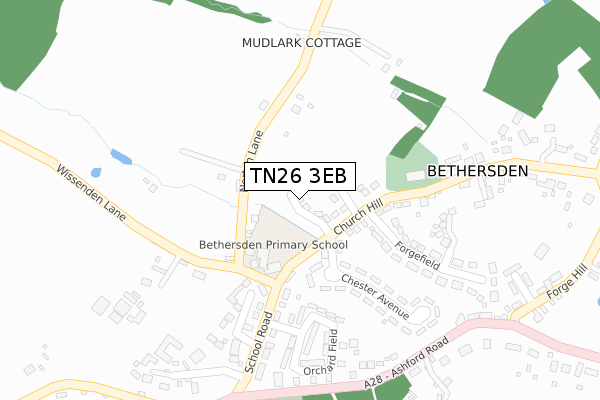
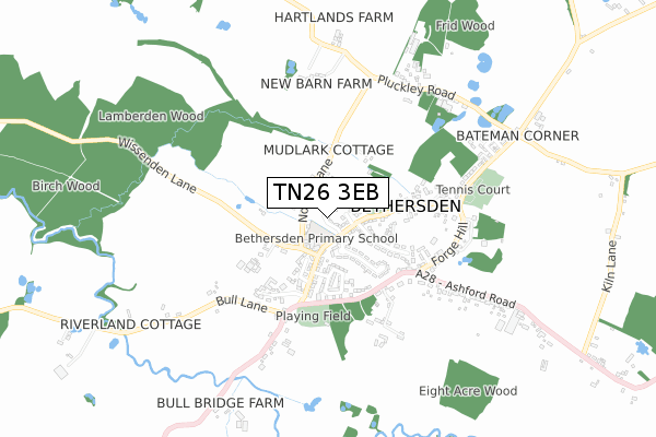
TN26 3EB is located in the Weald Central electoral ward, within the local authority district of Ashford and the English Parliamentary constituency of Ashford. The Sub Integrated Care Board (ICB) Location is NHS Kent and Medway ICB - 91Q and the police force is Kent. This postcode has been in use since November 2019.


GetTheData
Source: OS Open Zoomstack (Ordnance Survey)
Licence: Open Government Licence (requires attribution)
Attribution: Contains OS data © Crown copyright and database right 2024
Source: Open Postcode Geo
Licence: Open Government Licence (requires attribution)
Attribution: Contains OS data © Crown copyright and database right 2024; Contains Royal Mail data © Royal Mail copyright and database right 2024; Source: Office for National Statistics licensed under the Open Government Licence v.3.0
| Easting | 592628 |
| Northing | 140255 |
| Latitude | 51.129172 |
| Longitude | 0.751623 |
GetTheData
Source: Open Postcode Geo
Licence: Open Government Licence
| Country | England |
| Postcode District | TN26 |
➜ See where TN26 is on a map ➜ Where is Bethersden? | |
GetTheData
Source: Land Registry Price Paid Data
Licence: Open Government Licence
| Ward | Weald Central |
| Constituency | Ashford |
GetTheData
Source: ONS Postcode Database
Licence: Open Government Licence
3, ST MARGARETS PLACE, BETHERSDEN, ASHFORD, TN26 3EB 2020 2 DEC £725,000 |
10, ST MARGARETS PLACE, BETHERSDEN, ASHFORD, TN26 3EB 2020 9 OCT £760,000 |
6, ST MARGARETS PLACE, BETHERSDEN, ASHFORD, TN26 3EB 2020 8 OCT £675,000 |
5, ST MARGARETS PLACE, BETHERSDEN, ASHFORD, TN26 3EB 2020 30 SEP £600,000 |
8, ST MARGARETS PLACE, BETHERSDEN, ASHFORD, TN26 3EB 2020 28 AUG £740,282 |
4, ST MARGARETS PLACE, BETHERSDEN, ASHFORD, TN26 3EB 2020 25 AUG £646,000 |
23, ST MARGARETS PLACE, BETHERSDEN, ASHFORD, TN26 3EB 2020 7 AUG £625,000 |
21, ST MARGARETS PLACE, BETHERSDEN, ASHFORD, TN26 3EB 2020 31 JUL £625,000 |
2, ST MARGARETS PLACE, BETHERSDEN, ASHFORD, TN26 3EB 2020 23 JUL £600,000 |
7, ST MARGARETS PLACE, BETHERSDEN, ASHFORD, TN26 3EB 2020 29 MAY £600,000 |
GetTheData
Source: HM Land Registry Price Paid Data
Licence: Contains HM Land Registry data © Crown copyright and database right 2024. This data is licensed under the Open Government Licence v3.0.
| School (Church Hill) | Bethersden | 134m |
| School (School Road) | Bethersden | 160m |
| The George (The Street) | Bethersden | 256m |
| The George (The Street) | Bethersden | 293m |
| Cricket Pitch (Ashford Road) | Bethersden | 356m |
| Pluckley Station | 3.1km |
GetTheData
Source: NaPTAN
Licence: Open Government Licence
GetTheData
Source: ONS Postcode Database
Licence: Open Government Licence


➜ Get more ratings from the Food Standards Agency
GetTheData
Source: Food Standards Agency
Licence: FSA terms & conditions
| Last Collection | |||
|---|---|---|---|
| Location | Mon-Fri | Sat | Distance |
| Bethersden Post Office | 17:15 | 11:00 | 126m |
| Blackmans Corner | 16:00 | 09:00 | 1,556m |
| Wissenden | 16:00 | 09:00 | 1,966m |
GetTheData
Source: Dracos
Licence: Creative Commons Attribution-ShareAlike
The below table lists the International Territorial Level (ITL) codes (formerly Nomenclature of Territorial Units for Statistics (NUTS) codes) and Local Administrative Units (LAU) codes for TN26 3EB:
| ITL 1 Code | Name |
|---|---|
| TLJ | South East (England) |
| ITL 2 Code | Name |
| TLJ4 | Kent |
| ITL 3 Code | Name |
| TLJ45 | Mid Kent |
| LAU 1 Code | Name |
| E07000105 | Ashford |
GetTheData
Source: ONS Postcode Directory
Licence: Open Government Licence
The below table lists the Census Output Area (OA), Lower Layer Super Output Area (LSOA), and Middle Layer Super Output Area (MSOA) for TN26 3EB:
| Code | Name | |
|---|---|---|
| OA | E00122008 | |
| LSOA | E01024031 | Ashford 012B |
| MSOA | E02005007 | Ashford 012 |
GetTheData
Source: ONS Postcode Directory
Licence: Open Government Licence
| TN26 3AQ | Church Hill | 116m |
| TN26 3AL | Norton Lane | 123m |
| TN26 3BW | Chester Avenue | 144m |
| TN26 3BT | George Grove | 223m |
| TN26 3BL | Forgefield | 238m |
| TN26 3AH | School Road | 241m |
| TN26 3BN | Chester Avenue | 260m |
| TN26 3AW | Orchard Field | 270m |
| TN26 3AY | Lovelace Court | 272m |
| TN26 3AN | Orchard Field | 280m |
GetTheData
Source: Open Postcode Geo; Land Registry Price Paid Data
Licence: Open Government Licence