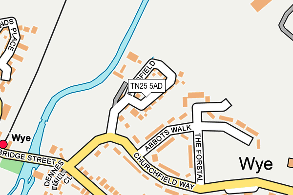
TN25 5AD is located in the Wye with Hinxhill electoral ward, within the local authority district of Ashford and the English Parliamentary constituency of Ashford. The Sub Integrated Care Board (ICB) Location is NHS Kent and Medway ICB - 91Q and the police force is Kent. This postcode has been in use since May 2017.


GetTheData
Source: OS OpenMap – Local (Ordnance Survey)
Source: OS VectorMap District (Ordnance Survey)
Licence: Open Government Licence (requires attribution)
| Easting | 605112 |
| Northing | 147050 |
| Latitude | 51.185865 |
| Longitude | 0.933667 |
GetTheData
Source: Open Postcode Geo
Licence: Open Government Licence
| Country | England |
| Postcode District | TN25 |
➜ See where TN25 is on a map ➜ Where is Wye? | |
GetTheData
Source: Land Registry Price Paid Data
Licence: Open Government Licence
| Ward | Wye With Hinxhill |
| Constituency | Ashford |
GetTheData
Source: ONS Postcode Database
Licence: Open Government Licence
| Abbots Walk (Churchfield Way) | Wye | 116m |
| School (Bridge Street) | Wye | 264m |
| Railway Station (Bramble Lane) | Wye | 318m |
| Little Chequers (Bridge Street) | Wye | 337m |
| Church (High Street) | Wye | 372m |
| Wye Station | 0.3km |
| Ashford International Station | 6.2km |
GetTheData
Source: NaPTAN
Licence: Open Government Licence
| Percentage of properties with Next Generation Access | 100.0% |
| Percentage of properties with Superfast Broadband | 100.0% |
| Percentage of properties with Ultrafast Broadband | 0.0% |
| Percentage of properties with Full Fibre Broadband | 0.0% |
Superfast Broadband is between 30Mbps and 300Mbps
Ultrafast Broadband is > 300Mbps
| Median download speed | 47.4Mbps |
| Average download speed | 44.9Mbps |
| Maximum download speed | 65.58Mbps |
| Median upload speed | 8.7Mbps |
| Average upload speed | 9.2Mbps |
| Maximum upload speed | 17.59Mbps |
| Percentage of properties unable to receive 2Mbps | 0.0% |
| Percentage of properties unable to receive 5Mbps | 0.0% |
| Percentage of properties unable to receive 10Mbps | 0.0% |
| Percentage of properties unable to receive 30Mbps | 0.0% |
GetTheData
Source: Ofcom
Licence: Ofcom Terms of Use (requires attribution)
GetTheData
Source: ONS Postcode Database
Licence: Open Government Licence


➜ Get more ratings from the Food Standards Agency
GetTheData
Source: Food Standards Agency
Licence: FSA terms & conditions
| Last Collection | |||
|---|---|---|---|
| Location | Mon-Fri | Sat | Distance |
| Wye Station | 16:30 | 11:00 | 320m |
| Wye Post Office | 17:00 | 11:00 | 416m |
| Little Chequers | 16:30 | 11:00 | 504m |
GetTheData
Source: Dracos
Licence: Creative Commons Attribution-ShareAlike
The below table lists the International Territorial Level (ITL) codes (formerly Nomenclature of Territorial Units for Statistics (NUTS) codes) and Local Administrative Units (LAU) codes for TN25 5AD:
| ITL 1 Code | Name |
|---|---|
| TLJ | South East (England) |
| ITL 2 Code | Name |
| TLJ4 | Kent |
| ITL 3 Code | Name |
| TLJ45 | Mid Kent |
| LAU 1 Code | Name |
| E07000105 | Ashford |
GetTheData
Source: ONS Postcode Directory
Licence: Open Government Licence
The below table lists the Census Output Area (OA), Lower Layer Super Output Area (LSOA), and Middle Layer Super Output Area (MSOA) for TN25 5AD:
| Code | Name | |
|---|---|---|
| OA | E00122059 | |
| LSOA | E01024040 | Ashford 001D |
| MSOA | E02004996 | Ashford 001 |
GetTheData
Source: ONS Postcode Directory
Licence: Open Government Licence
| TN25 5ES | Abbots Walk | 126m |
| TN25 5ER | The Forstal | 149m |
| TN25 5ET | Churchfield Way | 164m |
| TN25 5EQ | Churchfield Way | 175m |
| TN25 5ED | Bridge Street | 251m |
| TN25 5DR | Dennes Mill Close | 272m |
| TN25 5EG | Churchfield Way | 285m |
| TN25 5EA | Bridge Street | 287m |
| TN25 5GJ | Havillands Place | 314m |
| TN25 5BT | Taylors Yard | 319m |
GetTheData
Source: Open Postcode Geo; Land Registry Price Paid Data
Licence: Open Government Licence