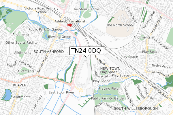
TN24 0DQ is located in the Norman electoral ward, within the local authority district of Ashford and the English Parliamentary constituency of Ashford. The Sub Integrated Care Board (ICB) Location is NHS Kent and Medway ICB - 91Q and the police force is Kent. This postcode has been in use since June 2019.


GetTheData
Source: OS Open Zoomstack (Ordnance Survey)
Licence: Open Government Licence (requires attribution)
Attribution: Contains OS data © Crown copyright and database right 2025
Source: Open Postcode Geo
Licence: Open Government Licence (requires attribution)
Attribution: Contains OS data © Crown copyright and database right 2025; Contains Royal Mail data © Royal Mail copyright and database right 2025; Source: Office for National Statistics licensed under the Open Government Licence v.3.0
| Easting | 601437 |
| Northing | 141669 |
| Latitude | 51.138845 |
| Longitude | 0.878143 |
GetTheData
Source: Open Postcode Geo
Licence: Open Government Licence
| Country | England |
| Postcode District | TN24 |
➜ See where TN24 is on a map ➜ Where is Ashford? | |
GetTheData
Source: Land Registry Price Paid Data
Licence: Open Government Licence
| Ward | Norman |
| Constituency | Ashford |
GetTheData
Source: ONS Postcode Database
Licence: Open Government Licence
| Designer Village (Newtown Road) | Ashford | 60m |
| Old Railway Works (Newtown Road) | Newtown | 218m |
| Wainwright Place (Alfred Road) | Newtown | 218m |
| Wainwright Place (Alfred Road) | Newtown | 238m |
| Stirling Road (Alfred Road) | Newtown | 321m |
| Ashford International Station | 0.6km |
GetTheData
Source: NaPTAN
Licence: Open Government Licence
GetTheData
Source: ONS Postcode Database
Licence: Open Government Licence


➜ Get more ratings from the Food Standards Agency
GetTheData
Source: Food Standards Agency
Licence: FSA terms & conditions
| Last Collection | |||
|---|---|---|---|
| Location | Mon-Fri | Sat | Distance |
| Newtown School | 17:30 | 12:15 | 244m |
| Newtown Post Office | 17:15 | 12:15 | 353m |
| South Ashford Post Office | 18:30 | 12:30 | 548m |
GetTheData
Source: Dracos
Licence: Creative Commons Attribution-ShareAlike
| Risk of TN24 0DQ flooding from rivers and sea | Low |
| ➜ TN24 0DQ flood map | |
GetTheData
Source: Open Flood Risk by Postcode
Licence: Open Government Licence
The below table lists the International Territorial Level (ITL) codes (formerly Nomenclature of Territorial Units for Statistics (NUTS) codes) and Local Administrative Units (LAU) codes for TN24 0DQ:
| ITL 1 Code | Name |
|---|---|
| TLJ | South East (England) |
| ITL 2 Code | Name |
| TLJ4 | Kent |
| ITL 3 Code | Name |
| TLJ45 | Mid Kent |
| LAU 1 Code | Name |
| E07000105 | Ashford |
GetTheData
Source: ONS Postcode Directory
Licence: Open Government Licence
The below table lists the Census Output Area (OA), Lower Layer Super Output Area (LSOA), and Middle Layer Super Output Area (MSOA) for TN24 0DQ:
| Code | Name | |
|---|---|---|
| OA | E00121853 | |
| LSOA | E01024001 | Ashford 009A |
| MSOA | E02005004 | Ashford 009 |
GetTheData
Source: ONS Postcode Directory
Licence: Open Government Licence
| TN24 0PF | Wainwright Place | 196m |
| TN23 7TG | Torrington Road | 255m |
| TN24 0PL | Newtown Green | 270m |
| TN23 7TN | Carlen Cottages | 277m |
| TN23 7TR | Riversdale Road | 302m |
| TN23 7TP | Riversdale Road | 306m |
| TN24 0PJ | Belmont Place | 307m |
| TN23 7SB | Eastmead Avenue | 310m |
| TN23 7TW | Providence Street | 342m |
| TN24 0PE | Newtown Green | 355m |
GetTheData
Source: Open Postcode Geo; Land Registry Price Paid Data
Licence: Open Government Licence