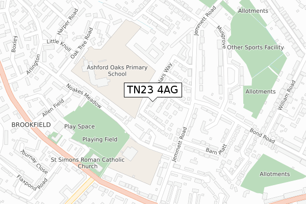
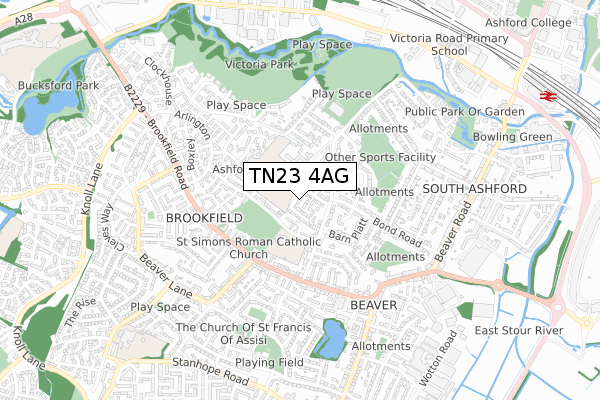
TN23 4AG is located in the Beaver electoral ward, within the local authority district of Ashford and the English Parliamentary constituency of Ashford. The Sub Integrated Care Board (ICB) Location is NHS Kent and Medway ICB - 91Q and the police force is Kent. This postcode has been in use since November 2019.


GetTheData
Source: OS Open Zoomstack (Ordnance Survey)
Licence: Open Government Licence (requires attribution)
Attribution: Contains OS data © Crown copyright and database right 2025
Source: Open Postcode Geo
Licence: Open Government Licence (requires attribution)
Attribution: Contains OS data © Crown copyright and database right 2025; Contains Royal Mail data © Royal Mail copyright and database right 2025; Source: Office for National Statistics licensed under the Open Government Licence v.3.0
| Easting | 600176 |
| Northing | 141651 |
| Latitude | 51.139124 |
| Longitude | 0.860131 |
GetTheData
Source: Open Postcode Geo
Licence: Open Government Licence
| Country | England |
| Postcode District | TN23 |
➜ See where TN23 is on a map ➜ Where is Ashford? | |
GetTheData
Source: Land Registry Price Paid Data
Licence: Open Government Licence
| Ward | Beaver |
| Constituency | Ashford |
GetTheData
Source: ONS Postcode Database
Licence: Open Government Licence
38, COLLEGE ROW, ASHFORD, TN23 4AG 2021 31 MAR £439,000 |
6, COLLEGE ROW, ASHFORD, TN23 4AG 2021 2 MAR £396,495 |
17, COLLEGE ROW, ASHFORD, TN23 4AG 2021 26 FEB £380,000 |
14, COLLEGE ROW, ASHFORD, TN23 4AG 2021 22 JAN £388,995 |
35, COLLEGE ROW, ASHFORD, TN23 4AG 2020 23 DEC £380,000 |
18, COLLEGE ROW, ASHFORD, TN23 4AG 2020 21 DEC £435,995 |
23, COLLEGE ROW, ASHFORD, TN23 4AG 2020 17 DEC £380,000 |
15, COLLEGE ROW, ASHFORD, TN23 4AG 2020 11 DEC £420,000 |
13, COLLEGE ROW, ASHFORD, TN23 4AG 2020 27 NOV £434,995 |
12, COLLEGE ROW, ASHFORD, TN23 4AG 2020 27 NOV £382,000 |
GetTheData
Source: HM Land Registry Price Paid Data
Licence: Contains HM Land Registry data © Crown copyright and database right 2025. This data is licensed under the Open Government Licence v3.0.
| K College (Jemmett Road) | South Ashford | 105m |
| K College (Jemmett Road) | South Ashford | 118m |
| Langholm Road (Jemmett Road) | South Ashford | 156m |
| Langholm Road (Jemmett Road) | South Ashford | 186m |
| Arcon Road (Beaver Lane) | South Ashford | 264m |
| Ashford International Station | 1.2km |
GetTheData
Source: NaPTAN
Licence: Open Government Licence
GetTheData
Source: ONS Postcode Database
Licence: Open Government Licence


➜ Get more ratings from the Food Standards Agency
GetTheData
Source: Food Standards Agency
Licence: FSA terms & conditions
| Last Collection | |||
|---|---|---|---|
| Location | Mon-Fri | Sat | Distance |
| Hillyfields | 17:15 | 12:30 | 353m |
| Court Wurtin | 17:00 | 12:30 | 412m |
| Brookfield Post Office | 17:00 | 12:00 | 473m |
GetTheData
Source: Dracos
Licence: Creative Commons Attribution-ShareAlike
The below table lists the International Territorial Level (ITL) codes (formerly Nomenclature of Territorial Units for Statistics (NUTS) codes) and Local Administrative Units (LAU) codes for TN23 4AG:
| ITL 1 Code | Name |
|---|---|
| TLJ | South East (England) |
| ITL 2 Code | Name |
| TLJ4 | Kent |
| ITL 3 Code | Name |
| TLJ45 | Mid Kent |
| LAU 1 Code | Name |
| E07000105 | Ashford |
GetTheData
Source: ONS Postcode Directory
Licence: Open Government Licence
The below table lists the Census Output Area (OA), Lower Layer Super Output Area (LSOA), and Middle Layer Super Output Area (MSOA) for TN23 4AG:
| Code | Name | |
|---|---|---|
| OA | E00121741 | |
| LSOA | E01023975 | Ashford 007B |
| MSOA | E02005002 | Ashford 007 |
GetTheData
Source: ONS Postcode Directory
Licence: Open Government Licence
| TN23 4RB | Noakes Meadow | 85m |
| TN23 4RJ | Jemmett Road | 123m |
| TN23 4QD | Jemmett Road | 158m |
| TN23 4RH | Jemmett Road | 162m |
| TN23 7UQ | Barn Platt | 187m |
| TN23 7UL | Bond Road | 193m |
| TN23 4RA | Noakes Meadow | 199m |
| TN23 4NJ | Langholm Road | 226m |
| TN23 5NU | Beaver Lane | 241m |
| TN23 4NR | Banks Road | 249m |
GetTheData
Source: Open Postcode Geo; Land Registry Price Paid Data
Licence: Open Government Licence