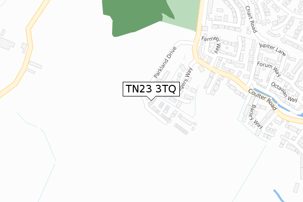
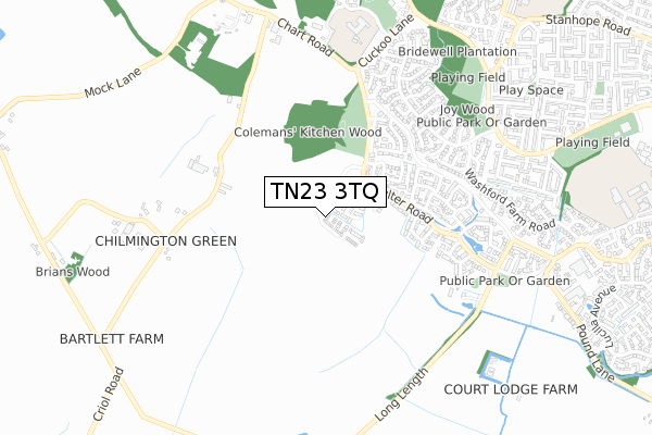
TN23 3TQ is located in the Weald Central electoral ward, within the local authority district of Ashford and the English Parliamentary constituency of Ashford. The Sub Integrated Care Board (ICB) Location is NHS Kent and Medway ICB - 91Q and the police force is Kent. This postcode has been in use since September 2019.


GetTheData
Source: OS Open Zoomstack (Ordnance Survey)
Licence: Open Government Licence (requires attribution)
Attribution: Contains OS data © Crown copyright and database right 2025
Source: Open Postcode Geo
Licence: Open Government Licence (requires attribution)
Attribution: Contains OS data © Crown copyright and database right 2025; Contains Royal Mail data © Royal Mail copyright and database right 2025; Source: Office for National Statistics licensed under the Open Government Licence v.3.0
| Easting | 598682 |
| Northing | 140276 |
| Latitude | 51.127295 |
| Longitude | 0.838045 |
GetTheData
Source: Open Postcode Geo
Licence: Open Government Licence
| Country | England |
| Postcode District | TN23 |
➜ See where TN23 is on a map ➜ Where is Ashford? | |
GetTheData
Source: Land Registry Price Paid Data
Licence: Open Government Licence
| Ward | Weald Central |
| Constituency | Ashford |
GetTheData
Source: ONS Postcode Database
Licence: Open Government Licence
1, PARKLAND CRESCENT, KINGSNORTH, ASHFORD, TN23 3TQ 2024 28 JUN £514,995 |
2024 27 JUN £425,995 |
2023 24 OCT £405,000 |
2019 29 NOV £377,995 |
4, PARKLAND CRESCENT, KINGSNORTH, ASHFORD, TN23 3TQ 2019 31 OCT £379,995 |
3, PARKLAND CRESCENT, KINGSNORTH, ASHFORD, TN23 3TQ 2019 31 OCT £379,995 |
GetTheData
Source: HM Land Registry Price Paid Data
Licence: Contains HM Land Registry data © Crown copyright and database right 2025. This data is licensed under the Open Government Licence v3.0.
| Ploughman's Way (Coulter Road) | Bridewell | 237m |
| Ploughman's Way (Coulter Road) | Bridewell | 246m |
| Brisley Close (Coulter Road) | Bridewell | 301m |
| Brisley Close (Coulter Road) | Bridewell | 319m |
| Penn Hill (Langney Drive) | Bridewell | 512m |
| Ashford International Station | 3.2km |
GetTheData
Source: NaPTAN
Licence: Open Government Licence
GetTheData
Source: ONS Postcode Database
Licence: Open Government Licence


➜ Get more ratings from the Food Standards Agency
GetTheData
Source: Food Standards Agency
Licence: FSA terms & conditions
| Last Collection | |||
|---|---|---|---|
| Location | Mon-Fri | Sat | Distance |
| Coulter Road | 17:15 | 12:15 | 211m |
| Repton Park | 17:30 | 11:45 | 212m |
| Langney Drive | 17:15 | 11:45 | 509m |
GetTheData
Source: Dracos
Licence: Creative Commons Attribution-ShareAlike
The below table lists the International Territorial Level (ITL) codes (formerly Nomenclature of Territorial Units for Statistics (NUTS) codes) and Local Administrative Units (LAU) codes for TN23 3TQ:
| ITL 1 Code | Name |
|---|---|
| TLJ | South East (England) |
| ITL 2 Code | Name |
| TLJ4 | Kent |
| ITL 3 Code | Name |
| TLJ45 | Mid Kent |
| LAU 1 Code | Name |
| E07000105 | Ashford |
GetTheData
Source: ONS Postcode Directory
Licence: Open Government Licence
The below table lists the Census Output Area (OA), Lower Layer Super Output Area (LSOA), and Middle Layer Super Output Area (MSOA) for TN23 3TQ:
| Code | Name | |
|---|---|---|
| OA | E00167570 | |
| LSOA | E01032816 | Ashford 008E |
| MSOA | E02005003 | Ashford 008 |
GetTheData
Source: ONS Postcode Directory
Licence: Open Government Licence
| TN23 3GN | Hedgers Way | 111m |
| TN23 3FX | Godwin Court | 216m |
| TN23 3HU | Ploughmans Way | 222m |
| TN23 3FY | Farmers Way | 263m |
| TN23 3HQ | Coulter Road | 277m |
| TN23 3JQ | Coulter Road | 280m |
| TN23 3HH | Brisley Close | 293m |
| TN23 3FW | Colemans Close | 307m |
| TN23 3GE | Brisley Court | 364m |
| TN23 3HF | Brisley Close | 370m |
GetTheData
Source: Open Postcode Geo; Land Registry Price Paid Data
Licence: Open Government Licence