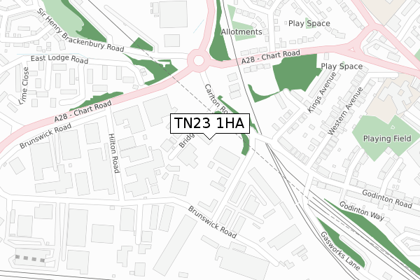
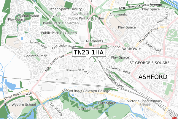
TN23 1HA is located in the Victoria electoral ward, within the local authority district of Ashford and the English Parliamentary constituency of Ashford. The Sub Integrated Care Board (ICB) Location is NHS Kent and Medway ICB - 91Q and the police force is Kent. This postcode has been in use since December 1998.


GetTheData
Source: OS Open Zoomstack (Ordnance Survey)
Licence: Open Government Licence (requires attribution)
Attribution: Contains OS data © Crown copyright and database right 2025
Source: Open Postcode Geo
Licence: Open Government Licence (requires attribution)
Attribution: Contains OS data © Crown copyright and database right 2025; Contains Royal Mail data © Royal Mail copyright and database right 2025; Source: Office for National Statistics licensed under the Open Government Licence v.3.0
| Easting | 600005 |
| Northing | 142958 |
| Latitude | 51.150923 |
| Longitude | 0.858384 |
GetTheData
Source: Open Postcode Geo
Licence: Open Government Licence
| Country | England |
| Postcode District | TN23 |
➜ See where TN23 is on a map ➜ Where is Ashford? | |
GetTheData
Source: Land Registry Price Paid Data
Licence: Open Government Licence
Elevation or altitude of TN23 1HA as distance above sea level:
| Metres | Feet | |
|---|---|---|
| Elevation | 50m | 164ft |
Elevation is measured from the approximate centre of the postcode, to the nearest point on an OS contour line from OS Terrain 50, which has contour spacing of ten vertical metres.
➜ How high above sea level am I? Find the elevation of your current position using your device's GPS.
GetTheData
Source: Open Postcode Elevation
Licence: Open Government Licence
| Ward | Victoria |
| Constituency | Ashford |
GetTheData
Source: ONS Postcode Database
Licence: Open Government Licence
| Bridge Road (Carlton Road) | Ashford | 71m |
| Bridge Road (Carlton Road) | Ashford | 85m |
| Chart Road Roundabout (Carlton Road) | Ashford | 118m |
| Chart Road Roundabout (Carlton Road) | Ashford | 128m |
| Godinton Way (Sackville Crescent) | Ashford | 263m |
| Ashford International Station | 1.5km |
| Wye Station | 6.2km |
GetTheData
Source: NaPTAN
Licence: Open Government Licence
GetTheData
Source: ONS Postcode Database
Licence: Open Government Licence


➜ Get more ratings from the Food Standards Agency
GetTheData
Source: Food Standards Agency
Licence: FSA terms & conditions
| Last Collection | |||
|---|---|---|---|
| Location | Mon-Fri | Sat | Distance |
| Cobbs Wood Meterbox | 71m | ||
| Chart Road | 18:30 | 12:30 | 262m |
| Western Avenue | 17:30 | 11:45 | 310m |
GetTheData
Source: Dracos
Licence: Creative Commons Attribution-ShareAlike
The below table lists the International Territorial Level (ITL) codes (formerly Nomenclature of Territorial Units for Statistics (NUTS) codes) and Local Administrative Units (LAU) codes for TN23 1HA:
| ITL 1 Code | Name |
|---|---|
| TLJ | South East (England) |
| ITL 2 Code | Name |
| TLJ4 | Kent |
| ITL 3 Code | Name |
| TLJ45 | Mid Kent |
| LAU 1 Code | Name |
| E07000105 | Ashford |
GetTheData
Source: ONS Postcode Directory
Licence: Open Government Licence
The below table lists the Census Output Area (OA), Lower Layer Super Output Area (LSOA), and Middle Layer Super Output Area (MSOA) for TN23 1HA:
| Code | Name | |
|---|---|---|
| OA | E00121809 | |
| LSOA | E01023992 | Ashford 004E |
| MSOA | E02004999 | Ashford 004 |
GetTheData
Source: ONS Postcode Directory
Licence: Open Government Licence
| TN23 1BB | Bridge Road | 88m |
| TN23 3HT | Chart Road | 209m |
| TN23 1EJ | Cobbs Wood Industrial Estate | 215m |
| TN23 1LT | Sackville Crescent | 219m |
| TN23 1LU | Kings Avenue | 235m |
| TN23 3HY | Chart Road | 238m |
| TN23 1AT | Kings Avenue | 287m |
| TN23 3DQ | East Lodge Road | 292m |
| TN23 1LS | Godinton Road | 294m |
| TN23 3HW | Repton Manor Road | 311m |
GetTheData
Source: Open Postcode Geo; Land Registry Price Paid Data
Licence: Open Government Licence