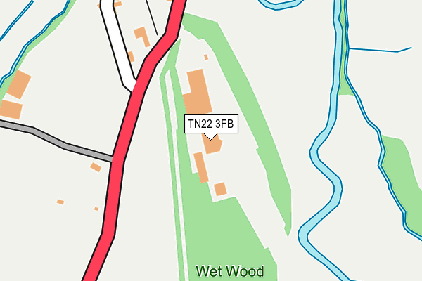
TN22 3FB is located in the Newick electoral ward, within the local authority district of Lewes and the English Parliamentary constituency of Lewes. The Sub Integrated Care Board (ICB) Location is NHS Sussex ICB - 97R and the police force is Sussex. This postcode has been in use since June 2011.


GetTheData
Source: OS OpenMap – Local (Ordnance Survey)
Source: OS VectorMap District (Ordnance Survey)
Licence: Open Government Licence (requires attribution)
| Easting | 540544 |
| Northing | 123267 |
| Latitude | 50.991646 |
| Longitude | 0.001237 |
GetTheData
Source: Open Postcode Geo
Licence: Open Government Licence
| Country | England |
| Postcode District | TN22 |
➜ See where TN22 is on a map | |
GetTheData
Source: Land Registry Price Paid Data
Licence: Open Government Licence
Elevation or altitude of TN22 3FB as distance above sea level:
| Metres | Feet | |
|---|---|---|
| Elevation | 20m | 66ft |
Elevation is measured from the approximate centre of the postcode, to the nearest point on an OS contour line from OS Terrain 50, which has contour spacing of ten vertical metres.
➜ How high above sea level am I? Find the elevation of your current position using your device's GPS.
GetTheData
Source: Open Postcode Elevation
Licence: Open Government Licence
| Ward | Newick |
| Constituency | Lewes |
GetTheData
Source: ONS Postcode Database
Licence: Open Government Licence
| The Dairy (A275) | Sheffield Park | 125m |
| The Dairy (A275) | Sheffield Park | 146m |
| Bluebell Railway Station (Station Car Park) | Sheffield Park | 335m |
| Bluebell Railway Station (A275) | Sheffield Park | 337m |
| Park Gardens (A275) | Sheffield Park | 920m |
| Sheffield Park (Bluebell Railway) | Sheffield Park | 498m |
GetTheData
Source: NaPTAN
Licence: Open Government Licence
GetTheData
Source: ONS Postcode Database
Licence: Open Government Licence


➜ Get more ratings from the Food Standards Agency
GetTheData
Source: Food Standards Agency
Licence: FSA terms & conditions
| Last Collection | |||
|---|---|---|---|
| Location | Mon-Fri | Sat | Distance |
| Sheffield Park Station | 16:15 | 09:00 | 462m |
| Fletching Common | 16:15 | 09:30 | 1,527m |
| Sheffield Green | 16:30 | 10:00 | 1,683m |
GetTheData
Source: Dracos
Licence: Creative Commons Attribution-ShareAlike
The below table lists the International Territorial Level (ITL) codes (formerly Nomenclature of Territorial Units for Statistics (NUTS) codes) and Local Administrative Units (LAU) codes for TN22 3FB:
| ITL 1 Code | Name |
|---|---|
| TLJ | South East (England) |
| ITL 2 Code | Name |
| TLJ2 | Surrey, East and West Sussex |
| ITL 3 Code | Name |
| TLJ22 | East Sussex CC |
| LAU 1 Code | Name |
| E07000063 | Lewes |
GetTheData
Source: ONS Postcode Directory
Licence: Open Government Licence
The below table lists the Census Output Area (OA), Lower Layer Super Output Area (LSOA), and Middle Layer Super Output Area (MSOA) for TN22 3FB:
| Code | Name | |
|---|---|---|
| OA | E00106923 | |
| LSOA | E01021052 | Lewes 001D |
| MSOA | E02004379 | Lewes 001 |
GetTheData
Source: ONS Postcode Directory
Licence: Open Government Licence
| TN22 3QB | Dairy Cottages | 157m |
| TN22 3QT | 170m | |
| TN22 3QE | Albert Cottages | 235m |
| TN22 3QG | 257m | |
| TN22 3QU | 417m | |
| TN22 3HQ | Bluebell Business Estate | 435m |
| TN22 3QY | Wellbeck Cottages | 1058m |
| BN8 4JJ | Fletching Common | 1093m |
| TN22 3QW | The Courtyard | 1141m |
| BN8 4JH | Fletching Common | 1161m |
GetTheData
Source: Open Postcode Geo; Land Registry Price Paid Data
Licence: Open Government Licence