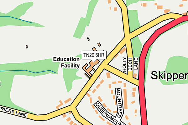
TN20 6HR is located in the Mayfield & Five Ashes electoral ward, within the local authority district of Wealden and the English Parliamentary constituency of Bexhill and Battle. The Sub Integrated Care Board (ICB) Location is NHS Sussex ICB - 97R and the police force is Sussex. This postcode has been in use since January 1980.


GetTheData
Source: OS OpenMap – Local (Ordnance Survey)
Source: OS VectorMap District (Ordnance Survey)
Licence: Open Government Licence (requires attribution)
| Easting | 555687 |
| Northing | 125484 |
| Latitude | 51.007677 |
| Longitude | 0.217766 |
GetTheData
Source: Open Postcode Geo
Licence: Open Government Licence
| Country | England |
| Postcode District | TN20 |
➜ See where TN20 is on a map ➜ Where is Skippers Hill? | |
GetTheData
Source: Land Registry Price Paid Data
Licence: Open Government Licence
Elevation or altitude of TN20 6HR as distance above sea level:
| Metres | Feet | |
|---|---|---|
| Elevation | 130m | 427ft |
Elevation is measured from the approximate centre of the postcode, to the nearest point on an OS contour line from OS Terrain 50, which has contour spacing of ten vertical metres.
➜ How high above sea level am I? Find the elevation of your current position using your device's GPS.
GetTheData
Source: Open Postcode Elevation
Licence: Open Government Licence
| Ward | Mayfield & Five Ashes |
| Constituency | Bexhill And Battle |
GetTheData
Source: ONS Postcode Database
Licence: Open Government Licence
| Skippers Hill (Tunbridge Wells Road) | Butchers Cross | 282m |
| Criers Lane (Tunbridge Wells Road) | Butchers Cross | 304m |
| Skippers Hill (Tunbridge Wells Road) | Butchers Cross | 307m |
| Criers Lane (Tunbridge Wells Road) | Butchers Cross | 350m |
| School (Mayfield Road) | Five Ashes | 598m |
| Crowborough Station | 4.8km |
GetTheData
Source: NaPTAN
Licence: Open Government Licence
GetTheData
Source: ONS Postcode Database
Licence: Open Government Licence


➜ Get more ratings from the Food Standards Agency
GetTheData
Source: Food Standards Agency
Licence: FSA terms & conditions
| Last Collection | |||
|---|---|---|---|
| Location | Mon-Fri | Sat | Distance |
| Fir Toll Road | 17:00 | 10:30 | 2,453m |
| Mayfield Station | 17:00 | 10:00 | 2,617m |
| Hadlow Down Old Post Office | 17:00 | 10:30 | 2,767m |
GetTheData
Source: Dracos
Licence: Creative Commons Attribution-ShareAlike
The below table lists the International Territorial Level (ITL) codes (formerly Nomenclature of Territorial Units for Statistics (NUTS) codes) and Local Administrative Units (LAU) codes for TN20 6HR:
| ITL 1 Code | Name |
|---|---|
| TLJ | South East (England) |
| ITL 2 Code | Name |
| TLJ2 | Surrey, East and West Sussex |
| ITL 3 Code | Name |
| TLJ22 | East Sussex CC |
| LAU 1 Code | Name |
| E07000065 | Wealden |
GetTheData
Source: ONS Postcode Directory
Licence: Open Government Licence
The below table lists the Census Output Area (OA), Lower Layer Super Output Area (LSOA), and Middle Layer Super Output Area (MSOA) for TN20 6HR:
| Code | Name | |
|---|---|---|
| OA | E00107439 | |
| LSOA | E01021149 | Wealden 011A |
| MSOA | E02004413 | Wealden 011 |
GetTheData
Source: ONS Postcode Directory
Licence: Open Government Licence
| TN20 6HT | 59m | |
| TN20 6HQ | Holly Beech Lane | 136m |
| TN20 6HP | Fir Point Cottages | 141m |
| TN20 6LN | Mountreed | 144m |
| TN20 6LH | Queensmount | 169m |
| TN20 6HS | 175m | |
| TN20 6LF | Criers Lane | 210m |
| TN20 6LJ | Stonehurst Lane | 273m |
| TN20 6LE | Criers Lane | 300m |
| TN20 6HX | 324m |
GetTheData
Source: Open Postcode Geo; Land Registry Price Paid Data
Licence: Open Government Licence