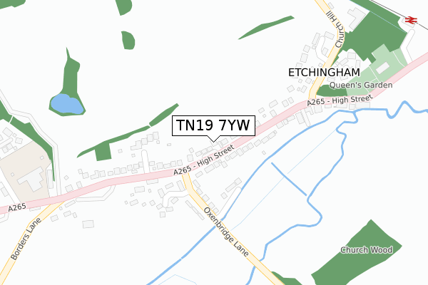
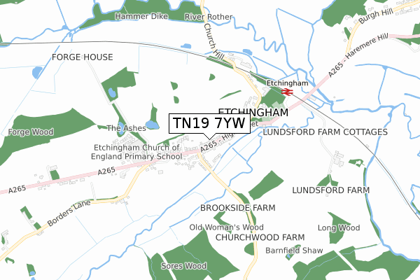
TN19 7YW is located in the Burwash & the Weald electoral ward, within the local authority district of Rother and the English Parliamentary constituency of Bexhill and Battle. The Sub Integrated Care Board (ICB) Location is NHS Sussex ICB - 97R and the police force is Sussex. This postcode has been in use since September 2018.


GetTheData
Source: OS Open Zoomstack (Ordnance Survey)
Licence: Open Government Licence (requires attribution)
Attribution: Contains OS data © Crown copyright and database right 2025
Source: Open Postcode Geo
Licence: Open Government Licence (requires attribution)
Attribution: Contains OS data © Crown copyright and database right 2025; Contains Royal Mail data © Royal Mail copyright and database right 2025; Source: Office for National Statistics licensed under the Open Government Licence v.3.0
| Easting | 570967 |
| Northing | 126029 |
| Latitude | 51.008236 |
| Longitude | 0.435649 |
GetTheData
Source: Open Postcode Geo
Licence: Open Government Licence
| Country | England |
| Postcode District | TN19 |
➜ See where TN19 is on a map ➜ Where is Etchingham? | |
GetTheData
Source: Land Registry Price Paid Data
Licence: Open Government Licence
| Ward | Burwash & The Weald |
| Constituency | Bexhill And Battle |
GetTheData
Source: ONS Postcode Database
Licence: Open Government Licence
| Post Office (High Street) | Etchingham | 24m |
| Post Office (High Street) | Etchingham | 39m |
| Village Hall (High Street) | Etchingham | 215m |
| Village Hall (High Street) | Etchingham | 218m |
| Church Lane (High Street) | Etchingham | 225m |
| Etchingham Station | 0.5km |
| Robertsbridge Station | 3.5km |
GetTheData
Source: NaPTAN
Licence: Open Government Licence
GetTheData
Source: ONS Postcode Database
Licence: Open Government Licence


➜ Get more ratings from the Food Standards Agency
GetTheData
Source: Food Standards Agency
Licence: FSA terms & conditions
| Last Collection | |||
|---|---|---|---|
| Location | Mon-Fri | Sat | Distance |
| Etchingham Post Office | 17:30 | 12:00 | 125m |
| Etchingham Church | 16:15 | 11:15 | 532m |
| New House | 16:00 | 09:00 | 1,488m |
GetTheData
Source: Dracos
Licence: Creative Commons Attribution-ShareAlike
The below table lists the International Territorial Level (ITL) codes (formerly Nomenclature of Territorial Units for Statistics (NUTS) codes) and Local Administrative Units (LAU) codes for TN19 7YW:
| ITL 1 Code | Name |
|---|---|
| TLJ | South East (England) |
| ITL 2 Code | Name |
| TLJ2 | Surrey, East and West Sussex |
| ITL 3 Code | Name |
| TLJ22 | East Sussex CC |
| LAU 1 Code | Name |
| E07000064 | Rother |
GetTheData
Source: ONS Postcode Directory
Licence: Open Government Licence
The below table lists the Census Output Area (OA), Lower Layer Super Output Area (LSOA), and Middle Layer Super Output Area (MSOA) for TN19 7YW:
| Code | Name | |
|---|---|---|
| OA | E00107383 | |
| LSOA | E01021141 | Rother 001F |
| MSOA | E02004392 | Rother 001 |
GetTheData
Source: ONS Postcode Directory
Licence: Open Government Licence
| TN19 7AG | High Street | 21m |
| TN19 7AA | Brookside Cottages | 134m |
| TN19 7AH | High Street | 136m |
| TN19 7DQ | Park Farm Close | 149m |
| TN19 7NR | Oaks Close | 161m |
| TN19 7AB | Oxenbridge Row | 165m |
| TN19 7AJ | High Street | 192m |
| TN19 7AD | High Street | 219m |
| TN19 7AN | High Street | 259m |
| TN19 7AR | Church Lane | 265m |
GetTheData
Source: Open Postcode Geo; Land Registry Price Paid Data
Licence: Open Government Licence