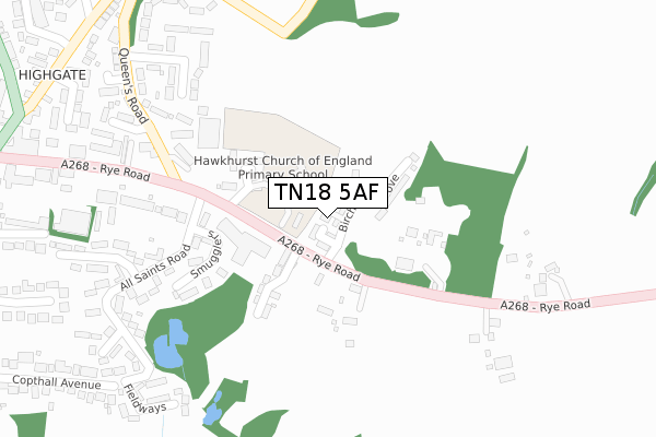
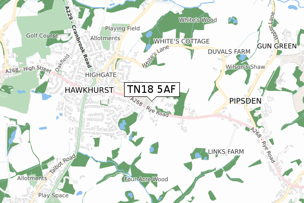
TN18 5AF is located in the Hawkhurst and Sandhurst electoral ward, within the local authority district of Tunbridge Wells and the English Parliamentary constituency of Tunbridge Wells. The Sub Integrated Care Board (ICB) Location is NHS Kent and Medway ICB - 91Q and the police force is Kent. This postcode has been in use since December 2018.


GetTheData
Source: OS Open Zoomstack (Ordnance Survey)
Licence: Open Government Licence (requires attribution)
Attribution: Contains OS data © Crown copyright and database right 2024
Source: Open Postcode Geo
Licence: Open Government Licence (requires attribution)
Attribution: Contains OS data © Crown copyright and database right 2024; Contains Royal Mail data © Royal Mail copyright and database right 2024; Source: Office for National Statistics licensed under the Open Government Licence v.3.0
| Easting | 576568 |
| Northing | 130481 |
| Latitude | 51.046540 |
| Longitude | 0.517573 |
GetTheData
Source: Open Postcode Geo
Licence: Open Government Licence
| Country | England |
| Postcode District | TN18 |
➜ See where TN18 is on a map ➜ Where is Hawkhurst? | |
GetTheData
Source: Land Registry Price Paid Data
Licence: Open Government Licence
| Ward | Hawkhurst And Sandhurst |
| Constituency | Tunbridge Wells |
GetTheData
Source: ONS Postcode Database
Licence: Open Government Licence
23, BIRCHFIELD GROVE, HAWKHURST, CRANBROOK, TN18 5AF 2019 27 SEP £732,500 |
22, BIRCHFIELD GROVE, HAWKHURST, CRANBROOK, TN18 5AF 2019 20 JUN £672,500 |
19, BIRCHFIELD GROVE, HAWKHURST, CRANBROOK, TN18 5AF 2019 15 MAY £630,000 |
25, BIRCHFIELD GROVE, HAWKHURST, CRANBROOK, TN18 5AF 2019 10 MAY £715,000 |
24, BIRCHFIELD GROVE, HAWKHURST, CRANBROOK, TN18 5AF 2019 29 MAR £835,000 |
20, BIRCHFIELD GROVE, HAWKHURST, CRANBROOK, TN18 5AF 2019 28 MAR £680,000 |
26, BIRCHFIELD GROVE, HAWKHURST, CRANBROOK, TN18 5AF 2019 20 MAR £715,000 |
21, BIRCHFIELD GROVE, HAWKHURST, CRANBROOK, TN18 5AF 2019 19 MAR £685,000 |
27, BIRCHFIELD GROVE, HAWKHURST, CRANBROOK, TN18 5AF 2019 28 FEB £850,000 |
10, BIRCHFIELD GROVE, HAWKHURST, CRANBROOK, TN18 5AF 2019 22 FEB £530,000 |
GetTheData
Source: HM Land Registry Price Paid Data
Licence: Contains HM Land Registry data © Crown copyright and database right 2024. This data is licensed under the Open Government Licence v3.0.
| All Saints Road (Rye Road) | Hawkhurst | 194m |
| All Saints Road (Rye Road) | Hawkhurst | 218m |
| Victoria Hall (Rye Road) | Hawkhurst | 364m |
| Victoria Hall (Rye Road) | Hawkhurst | 461m |
| Tudor Hall (Rye Road) | Hawkhurst | 474m |
GetTheData
Source: NaPTAN
Licence: Open Government Licence
| Percentage of properties with Next Generation Access | 100.0% |
| Percentage of properties with Superfast Broadband | 100.0% |
| Percentage of properties with Ultrafast Broadband | 0.0% |
| Percentage of properties with Full Fibre Broadband | 0.0% |
Superfast Broadband is between 30Mbps and 300Mbps
Ultrafast Broadband is > 300Mbps
| Median download speed | 20.6Mbps |
| Average download speed | 22.6Mbps |
| Maximum download speed | 80.00Mbps |
| Median upload speed | 1.2Mbps |
| Average upload speed | 2.3Mbps |
| Maximum upload speed | 20.00Mbps |
| Percentage of properties unable to receive 2Mbps | 0.0% |
| Percentage of properties unable to receive 5Mbps | 0.0% |
| Percentage of properties unable to receive 10Mbps | 0.0% |
| Percentage of properties unable to receive 30Mbps | 0.0% |
GetTheData
Source: Ofcom
Licence: Ofcom Terms of Use (requires attribution)
GetTheData
Source: ONS Postcode Database
Licence: Open Government Licence


➜ Get more ratings from the Food Standards Agency
GetTheData
Source: Food Standards Agency
Licence: FSA terms & conditions
| Last Collection | |||
|---|---|---|---|
| Location | Mon-Fri | Sat | Distance |
| Hawkhurst Post Office | 17:00 | 10:30 | 575m |
| Winchester Road | 16:15 | 09:00 | 628m |
| Cockshot | 16:30 | 09:00 | 705m |
GetTheData
Source: Dracos
Licence: Creative Commons Attribution-ShareAlike
The below table lists the International Territorial Level (ITL) codes (formerly Nomenclature of Territorial Units for Statistics (NUTS) codes) and Local Administrative Units (LAU) codes for TN18 5AF:
| ITL 1 Code | Name |
|---|---|
| TLJ | South East (England) |
| ITL 2 Code | Name |
| TLJ4 | Kent |
| ITL 3 Code | Name |
| TLJ46 | West Kent |
| LAU 1 Code | Name |
| E07000116 | Tunbridge Wells |
GetTheData
Source: ONS Postcode Directory
Licence: Open Government Licence
The below table lists the Census Output Area (OA), Lower Layer Super Output Area (LSOA), and Middle Layer Super Output Area (MSOA) for TN18 5AF:
| Code | Name | |
|---|---|---|
| OA | E00125924 | |
| LSOA | E01024807 | Tunbridge Wells 014B |
| MSOA | E02005175 | Tunbridge Wells 014 |
GetTheData
Source: ONS Postcode Directory
Licence: Open Government Licence
| TN18 5DA | Rye Road | 181m |
| TN18 4HT | All Saints Road | 231m |
| TN18 4HZ | Smugglers | 235m |
| TN18 4HG | Linnington | 259m |
| TN18 4JG | Kent Cottage | 267m |
| TN18 4HD | Rye Road | 310m |
| TN18 4HQ | Queens Road | 311m |
| TN18 4HR | All Saints Road | 329m |
| TN18 4HH | Queens Road | 342m |
| TN18 4EZ | Queens Mews | 346m |
GetTheData
Source: Open Postcode Geo; Land Registry Price Paid Data
Licence: Open Government Licence