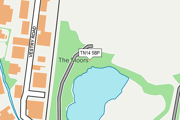
TN14 5BP is located in the Sevenoaks Northern electoral ward, within the local authority district of Sevenoaks and the English Parliamentary constituency of Sevenoaks. The Sub Integrated Care Board (ICB) Location is NHS Kent and Medway ICB - 91Q and the police force is Kent. This postcode has been in use since June 2005.


GetTheData
Source: OS OpenMap – Local (Ordnance Survey)
Source: OS VectorMap District (Ordnance Survey)
Licence: Open Government Licence (requires attribution)
| Easting | 553338 |
| Northing | 157604 |
| Latitude | 51.296918 |
| Longitude | 0.198010 |
GetTheData
Source: Open Postcode Geo
Licence: Open Government Licence
| Country | England |
| Postcode District | TN14 |
➜ See where TN14 is on a map | |
GetTheData
Source: Land Registry Price Paid Data
Licence: Open Government Licence
Elevation or altitude of TN14 5BP as distance above sea level:
| Metres | Feet | |
|---|---|---|
| Elevation | 70m | 230ft |
Elevation is measured from the approximate centre of the postcode, to the nearest point on an OS contour line from OS Terrain 50, which has contour spacing of ten vertical metres.
➜ How high above sea level am I? Find the elevation of your current position using your device's GPS.
GetTheData
Source: Open Postcode Elevation
Licence: Open Government Licence
| Ward | Sevenoaks Northern |
| Constituency | Sevenoaks |
GetTheData
Source: ONS Postcode Database
Licence: Open Government Licence
| Sainsbury's (Otford Road) | Sevenoaks | 430m |
| Vestry Road (Otford Road) | Sevenoaks | 441m |
| Sainsbury's (Otford Road) | Sevenoaks | 442m |
| Crampton's Road | Sevenoaks | 453m |
| Crampton's Road | Sevenoaks | 472m |
| Bat & Ball Station | 0.8km |
| Otford Station | 1.8km |
| Dunton Green Station | 1.9km |
GetTheData
Source: NaPTAN
Licence: Open Government Licence
GetTheData
Source: ONS Postcode Database
Licence: Open Government Licence


➜ Get more ratings from the Food Standards Agency
GetTheData
Source: Food Standards Agency
Licence: FSA terms & conditions
| Last Collection | |||
|---|---|---|---|
| Location | Mon-Fri | Sat | Distance |
| Vestry Estate Meterbox | 427m | ||
| Cramptons | 16:30 | 12:15 | 482m |
| Greatness | 17:00 | 12:15 | 601m |
GetTheData
Source: Dracos
Licence: Creative Commons Attribution-ShareAlike
The below table lists the International Territorial Level (ITL) codes (formerly Nomenclature of Territorial Units for Statistics (NUTS) codes) and Local Administrative Units (LAU) codes for TN14 5BP:
| ITL 1 Code | Name |
|---|---|
| TLJ | South East (England) |
| ITL 2 Code | Name |
| TLJ4 | Kent |
| ITL 3 Code | Name |
| TLJ46 | West Kent |
| LAU 1 Code | Name |
| E07000111 | Sevenoaks |
GetTheData
Source: ONS Postcode Directory
Licence: Open Government Licence
The below table lists the Census Output Area (OA), Lower Layer Super Output Area (LSOA), and Middle Layer Super Output Area (MSOA) for TN14 5BP:
| Code | Name | |
|---|---|---|
| OA | E00124187 | |
| LSOA | E01024465 | Sevenoaks 010D |
| MSOA | E02005096 | Sevenoaks 010 |
GetTheData
Source: ONS Postcode Directory
Licence: Open Government Licence
| TN14 5EL | Vestry Road | 308m |
| TN14 5AH | Watercress Close | 349m |
| TN14 5AN | Watercress Drive | 368m |
| TN14 5AL | Watercress Drive | 414m |
| TN14 5EE | Swanzy Road | 434m |
| TN14 5EB | The Moor Road | 436m |
| TN14 5EH | Old Otford Road | 469m |
| TN14 5DZ | Cramptons Road | 492m |
| TN14 5BJ | Orchard Close | 494m |
| TN14 5ED | The Moor Road | 513m |
GetTheData
Source: Open Postcode Geo; Land Registry Price Paid Data
Licence: Open Government Licence