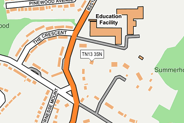
TN13 3SN is located in the Seal and Weald electoral ward, within the local authority district of Sevenoaks and the English Parliamentary constituency of Sevenoaks. The Sub Integrated Care Board (ICB) Location is NHS Kent and Medway ICB - 91Q and the police force is Kent. This postcode has been in use since June 2017.


GetTheData
Source: OS OpenMap – Local (Ordnance Survey)
Source: OS VectorMap District (Ordnance Survey)
Licence: Open Government Licence (requires attribution)
| Easting | 554167 |
| Northing | 156622 |
| Latitude | 51.287871 |
| Longitude | 0.209468 |
GetTheData
Source: Open Postcode Geo
Licence: Open Government Licence
| Country | England |
| Postcode District | TN13 |
➜ See where TN13 is on a map ➜ Where is Sevenoaks? | |
GetTheData
Source: Land Registry Price Paid Data
Licence: Open Government Licence
| Ward | Seal And Weald |
| Constituency | Sevenoaks |
GetTheData
Source: ONS Postcode Database
Licence: Open Government Licence
| Trinity School (Seal Hollow Road) | Greatness | 105m |
| Seal Cemetery (Seal Road) | Greatness | 204m |
| Seal Cemetery (Seal Road) | Greatness | 309m |
| Wildernesse Avenue (Seal Hollow Road) | Sevenoaks | 333m |
| The Crescent (Hillingdon Avenue) | Sevenoaks | 394m |
| Bat & Ball Station | 1.1km |
| Sevenoaks Station | 2.3km |
| Kemsing Station | 2.8km |
GetTheData
Source: NaPTAN
Licence: Open Government Licence
GetTheData
Source: ONS Postcode Database
Licence: Open Government Licence


➜ Get more ratings from the Food Standards Agency
GetTheData
Source: Food Standards Agency
Licence: FSA terms & conditions
| Last Collection | |||
|---|---|---|---|
| Location | Mon-Fri | Sat | Distance |
| Paygate | 16:45 | 12:30 | 190m |
| Wilderness Mount | 16:45 | 12:30 | 330m |
| Wildernesse Avenue | 16:30 | 09:00 | 565m |
GetTheData
Source: Dracos
Licence: Creative Commons Attribution-ShareAlike
The below table lists the International Territorial Level (ITL) codes (formerly Nomenclature of Territorial Units for Statistics (NUTS) codes) and Local Administrative Units (LAU) codes for TN13 3SN:
| ITL 1 Code | Name |
|---|---|
| TLJ | South East (England) |
| ITL 2 Code | Name |
| TLJ4 | Kent |
| ITL 3 Code | Name |
| TLJ46 | West Kent |
| LAU 1 Code | Name |
| E07000111 | Sevenoaks |
GetTheData
Source: ONS Postcode Directory
Licence: Open Government Licence
The below table lists the Census Output Area (OA), Lower Layer Super Output Area (LSOA), and Middle Layer Super Output Area (MSOA) for TN13 3SN:
| Code | Name | |
|---|---|---|
| OA | E00124148 | |
| LSOA | E01024458 | Sevenoaks 012A |
| MSOA | E02005098 | Sevenoaks 012 |
GetTheData
Source: ONS Postcode Directory
Licence: Open Government Licence
| TN13 3SP | Seal Hollow Road | 166m |
| TN13 3SL | Seal Hollow Road | 178m |
| TN14 5AD | Seal Road | 217m |
| TN14 5AB | Seal Road | 242m |
| TN15 0AA | Seal Road | 242m |
| TN13 3SJ | Seal Hollow Road | 251m |
| TN14 5AF | Pinewood Avenue | 276m |
| TN13 3QX | The Crescent | 298m |
| TN13 3QY | The Crescent | 306m |
| TN14 5AE | Pinewood Avenue | 308m |
GetTheData
Source: Open Postcode Geo; Land Registry Price Paid Data
Licence: Open Government Licence