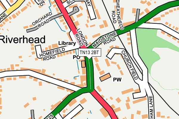
TN13 2BT is located in the Dunton Green and Riverhead electoral ward, within the local authority district of Sevenoaks and the English Parliamentary constituency of Sevenoaks. The Sub Integrated Care Board (ICB) Location is NHS Kent and Medway ICB - 91Q and the police force is Kent. This postcode has been in use since April 2017.


GetTheData
Source: OS OpenMap – Local (Ordnance Survey)
Source: OS VectorMap District (Ordnance Survey)
Licence: Open Government Licence (requires attribution)
| Easting | 551453 |
| Northing | 156180 |
| Latitude | 51.284627 |
| Longitude | 0.170391 |
GetTheData
Source: Open Postcode Geo
Licence: Open Government Licence
| Country | England |
| Postcode District | TN13 |
➜ See where TN13 is on a map ➜ Where is Sevenoaks? | |
GetTheData
Source: Land Registry Price Paid Data
Licence: Open Government Licence
| Ward | Dunton Green And Riverhead |
| Constituency | Sevenoaks |
GetTheData
Source: ONS Postcode Database
Licence: Open Government Licence
| Church (London Road) | Riverhead | 36m |
| Library (London Road) | Riverhead | 120m |
| The Riverhead (Amherst Hill) | Riverhead | 131m |
| The Riverhead (Amherst Hill) | Riverhead | 132m |
| Library (A224 To Sevenoaks) | Riverhead | 151m |
| Sevenoaks Station | 1.2km |
| Dunton Green Station | 1.3km |
| Bat & Ball Station | 1.8km |
GetTheData
Source: NaPTAN
Licence: Open Government Licence
GetTheData
Source: ONS Postcode Database
Licence: Open Government Licence


➜ Get more ratings from the Food Standards Agency
GetTheData
Source: Food Standards Agency
Licence: FSA terms & conditions
| Last Collection | |||
|---|---|---|---|
| Location | Mon-Fri | Sat | Distance |
| Riverhead Old Post Office | 17:15 | 12:30 | 100m |
| Riverhead Post Office | 17:15 | 12:00 | 111m |
| Chipstead Common | 16:00 | 12:15 | 499m |
GetTheData
Source: Dracos
Licence: Creative Commons Attribution-ShareAlike
The below table lists the International Territorial Level (ITL) codes (formerly Nomenclature of Territorial Units for Statistics (NUTS) codes) and Local Administrative Units (LAU) codes for TN13 2BT:
| ITL 1 Code | Name |
|---|---|
| TLJ | South East (England) |
| ITL 2 Code | Name |
| TLJ4 | Kent |
| ITL 3 Code | Name |
| TLJ46 | West Kent |
| LAU 1 Code | Name |
| E07000111 | Sevenoaks |
GetTheData
Source: ONS Postcode Directory
Licence: Open Government Licence
The below table lists the Census Output Area (OA), Lower Layer Super Output Area (LSOA), and Middle Layer Super Output Area (MSOA) for TN13 2BT:
| Code | Name | |
|---|---|---|
| OA | E00123985 | |
| LSOA | E01024423 | Sevenoaks 008B |
| MSOA | E02005094 | Sevenoaks 008 |
GetTheData
Source: ONS Postcode Directory
Licence: Open Government Licence
| TN13 2BS | The Heights | 24m |
| TN13 2BP | London Road | 41m |
| TN13 2BU | London Road | 50m |
| TN13 3DU | Church Field | 65m |
| TN13 3BY | Maidstone Road | 76m |
| TN13 2BH | London Road | 77m |
| TN13 2DA | River Parade | 98m |
| TN13 2AA | The Square | 103m |
| TN13 2DB | London Road | 110m |
| TN13 3DX | Shoreham Lane | 125m |
GetTheData
Source: Open Postcode Geo; Land Registry Price Paid Data
Licence: Open Government Licence