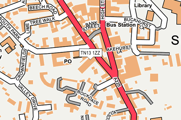
TN13 1ZZ is located in the Sevenoaks Town and St John's electoral ward, within the local authority district of Sevenoaks and the English Parliamentary constituency of Sevenoaks. The Sub Integrated Care Board (ICB) Location is NHS Kent and Medway ICB - 91Q and the police force is Kent. This postcode has been in use since May 1994.


GetTheData
Source: OS OpenMap – Local (Ordnance Survey)
Source: OS VectorMap District (Ordnance Survey)
Licence: Open Government Licence (requires attribution)
| Easting | 553010 |
| Northing | 154605 |
| Latitude | 51.270061 |
| Longitude | 0.191999 |
GetTheData
Source: Open Postcode Geo
Licence: Open Government Licence
| Country | England |
| Postcode District | TN13 |
➜ See where TN13 is on a map ➜ Where is Sevenoaks? | |
GetTheData
Source: Land Registry Price Paid Data
Licence: Open Government Licence
Elevation or altitude of TN13 1ZZ as distance above sea level:
| Metres | Feet | |
|---|---|---|
| Elevation | 150m | 492ft |
Elevation is measured from the approximate centre of the postcode, to the nearest point on an OS contour line from OS Terrain 50, which has contour spacing of ten vertical metres.
➜ How high above sea level am I? Find the elevation of your current position using your device's GPS.
GetTheData
Source: Open Postcode Elevation
Licence: Open Government Licence
| Ward | Sevenoaks Town And St John's |
| Constituency | Sevenoaks |
GetTheData
Source: ONS Postcode Database
Licence: Open Government Licence
| Stag Theatre (London Road) | Sevenoaks | 22m |
| The Chequers (High Street) | Sevenoaks | 64m |
| The Chequers (High Street) | Sevenoaks | 131m |
| M3 House (London Road) | Sevenoaks | 282m |
| M3 House (London Road) | Sevenoaks | 283m |
| Sevenoaks Station | 1km |
| Bat & Ball Station | 2.2km |
| Dunton Green Station | 3.3km |
GetTheData
Source: NaPTAN
Licence: Open Government Licence
GetTheData
Source: ONS Postcode Database
Licence: Open Government Licence


➜ Get more ratings from the Food Standards Agency
GetTheData
Source: Food Standards Agency
Licence: FSA terms & conditions
| Last Collection | |||
|---|---|---|---|
| Location | Mon-Fri | Sat | Distance |
| Sevenoaks Post Office | 19:00 | 13:00 | 39m |
| Sevenoaks Post Office | 19:00 | 13:00 | 41m |
| Market Place | 18:30 | 12:30 | 67m |
GetTheData
Source: Dracos
Licence: Creative Commons Attribution-ShareAlike
The below table lists the International Territorial Level (ITL) codes (formerly Nomenclature of Territorial Units for Statistics (NUTS) codes) and Local Administrative Units (LAU) codes for TN13 1ZZ:
| ITL 1 Code | Name |
|---|---|
| TLJ | South East (England) |
| ITL 2 Code | Name |
| TLJ4 | Kent |
| ITL 3 Code | Name |
| TLJ46 | West Kent |
| LAU 1 Code | Name |
| E07000111 | Sevenoaks |
GetTheData
Source: ONS Postcode Directory
Licence: Open Government Licence
The below table lists the Census Output Area (OA), Lower Layer Super Output Area (LSOA), and Middle Layer Super Output Area (MSOA) for TN13 1ZZ:
| Code | Name | |
|---|---|---|
| OA | E00124207 | |
| LSOA | E01024471 | Sevenoaks 012F |
| MSOA | E02005098 | Sevenoaks 012 |
GetTheData
Source: ONS Postcode Directory
Licence: Open Government Licence
| TN13 1AH | London Road | 32m |
| TN13 1AJ | London Road | 48m |
| TN13 1LD | High Street | 49m |
| TN13 1LA | High Street | 74m |
| TN13 1JS | Rockdale Mews | 85m |
| TN13 1LL | Dorset Street | 90m |
| TN13 1JY | High Street | 90m |
| TN13 1LH | High Street | 91m |
| TN13 1AP | London Road | 92m |
| TN13 1LP | High Street | 97m |
GetTheData
Source: Open Postcode Geo; Land Registry Price Paid Data
Licence: Open Government Licence