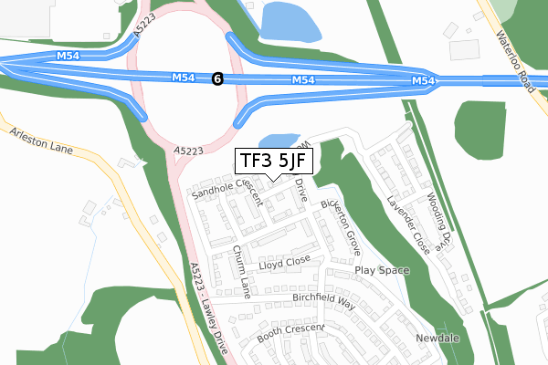
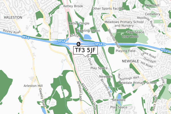
TF3 5JF is located in the Lawley electoral ward, within the unitary authority of Telford and Wrekin and the English Parliamentary constituency of Telford. The Sub Integrated Care Board (ICB) Location is NHS Shropshire, Telford and Wrekin ICB - M2L0M and the police force is West Mercia. This postcode has been in use since October 2018.


GetTheData
Source: OS Open Zoomstack (Ordnance Survey)
Licence: Open Government Licence (requires attribution)
Attribution: Contains OS data © Crown copyright and database right 2025
Source: Open Postcode Geo
Licence: Open Government Licence (requires attribution)
Attribution: Contains OS data © Crown copyright and database right 2025; Contains Royal Mail data © Royal Mail copyright and database right 2025; Source: Office for National Statistics licensed under the Open Government Licence v.3.0
| Easting | 367220 |
| Northing | 310004 |
| Latitude | 52.686742 |
| Longitude | -2.486368 |
GetTheData
Source: Open Postcode Geo
Licence: Open Government Licence
| Country | England |
| Postcode District | TF3 |
➜ See where TF3 is on a map ➜ Where is Telford? | |
GetTheData
Source: Land Registry Price Paid Data
Licence: Open Government Licence
| Ward | Lawley |
| Constituency | Telford |
GetTheData
Source: ONS Postcode Database
Licence: Open Government Licence
1, BARN LANE, TELFORD, TF3 5JF 2018 28 SEP £199,950 |
GetTheData
Source: HM Land Registry Price Paid Data
Licence: Contains HM Land Registry data © Crown copyright and database right 2025. This data is licensed under the Open Government Licence v3.0.
| Tesco Store (Wrekin Retail Park) | Wrekin Retail Park | 444m |
| Newdale Halt (Synders Way) | Lawley | 484m |
| Sinclair Gardens (Waterloo Road) | Ketley | 568m |
| Sinclair Gardens (Waterloo Road) | Ketley | 575m |
| Harris Terrace (Rock Road) | Overdale | 613m |
| Oakengates Station | 2.6km |
| Wellington (Shropshire) Station | 2.6km |
| Telford Central Station | 3.1km |
GetTheData
Source: NaPTAN
Licence: Open Government Licence
| Percentage of properties with Next Generation Access | 100.0% |
| Percentage of properties with Superfast Broadband | 100.0% |
| Percentage of properties with Ultrafast Broadband | 100.0% |
| Percentage of properties with Full Fibre Broadband | 0.0% |
Superfast Broadband is between 30Mbps and 300Mbps
Ultrafast Broadband is > 300Mbps
| Percentage of properties unable to receive 2Mbps | 0.0% |
| Percentage of properties unable to receive 5Mbps | 0.0% |
| Percentage of properties unable to receive 10Mbps | 0.0% |
| Percentage of properties unable to receive 30Mbps | 0.0% |
GetTheData
Source: Ofcom
Licence: Ofcom Terms of Use (requires attribution)
GetTheData
Source: ONS Postcode Database
Licence: Open Government Licence


➜ Get more ratings from the Food Standards Agency
GetTheData
Source: Food Standards Agency
Licence: FSA terms & conditions
| Last Collection | |||
|---|---|---|---|
| Location | Mon-Fri | Sat | Distance |
| Tesco | 18:00 | 12:00 | 540m |
| Overdale Post Office | 17:15 | 11:00 | 790m |
| Holyhead Road | 16:45 | 11:15 | 1,107m |
GetTheData
Source: Dracos
Licence: Creative Commons Attribution-ShareAlike
The below table lists the International Territorial Level (ITL) codes (formerly Nomenclature of Territorial Units for Statistics (NUTS) codes) and Local Administrative Units (LAU) codes for TF3 5JF:
| ITL 1 Code | Name |
|---|---|
| TLG | West Midlands (England) |
| ITL 2 Code | Name |
| TLG2 | Shropshire and Staffordshire |
| ITL 3 Code | Name |
| TLG21 | Telford and Wrekin |
| LAU 1 Code | Name |
| E06000020 | Telford and Wrekin |
GetTheData
Source: ONS Postcode Directory
Licence: Open Government Licence
The below table lists the Census Output Area (OA), Lower Layer Super Output Area (LSOA), and Middle Layer Super Output Area (MSOA) for TF3 5JF:
| Code | Name | |
|---|---|---|
| OA | E00173129 | |
| LSOA | E01014156 | Telford and Wrekin 016C |
| MSOA | E02002943 | Telford and Wrekin 016 |
GetTheData
Source: ONS Postcode Directory
Licence: Open Government Licence
| TF1 2LA | Arleston Brook | 279m |
| TF1 5HP | Sinclair Gardens | 492m |
| TF3 5GE | Synders Way | 510m |
| TF1 2JZ | 527m | |
| TF3 5GG | Cottom Way | 560m |
| TF1 5HR | Sinclair Gardens | 569m |
| TF3 5HF | Marlborough Way | 571m |
| TF3 5GF | Newdale Halt | 591m |
| TF3 5GB | Sunny Lane | 601m |
| TF3 5GH | Dobbins Lane | 608m |
GetTheData
Source: Open Postcode Geo; Land Registry Price Paid Data
Licence: Open Government Licence