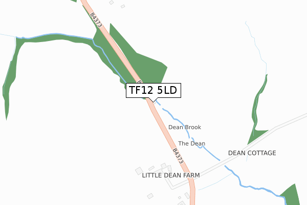
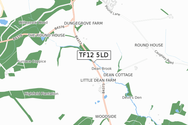
TF12 5LD is located in the Broseley electoral ward, within the unitary authority of Shropshire and the English Parliamentary constituency of Ludlow. The Sub Integrated Care Board (ICB) Location is NHS Shropshire, Telford and Wrekin ICB - M2L0M and the police force is West Mercia. This postcode has been in use since April 2020.


GetTheData
Source: OS Open Zoomstack (Ordnance Survey)
Licence: Open Government Licence (requires attribution)
Attribution: Contains OS data © Crown copyright and database right 2025
Source: Open Postcode Geo
Licence: Open Government Licence (requires attribution)
Attribution: Contains OS data © Crown copyright and database right 2025; Contains Royal Mail data © Royal Mail copyright and database right 2025; Source: Office for National Statistics licensed under the Open Government Licence v.3.0
| Easting | 367374 |
| Northing | 302845 |
| Latitude | 52.622396 |
| Longitude | -2.483379 |
GetTheData
Source: Open Postcode Geo
Licence: Open Government Licence
| Country | England |
| Postcode District | TF12 |
➜ See where TF12 is on a map ➜ Where is Broseley? | |
GetTheData
Source: Land Registry Price Paid Data
Licence: Open Government Licence
| Ward | Broseley |
| Constituency | Ludlow |
GetTheData
Source: ONS Postcode Database
Licence: Open Government Licence
| Windsor Crescent Jct (Elizabeth Crescent) | Broseley | 484m |
| Windsor Crescent Jct (Elizabeth Crescent) | Broseley | 485m |
| Elizabeth Crescent Jct (King Street) | Benthall | 538m |
| Old Police Station (Waterloo Street) | Ironbridge | 583m |
| The Square (High Street) | Ironbridge | 601m |
GetTheData
Source: NaPTAN
Licence: Open Government Licence
GetTheData
Source: ONS Postcode Database
Licence: Open Government Licence


➜ Get more ratings from the Food Standards Agency
GetTheData
Source: Food Standards Agency
Licence: FSA terms & conditions
| Last Collection | |||
|---|---|---|---|
| Location | Mon-Fri | Sat | Distance |
| Broseley Wood | 12:00 | 11:30 | 325m |
| Cockshutt Road | 12:00 | 12:00 | 545m |
| King Street | 12:00 | 11:15 | 578m |
GetTheData
Source: Dracos
Licence: Creative Commons Attribution-ShareAlike
The below table lists the International Territorial Level (ITL) codes (formerly Nomenclature of Territorial Units for Statistics (NUTS) codes) and Local Administrative Units (LAU) codes for TF12 5LD:
| ITL 1 Code | Name |
|---|---|
| TLG | West Midlands (England) |
| ITL 2 Code | Name |
| TLG2 | Shropshire and Staffordshire |
| ITL 3 Code | Name |
| TLG22 | Shropshire |
| LAU 1 Code | Name |
| E06000051 | Shropshire |
GetTheData
Source: ONS Postcode Directory
Licence: Open Government Licence
The below table lists the Census Output Area (OA), Lower Layer Super Output Area (LSOA), and Middle Layer Super Output Area (MSOA) for TF12 5LD:
| Code | Name | |
|---|---|---|
| OA | E00146890 | |
| LSOA | E01028840 | Shropshire 029C |
| MSOA | E02006010 | Shropshire 029 |
GetTheData
Source: ONS Postcode Directory
Licence: Open Government Licence
| TF12 5QJ | Maypole Road | 64m |
| TF12 5QL | Cobwell Road | 90m |
| TF12 5QB | Woodlands Road | 108m |
| TF12 5PY | Woodlands Close | 116m |
| TF12 5QP | Easthope Road | 118m |
| TF12 5QH | Maypole Road | 146m |
| TF12 5QN | Cobwell Road | 160m |
| TF12 5PX | Woodlands Road | 190m |
| TF12 5QG | Sycamore Road | 206m |
| TF12 5QW | Cobwell Road | 217m |
GetTheData
Source: Open Postcode Geo; Land Registry Price Paid Data
Licence: Open Government Licence