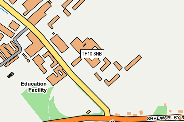
TF10 8NB is located in the Edgmond electoral ward, within the unitary authority of Telford and Wrekin and the English Parliamentary constituency of The Wrekin. The Sub Integrated Care Board (ICB) Location is NHS Shropshire, Telford and Wrekin ICB - M2L0M and the police force is West Mercia. This postcode has been in use since April 2017.


GetTheData
Source: OS OpenMap – Local (Ordnance Survey)
Source: OS VectorMap District (Ordnance Survey)
Licence: Open Government Licence (requires attribution)
| Easting | 371392 |
| Northing | 320342 |
| Latitude | 52.779910 |
| Longitude | -2.425557 |
GetTheData
Source: Open Postcode Geo
Licence: Open Government Licence
| Country | England |
| Postcode District | TF10 |
➜ See where TF10 is on a map ➜ Where is Edgmond? | |
GetTheData
Source: Land Registry Price Paid Data
Licence: Open Government Licence
Elevation or altitude of TF10 8NB as distance above sea level:
| Metres | Feet | |
|---|---|---|
| Elevation | 70m | 230ft |
Elevation is measured from the approximate centre of the postcode, to the nearest point on an OS contour line from OS Terrain 50, which has contour spacing of ten vertical metres.
➜ How high above sea level am I? Find the elevation of your current position using your device's GPS.
GetTheData
Source: Open Postcode Elevation
Licence: Open Government Licence
| Ward | Edgmond |
| Constituency | The Wrekin |
GetTheData
Source: ONS Postcode Database
Licence: Open Government Licence
| Harper Adams University (Flatt Road) | Edgmond | 219m |
| Harper Adams University (Shrewsbury Road) | Edgmond | 220m |
| Harper Adams University (Shrewsbury Road) | Edgmond | 222m |
| Harper Adams University (Flatt Road) | Edgmond | 225m |
| Longwithy Lane (Shrewsbury Road) | Edgmond | 592m |
GetTheData
Source: NaPTAN
Licence: Open Government Licence
Estimated total energy consumption in TF10 8NB by fuel type, 2015.
| Consumption (kWh) | 185,414 |
|---|---|
| Meter count | 7 |
| Mean (kWh/meter) | 26,488 |
| Median (kWh/meter) | 23,335 |
GetTheData
Source: Postcode level gas estimates: 2015 (experimental)
Source: Postcode level electricity estimates: 2015 (experimental)
Licence: Open Government Licence
GetTheData
Source: ONS Postcode Database
Licence: Open Government Licence


➜ Get more ratings from the Food Standards Agency
GetTheData
Source: Food Standards Agency
Licence: FSA terms & conditions
| Last Collection | |||
|---|---|---|---|
| Location | Mon-Fri | Sat | Distance |
| Marsh Road | 10:30 | 10:30 | 548m |
| Newport Road | 10:30 | 10:30 | 1,737m |
| Puleston | 10:30 | 09:00 | 2,906m |
GetTheData
Source: Dracos
Licence: Creative Commons Attribution-ShareAlike
The below table lists the International Territorial Level (ITL) codes (formerly Nomenclature of Territorial Units for Statistics (NUTS) codes) and Local Administrative Units (LAU) codes for TF10 8NB:
| ITL 1 Code | Name |
|---|---|
| TLG | West Midlands (England) |
| ITL 2 Code | Name |
| TLG2 | Shropshire and Staffordshire |
| ITL 3 Code | Name |
| TLG21 | Telford and Wrekin |
| LAU 1 Code | Name |
| E06000020 | Telford and Wrekin |
GetTheData
Source: ONS Postcode Directory
Licence: Open Government Licence
The below table lists the Census Output Area (OA), Lower Layer Super Output Area (LSOA), and Middle Layer Super Output Area (MSOA) for TF10 8NB:
| Code | Name | |
|---|---|---|
| OA | E00173135 | |
| LSOA | E01014131 | Telford and Wrekin 002B |
| MSOA | E02002929 | Telford and Wrekin 002 |
GetTheData
Source: ONS Postcode Directory
Licence: Open Government Licence
| TF10 8HY | Newtown | 208m |
| TF10 8EL | Green Lane | 409m |
| TF10 8HX | Shrewsbury Road | 519m |
| TF10 8EN | Marsh Road | 527m |
| TF10 8EW | Waterloo Road | 669m |
| TF10 8EP | Marsh Road | 693m |
| TF10 8EJ | Longwithy Lane | 704m |
| TF10 8JE | Stackyard Lane | 805m |
| TF10 8ER | Marsh Road | 867m |
| TF10 8LH | Kilvert Close | 1026m |
GetTheData
Source: Open Postcode Geo; Land Registry Price Paid Data
Licence: Open Government Licence