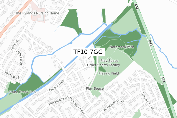
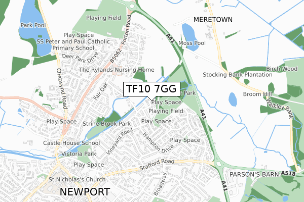
TF10 7GG lies on The Horseshoes in Newport. TF10 7GG is located in the Newport East electoral ward, within the unitary authority of Telford and Wrekin and the English Parliamentary constituency of The Wrekin. The Sub Integrated Care Board (ICB) Location is NHS Shropshire, Telford and Wrekin ICB - M2L0M and the police force is West Mercia. This postcode has been in use since November 2013.


GetTheData
Source: OS Open Zoomstack (Ordnance Survey)
Licence: Open Government Licence (requires attribution)
Attribution: Contains OS data © Crown copyright and database right 2025
Source: Open Postcode Geo
Licence: Open Government Licence (requires attribution)
Attribution: Contains OS data © Crown copyright and database right 2025; Contains Royal Mail data © Royal Mail copyright and database right 2025; Source: Office for National Statistics licensed under the Open Government Licence v.3.0
| Easting | 375114 |
| Northing | 319840 |
| Latitude | 52.775568 |
| Longitude | -2.370342 |
GetTheData
Source: Open Postcode Geo
Licence: Open Government Licence
| Street | The Horseshoes |
| Town/City | Newport |
| Country | England |
| Postcode District | TF10 |
➜ See where TF10 is on a map | |
GetTheData
Source: Land Registry Price Paid Data
Licence: Open Government Licence
Elevation or altitude of TF10 7GG as distance above sea level:
| Metres | Feet | |
|---|---|---|
| Elevation | 70m | 230ft |
Elevation is measured from the approximate centre of the postcode, to the nearest point on an OS contour line from OS Terrain 50, which has contour spacing of ten vertical metres.
➜ How high above sea level am I? Find the elevation of your current position using your device's GPS.
GetTheData
Source: Open Postcode Elevation
Licence: Open Government Licence
| Ward | Newport East |
| Constituency | The Wrekin |
GetTheData
Source: ONS Postcode Database
Licence: Open Government Licence
| Vineyard Road (Hampton Drive) | Newport | 273m |
| Lapworth Way (Hampton Drive) | Newport | 406m |
| Fishers Lock (Vineyard Road) | Newport | 420m |
| Fishers Lock (Vineyard Road) | Newport | 427m |
| Hampton Drive | Newport | 480m |
GetTheData
Source: NaPTAN
Licence: Open Government Licence
| Percentage of properties with Next Generation Access | 100.0% |
| Percentage of properties with Superfast Broadband | 100.0% |
| Percentage of properties with Ultrafast Broadband | 100.0% |
| Percentage of properties with Full Fibre Broadband | 0.0% |
Superfast Broadband is between 30Mbps and 300Mbps
Ultrafast Broadband is > 300Mbps
| Median download speed | 70.0Mbps |
| Average download speed | 100.2Mbps |
| Maximum download speed | 350.00Mbps |
| Median upload speed | 10.0Mbps |
| Average upload speed | 9.2Mbps |
| Maximum upload speed | 20.00Mbps |
| Percentage of properties unable to receive 2Mbps | 0.0% |
| Percentage of properties unable to receive 5Mbps | 0.0% |
| Percentage of properties unable to receive 10Mbps | 0.0% |
| Percentage of properties unable to receive 30Mbps | 0.0% |
GetTheData
Source: Ofcom
Licence: Ofcom Terms of Use (requires attribution)
GetTheData
Source: ONS Postcode Database
Licence: Open Government Licence


➜ Get more ratings from the Food Standards Agency
GetTheData
Source: Food Standards Agency
Licence: FSA terms & conditions
| Last Collection | |||
|---|---|---|---|
| Location | Mon-Fri | Sat | Distance |
| Mere Close | 17:15 | 11:30 | 417m |
| Stafford Road | 17:15 | 11:30 | 530m |
| Masons Place | 17:00 | 11:30 | 543m |
GetTheData
Source: Dracos
Licence: Creative Commons Attribution-ShareAlike
The below table lists the International Territorial Level (ITL) codes (formerly Nomenclature of Territorial Units for Statistics (NUTS) codes) and Local Administrative Units (LAU) codes for TF10 7GG:
| ITL 1 Code | Name |
|---|---|
| TLG | West Midlands (England) |
| ITL 2 Code | Name |
| TLG2 | Shropshire and Staffordshire |
| ITL 3 Code | Name |
| TLG21 | Telford and Wrekin |
| LAU 1 Code | Name |
| E06000020 | Telford and Wrekin |
GetTheData
Source: ONS Postcode Directory
Licence: Open Government Licence
The below table lists the Census Output Area (OA), Lower Layer Super Output Area (LSOA), and Middle Layer Super Output Area (MSOA) for TF10 7GG:
| Code | Name | |
|---|---|---|
| OA | E00071563 | |
| LSOA | E01014172 | Telford and Wrekin 001B |
| MSOA | E02002928 | Telford and Wrekin 001 |
GetTheData
Source: ONS Postcode Directory
Licence: Open Government Licence
| TF10 7TA | Maynards Croft | 117m |
| TF10 7SZ | Maynards Croft | 128m |
| TF10 7TB | Maynards Croft | 130m |
| TF10 7SW | Vineyard Road | 170m |
| TF10 7SY | Fishers Lock | 194m |
| TF10 7SX | Fishers Lock | 199m |
| TF10 7SB | Henley Drive | 209m |
| TF10 7BZ | Vineyard Road | 219m |
| TF10 7TF | Aqualate Close | 228m |
| TF10 7SP | Caldercrofts | 232m |
GetTheData
Source: Open Postcode Geo; Land Registry Price Paid Data
Licence: Open Government Licence