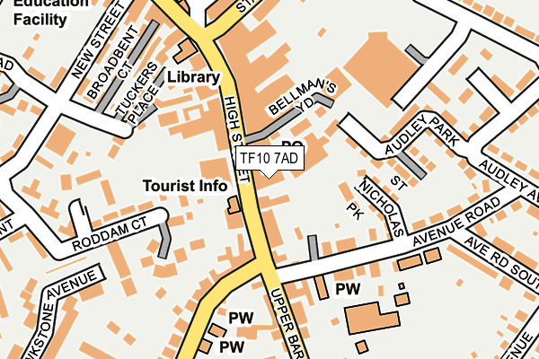
TF10 7AD is located in the Newport West electoral ward, within the unitary authority of Telford and Wrekin and the English Parliamentary constituency of The Wrekin. The Sub Integrated Care Board (ICB) Location is NHS Shropshire, Telford and Wrekin ICB - M2L0M and the police force is West Mercia. This postcode has been in use since April 1987.


GetTheData
Source: OS OpenMap – Local (Ordnance Survey)
Source: OS VectorMap District (Ordnance Survey)
Licence: Open Government Licence (requires attribution)
| Easting | 374650 |
| Northing | 318923 |
| Latitude | 52.767303 |
| Longitude | -2.377148 |
GetTheData
Source: Open Postcode Geo
Licence: Open Government Licence
| Country | England |
| Postcode District | TF10 |
➜ See where TF10 is on a map ➜ Where is Newport? | |
GetTheData
Source: Land Registry Price Paid Data
Licence: Open Government Licence
Elevation or altitude of TF10 7AD as distance above sea level:
| Metres | Feet | |
|---|---|---|
| Elevation | 70m | 230ft |
Elevation is measured from the approximate centre of the postcode, to the nearest point on an OS contour line from OS Terrain 50, which has contour spacing of ten vertical metres.
➜ How high above sea level am I? Find the elevation of your current position using your device's GPS.
GetTheData
Source: Open Postcode Elevation
Licence: Open Government Licence
| Ward | Newport West |
| Constituency | The Wrekin |
GetTheData
Source: ONS Postcode Database
Licence: Open Government Licence
| Guildhall (High Street) | Newport | 42m |
| Boots (High Street) | Newport | 128m |
| Beaumarais Road (Gravelly Drive) | Newport | 245m |
| Underhill Close (Audley Avenue) | Newport | 261m |
| Beaumaris Road (Gravelly Drive) | Newport | 261m |
GetTheData
Source: NaPTAN
Licence: Open Government Licence
GetTheData
Source: ONS Postcode Database
Licence: Open Government Licence


➜ Get more ratings from the Food Standards Agency
GetTheData
Source: Food Standards Agency
Licence: FSA terms & conditions
| Last Collection | |||
|---|---|---|---|
| Location | Mon-Fri | Sat | Distance |
| Somerfields | 17:30 | 11:00 | 21m |
| Upper Bar | 17:30 | 11:30 | 50m |
| Audley Avenue | 17:30 | 11:30 | 234m |
GetTheData
Source: Dracos
Licence: Creative Commons Attribution-ShareAlike
The below table lists the International Territorial Level (ITL) codes (formerly Nomenclature of Territorial Units for Statistics (NUTS) codes) and Local Administrative Units (LAU) codes for TF10 7AD:
| ITL 1 Code | Name |
|---|---|
| TLG | West Midlands (England) |
| ITL 2 Code | Name |
| TLG2 | Shropshire and Staffordshire |
| ITL 3 Code | Name |
| TLG21 | Telford and Wrekin |
| LAU 1 Code | Name |
| E06000020 | Telford and Wrekin |
GetTheData
Source: ONS Postcode Directory
Licence: Open Government Licence
The below table lists the Census Output Area (OA), Lower Layer Super Output Area (LSOA), and Middle Layer Super Output Area (MSOA) for TF10 7AD:
| Code | Name | |
|---|---|---|
| OA | E00071588 | |
| LSOA | E01014178 | Telford and Wrekin 003D |
| MSOA | E02002930 | Telford and Wrekin 003 |
GetTheData
Source: ONS Postcode Directory
Licence: Open Government Licence
| TF10 7AN | High Street | 18m |
| TF10 7AW | Upper Bar | 59m |
| TF10 7AJ | Bellmans Yard | 69m |
| TF10 7AP | Upper Bar | 73m |
| TF10 7NH | Smallwood Court | 100m |
| TF10 7AQ | High Street | 104m |
| TF10 7GJ | St Nicholas Park | 116m |
| TF10 7AT | High Street | 135m |
| TF10 7AA | Crown Mews | 139m |
| TF10 7EA | Avenue Road | 147m |
GetTheData
Source: Open Postcode Geo; Land Registry Price Paid Data
Licence: Open Government Licence