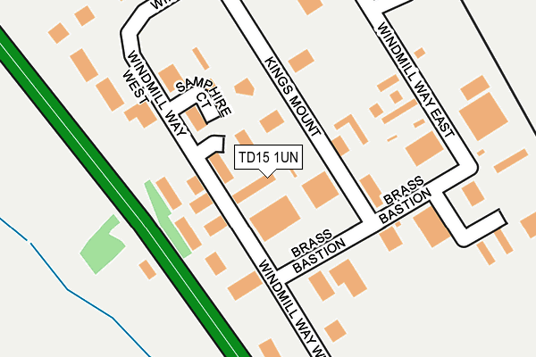
TD15 1UN is located in the Berwick North electoral ward, within the unitary authority of Northumberland and the English Parliamentary constituency of Berwick-upon-Tweed. The Sub Integrated Care Board (ICB) Location is NHS North East and North Cumbria ICB - 00L and the police force is Northumbria. This postcode has been in use since June 1981.


GetTheData
Source: OS OpenMap – Local (Ordnance Survey)
Source: OS VectorMap District (Ordnance Survey)
Licence: Open Government Licence (requires attribution)
| Easting | 398994 |
| Northing | 655054 |
| Latitude | 55.788792 |
| Longitude | -2.017611 |
GetTheData
Source: Open Postcode Geo
Licence: Open Government Licence
| Country | England |
| Postcode District | TD15 |
➜ See where TD15 is on a map ➜ Where is Berwick-upon-Tweed? | |
GetTheData
Source: Land Registry Price Paid Data
Licence: Open Government Licence
Elevation or altitude of TD15 1UN as distance above sea level:
| Metres | Feet | |
|---|---|---|
| Elevation | 60m | 197ft |
Elevation is measured from the approximate centre of the postcode, to the nearest point on an OS contour line from OS Terrain 50, which has contour spacing of ten vertical metres.
➜ How high above sea level am I? Find the elevation of your current position using your device's GPS.
GetTheData
Source: Open Postcode Elevation
Licence: Open Government Licence
| Ward | Berwick North |
| Constituency | Berwick-upon-tweed |
GetTheData
Source: ONS Postcode Database
Licence: Open Government Licence
| Perryman's Garage (Brass Bastion) | Ramparts Business Park | 108m |
| Conundrum (A1) | Ramparts Business Park | 175m |
| Windmill Way North | Ramparts Business Park | 239m |
| Conundrum (A1) | Ramparts Business Park | 381m |
| Morrisons Car Park (Loaning Meadows) | Newfields | 504m |
| Berwick-upon-Tweed Station | 1.7km |
GetTheData
Source: NaPTAN
Licence: Open Government Licence
Estimated total energy consumption in TD15 1UN by fuel type, 2015.
| Consumption (kWh) | 315,578 |
|---|---|
| Meter count | 13 |
| Mean (kWh/meter) | 24,275 |
| Median (kWh/meter) | 11,729 |
GetTheData
Source: Postcode level gas estimates: 2015 (experimental)
Source: Postcode level electricity estimates: 2015 (experimental)
Licence: Open Government Licence
GetTheData
Source: ONS Postcode Database
Licence: Open Government Licence


➜ Get more ratings from the Food Standards Agency
GetTheData
Source: Food Standards Agency
Licence: FSA terms & conditions
| Last Collection | |||
|---|---|---|---|
| Location | Mon-Fri | Sat | Distance |
| Berwick Delivery Office | 18:15 | 13:00 | 1,073m |
| Railway Station | 17:00 | 11:30 | 1,727m |
| Castle Gate Post Office | 17:30 | 12:15 | 1,845m |
GetTheData
Source: Dracos
Licence: Creative Commons Attribution-ShareAlike
The below table lists the International Territorial Level (ITL) codes (formerly Nomenclature of Territorial Units for Statistics (NUTS) codes) and Local Administrative Units (LAU) codes for TD15 1UN:
| ITL 1 Code | Name |
|---|---|
| TLC | North East (England) |
| ITL 2 Code | Name |
| TLC2 | Northumberland, and Tyne and Wear |
| ITL 3 Code | Name |
| TLC21 | Northumberland |
| LAU 1 Code | Name |
| E06000057 | Northumberland |
GetTheData
Source: ONS Postcode Directory
Licence: Open Government Licence
The below table lists the Census Output Area (OA), Lower Layer Super Output Area (LSOA), and Middle Layer Super Output Area (MSOA) for TD15 1UN:
| Code | Name | |
|---|---|---|
| OA | E00139312 | |
| LSOA | E01027376 | Northumberland 001A |
| MSOA | E02005706 | Northumberland 001 |
GetTheData
Source: ONS Postcode Directory
Licence: Open Government Licence
| TD15 1TB | Windmill Way West | 97m |
| TD15 1SW | Newfields | 402m |
| TD15 1SN | Newfields | 486m |
| TD15 1SJ | Newfields | 525m |
| TD15 1SL | Newfields | 585m |
| TD15 1QB | St Aidans Road | 652m |
| TD15 1PQ | Carrick Close | 685m |
| TD15 1PH | Countess Of Buchan Way | 695m |
| TD15 1PG | Douglas Close | 752m |
| TD15 1QD | St Cuthberts Road | 782m |
GetTheData
Source: Open Postcode Geo; Land Registry Price Paid Data
Licence: Open Government Licence