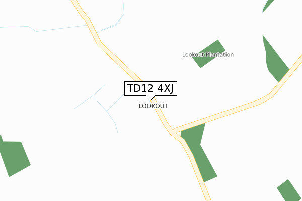
TD12 4XJ is located in the Norham and Islandshires electoral ward, within the unitary authority of Northumberland and the English Parliamentary constituency of Berwick-upon-Tweed. The Sub Integrated Care Board (ICB) Location is NHS North East and North Cumbria ICB - 00L and the police force is Northumbria. This postcode has been in use since November 2019.


GetTheData
Source: OS Open Zoomstack (Ordnance Survey)
Licence: Open Government Licence (requires attribution)
Attribution: Contains OS data © Crown copyright and database right 2025
Source: Open Postcode Geo
Licence: Open Government Licence (requires attribution)
Attribution: Contains OS data © Crown copyright and database right 2025; Contains Royal Mail data © Royal Mail copyright and database right 2025; Source: Office for National Statistics licensed under the Open Government Licence v.3.0
| Easting | 391225 |
| Northing | 639518 |
| Latitude | 55.649118 |
| Longitude | -2.141004 |
GetTheData
Source: Open Postcode Geo
Licence: Open Government Licence
| Country | England |
| Postcode District | TD12 |
➜ See where TD12 is on a map | |
GetTheData
Source: Land Registry Price Paid Data
Licence: Open Government Licence
| Ward | Norham And Islandshires |
| Constituency | Berwick-upon-tweed |
GetTheData
Source: ONS Postcode Database
Licence: Open Government Licence
| Pallinsburn (A697) | Crookham | 1,330m |
| Pallinsburn (A697) | Crookham | 1,359m |
| Village (B6353) | Crookham | 1,373m |
| Village (B6353) | Crookham | 1,374m |
GetTheData
Source: NaPTAN
Licence: Open Government Licence
GetTheData
Source: ONS Postcode Database
Licence: Open Government Licence


➜ Get more ratings from the Food Standards Agency
GetTheData
Source: Food Standards Agency
Licence: FSA terms & conditions
| Last Collection | |||
|---|---|---|---|
| Location | Mon-Fri | Sat | Distance |
| Crookham Eastfield | 10:00 | 09:00 | 640m |
| Crookham | 15:45 | 09:30 | 1,377m |
| Etal Village | 15:45 | 10:00 | 1,516m |
GetTheData
Source: Dracos
Licence: Creative Commons Attribution-ShareAlike
The below table lists the International Territorial Level (ITL) codes (formerly Nomenclature of Territorial Units for Statistics (NUTS) codes) and Local Administrative Units (LAU) codes for TD12 4XJ:
| ITL 1 Code | Name |
|---|---|
| TLC | North East (England) |
| ITL 2 Code | Name |
| TLC2 | Northumberland, and Tyne and Wear |
| ITL 3 Code | Name |
| TLC21 | Northumberland |
| LAU 1 Code | Name |
| E06000057 | Northumberland |
GetTheData
Source: ONS Postcode Directory
Licence: Open Government Licence
The below table lists the Census Output Area (OA), Lower Layer Super Output Area (LSOA), and Middle Layer Super Output Area (MSOA) for TD12 4XJ:
| Code | Name | |
|---|---|---|
| OA | E00139330 | |
| LSOA | E01027381 | Northumberland 003C |
| MSOA | E02005708 | Northumberland 003 |
GetTheData
Source: ONS Postcode Directory
Licence: Open Government Licence
| TD12 4SQ | Crookham Eastfield Farm Cottages | 667m |
| TD12 4SH | Pallinsburn | 1265m |
| TD12 4TA | 1379m | |
| TD12 4SX | 1384m | |
| TD12 4SY | 1422m | |
| TD12 4ST | Croft Gardens | 1459m |
| TD12 4SJ | Mardon Farm Cottage | 1904m |
| TD12 4XH | New Heaton Cottages | 2297m |
| TD12 4TH | 2336m | |
| TD12 4TJ | Heatherslaw Pensioners Cottage | 2472m |
GetTheData
Source: Open Postcode Geo; Land Registry Price Paid Data
Licence: Open Government Licence