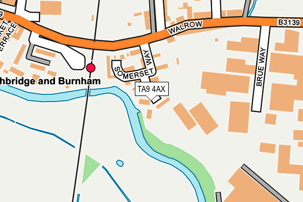
TA9 4AX is located in the King Alfred electoral ward, within the unitary authority of Somerset and the English Parliamentary constituency of Wells. The Sub Integrated Care Board (ICB) Location is NHS Somerset ICB - 11X and the police force is Avon and Somerset. This postcode has been in use since June 2017.


GetTheData
Source: OS OpenMap – Local (Ordnance Survey)
Source: OS VectorMap District (Ordnance Survey)
Licence: Open Government Licence (requires attribution)
| Easting | 337696 |
| Northing | 146999 |
| Latitude | 51.218769 |
| Longitude | -2.893480 |
GetTheData
Source: Open Postcode Geo
Licence: Open Government Licence
| Country | England |
| Postcode District | TA9 |
➜ See where TA9 is on a map | |
GetTheData
Source: Land Registry Price Paid Data
Licence: Open Government Licence
| Ward | King Alfred |
| Constituency | Wells |
GetTheData
Source: ONS Postcode Database
Licence: Open Government Licence
| The White Horse Inn (Mark Causeway) | Mark | 910m |
| White Horse Inn (Mark Causeway) | Mark | 911m |
| The Packhorse Inn (Church Street) | Mark | 933m |
| Averys Garage (Church Street) | Mark | 945m |
| Yardwall Road (Mark Causeway) | Mark | 1,373m |
GetTheData
Source: NaPTAN
Licence: Open Government Licence
| Percentage of properties with Next Generation Access | 0.0% |
| Percentage of properties with Superfast Broadband | 0.0% |
| Percentage of properties with Ultrafast Broadband | 0.0% |
| Percentage of properties with Full Fibre Broadband | 0.0% |
Superfast Broadband is between 30Mbps and 300Mbps
Ultrafast Broadband is > 300Mbps
| Percentage of properties unable to receive 2Mbps | 0.0% |
| Percentage of properties unable to receive 5Mbps | 0.0% |
| Percentage of properties unable to receive 10Mbps | 0.0% |
| Percentage of properties unable to receive 30Mbps | 100.0% |
GetTheData
Source: Ofcom
Licence: Ofcom Terms of Use (requires attribution)
GetTheData
Source: ONS Postcode Database
Licence: Open Government Licence


➜ Get more ratings from the Food Standards Agency
GetTheData
Source: Food Standards Agency
Licence: FSA terms & conditions
| Last Collection | |||
|---|---|---|---|
| Location | Mon-Fri | Sat | Distance |
| Blackford (Old Post Office) | 16:30 | 10:15 | 3,429m |
| Edington | 12:00 | 11:00 | 4,284m |
| Market Street | 17:15 | 11:30 | 4,361m |
GetTheData
Source: Dracos
Licence: Creative Commons Attribution-ShareAlike
The below table lists the International Territorial Level (ITL) codes (formerly Nomenclature of Territorial Units for Statistics (NUTS) codes) and Local Administrative Units (LAU) codes for TA9 4AX:
| ITL 1 Code | Name |
|---|---|
| TLK | South West (England) |
| ITL 2 Code | Name |
| TLK2 | Dorset and Somerset |
| ITL 3 Code | Name |
| TLK23 | Somerset CC |
| LAU 1 Code | Name |
| E07000188 | Sedgemoor |
GetTheData
Source: ONS Postcode Directory
Licence: Open Government Licence
The below table lists the Census Output Area (OA), Lower Layer Super Output Area (LSOA), and Middle Layer Super Output Area (MSOA) for TA9 4AX:
| Code | Name | |
|---|---|---|
| OA | E00148466 | |
| LSOA | E01029149 | Sedgemoor 003D |
| MSOA | E02006063 | Sedgemoor 003 |
GetTheData
Source: ONS Postcode Directory
Licence: Open Government Licence
| TA9 4LN | Yarrow | 313m |
| TA9 4LP | Yarrow Road | 329m |
| TA9 4LR | Yarrow Road | 429m |
| TA9 4LW | Yarrow Road | 580m |
| TA9 4LS | Yarrow Road | 714m |
| TA9 4RW | Grange Paddock | 810m |
| TA9 4QJ | The Causeway | 841m |
| TA9 4NG | Littlemoor Road | 862m |
| TA9 4ND | Churchlands | 886m |
| TA9 4NJ | Littlemoor Road | 888m |
GetTheData
Source: Open Postcode Geo; Land Registry Price Paid Data
Licence: Open Government Licence