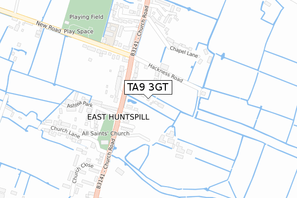
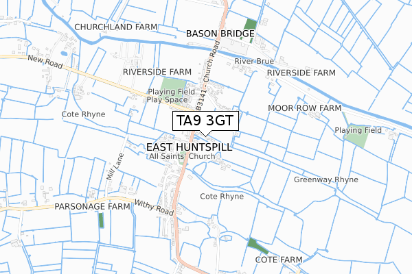
TA9 3GT is located in the Huntspill electoral ward, within the unitary authority of Somerset and the English Parliamentary constituency of Bridgwater and West Somerset. The Sub Integrated Care Board (ICB) Location is NHS Somerset ICB - 11X and the police force is Avon and Somerset. This postcode has been in use since September 2019.


GetTheData
Source: OS Open Zoomstack (Ordnance Survey)
Licence: Open Government Licence (requires attribution)
Attribution: Contains OS data © Crown copyright and database right 2025
Source: Open Postcode Geo
Licence: Open Government Licence (requires attribution)
Attribution: Contains OS data © Crown copyright and database right 2025; Contains Royal Mail data © Royal Mail copyright and database right 2025; Source: Office for National Statistics licensed under the Open Government Licence v.3.0
| Easting | 334548 |
| Northing | 145271 |
| Latitude | 51.202880 |
| Longitude | -2.938232 |
GetTheData
Source: Open Postcode Geo
Licence: Open Government Licence
| Country | England |
| Postcode District | TA9 |
➜ See where TA9 is on a map ➜ Where is East Huntspill? | |
GetTheData
Source: Land Registry Price Paid Data
Licence: Open Government Licence
| Ward | Huntspill |
| Constituency | Bridgwater And West Somerset |
GetTheData
Source: ONS Postcode Database
Licence: Open Government Licence
2, MEADOW DRIVE, EAST HUNTSPILL, HIGHBRIDGE, TA9 3GT 2020 24 SEP £360,000 |
1, MEADOW DRIVE, EAST HUNTSPILL, HIGHBRIDGE, TA9 3GT 2020 12 FEB £360,000 |
3, MEADOW DRIVE, EAST HUNTSPILL, HIGHBRIDGE, TA9 3GT 2019 4 DEC £365,000 |
GetTheData
Source: HM Land Registry Price Paid Data
Licence: Contains HM Land Registry data © Crown copyright and database right 2025. This data is licensed under the Open Government Licence v3.0.
| Hackness Road (Church Road) | East Huntspill | 124m |
| Hackness Road (Church Road) | East Huntspill | 136m |
| All Saints Church (Church Road) | East Huntspill | 206m |
| All Saints Church (Church Road) | East Huntspill | 211m |
| East Hunspill School (New Road) | East Huntspill | 239m |
| Highbridge & Burnham-on-Sea Station | 2.9km |
GetTheData
Source: NaPTAN
Licence: Open Government Licence
GetTheData
Source: ONS Postcode Database
Licence: Open Government Licence


➜ Get more ratings from the Food Standards Agency
GetTheData
Source: Food Standards Agency
Licence: FSA terms & conditions
| Last Collection | |||
|---|---|---|---|
| Location | Mon-Fri | Sat | Distance |
| Market Street | 17:15 | 11:30 | 1,683m |
| Huntspill Church | 11:45 | 10:00 | 4,050m |
| Park Close | 11:00 | 10:00 | 4,827m |
GetTheData
Source: Dracos
Licence: Creative Commons Attribution-ShareAlike
| Risk of TA9 3GT flooding from rivers and sea | Low |
| ➜ TA9 3GT flood map | |
GetTheData
Source: Open Flood Risk by Postcode
Licence: Open Government Licence
The below table lists the International Territorial Level (ITL) codes (formerly Nomenclature of Territorial Units for Statistics (NUTS) codes) and Local Administrative Units (LAU) codes for TA9 3GT:
| ITL 1 Code | Name |
|---|---|
| TLK | South West (England) |
| ITL 2 Code | Name |
| TLK2 | Dorset and Somerset |
| ITL 3 Code | Name |
| TLK23 | Somerset CC |
| LAU 1 Code | Name |
| E07000188 | Sedgemoor |
GetTheData
Source: ONS Postcode Directory
Licence: Open Government Licence
The below table lists the Census Output Area (OA), Lower Layer Super Output Area (LSOA), and Middle Layer Super Output Area (MSOA) for TA9 3GT:
| Code | Name | |
|---|---|---|
| OA | E00148396 | |
| LSOA | E01029136 | Sedgemoor 006B |
| MSOA | E02006066 | Sedgemoor 006 |
GetTheData
Source: ONS Postcode Directory
Licence: Open Government Licence
| TA9 3PP | Combe Terrace | 49m |
| TA9 3PL | Church Road | 103m |
| TA9 3PQ | Church Road | 112m |
| TA9 3PR | Hackness Road | 117m |
| TA9 3PN | Nut Tree Close | 123m |
| TA9 3QQ | Ashlea Park | 206m |
| TA9 3NQ | Chapel Lane | 210m |
| TA9 3HH | Orchard Close | 250m |
| TA9 3NF | Mead Close | 278m |
| TA9 3PT | New Road | 283m |
GetTheData
Source: Open Postcode Geo; Land Registry Price Paid Data
Licence: Open Government Licence