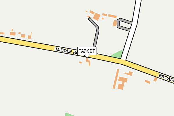
TA7 9DT is in Chilton Polden, Bridgwater. TA7 9DT is located in the Huntspill electoral ward, within the unitary authority of Somerset and the English Parliamentary constituency of Bridgwater and West Somerset. The Sub Integrated Care Board (ICB) Location is NHS Somerset ICB - 11X and the police force is Avon and Somerset. This postcode has been in use since January 1980.


GetTheData
Source: OS OpenMap – Local (Ordnance Survey)
Source: OS VectorMap District (Ordnance Survey)
Licence: Open Government Licence (requires attribution)
| Easting | 336805 |
| Northing | 140162 |
| Latitude | 51.157200 |
| Longitude | -2.905029 |
GetTheData
Source: Open Postcode Geo
Licence: Open Government Licence
| Locality | Chilton Polden |
| Town/City | Bridgwater |
| Country | England |
| Postcode District | TA7 |
➜ See where TA7 is on a map | |
GetTheData
Source: Land Registry Price Paid Data
Licence: Open Government Licence
Elevation or altitude of TA7 9DT as distance above sea level:
| Metres | Feet | |
|---|---|---|
| Elevation | 40m | 131ft |
Elevation is measured from the approximate centre of the postcode, to the nearest point on an OS contour line from OS Terrain 50, which has contour spacing of ten vertical metres.
➜ How high above sea level am I? Find the elevation of your current position using your device's GPS.
GetTheData
Source: Open Postcode Elevation
Licence: Open Government Licence
| Ward | Huntspill |
| Constituency | Bridgwater And West Somerset |
GetTheData
Source: ONS Postcode Database
Licence: Open Government Licence
| Post Office (Broadway) | Chilton Polden | 734m |
| Post Office (Broadway) | Chilton Polden | 737m |
| The Laurels (Middle Road) | Cossington | 972m |
| The Laurels (Middle Road) | Cossington | 975m |
| Park Close (Brent Road) | Cossington | 1,270m |
GetTheData
Source: NaPTAN
Licence: Open Government Licence
| Percentage of properties with Next Generation Access | 100.0% |
| Percentage of properties with Superfast Broadband | 100.0% |
| Percentage of properties with Ultrafast Broadband | 0.0% |
| Percentage of properties with Full Fibre Broadband | 0.0% |
Superfast Broadband is between 30Mbps and 300Mbps
Ultrafast Broadband is > 300Mbps
| Percentage of properties unable to receive 2Mbps | 0.0% |
| Percentage of properties unable to receive 5Mbps | 0.0% |
| Percentage of properties unable to receive 10Mbps | 0.0% |
| Percentage of properties unable to receive 30Mbps | 0.0% |
GetTheData
Source: Ofcom
Licence: Ofcom Terms of Use (requires attribution)
GetTheData
Source: ONS Postcode Database
Licence: Open Government Licence

➜ Get more ratings from the Food Standards Agency
GetTheData
Source: Food Standards Agency
Licence: FSA terms & conditions
| Last Collection | |||
|---|---|---|---|
| Location | Mon-Fri | Sat | Distance |
| Park Close | 11:00 | 10:00 | 1,206m |
| Holywell Corner | 12:00 | 11:30 | 2,059m |
| Broadway Edington | 16:30 | 10:45 | 2,066m |
GetTheData
Source: Dracos
Licence: Creative Commons Attribution-ShareAlike
The below table lists the International Territorial Level (ITL) codes (formerly Nomenclature of Territorial Units for Statistics (NUTS) codes) and Local Administrative Units (LAU) codes for TA7 9DT:
| ITL 1 Code | Name |
|---|---|
| TLK | South West (England) |
| ITL 2 Code | Name |
| TLK2 | Dorset and Somerset |
| ITL 3 Code | Name |
| TLK23 | Somerset CC |
| LAU 1 Code | Name |
| E07000188 | Sedgemoor |
GetTheData
Source: ONS Postcode Directory
Licence: Open Government Licence
The below table lists the Census Output Area (OA), Lower Layer Super Output Area (LSOA), and Middle Layer Super Output Area (MSOA) for TA7 9DT:
| Code | Name | |
|---|---|---|
| OA | E00148485 | |
| LSOA | E01029151 | Sedgemoor 012F |
| MSOA | E02006072 | Sedgemoor 012 |
GetTheData
Source: ONS Postcode Directory
Licence: Open Government Licence
| TA7 9DS | 152m | |
| TA7 9DR | Broadway | 384m |
| TA7 8LN | Middle Road | 493m |
| TA7 9DP | Broadway | 574m |
| TA7 9EB | Barton Rise | 598m |
| TA7 9DW | The Grange | 643m |
| TA7 9DX | St Edwards Close | 646m |
| TA7 9DZ | South Moors Lane | 663m |
| TA7 9DU | Church Lane | 689m |
| TA7 9ED | Goose Lane | 713m |
GetTheData
Source: Open Postcode Geo; Land Registry Price Paid Data
Licence: Open Government Licence