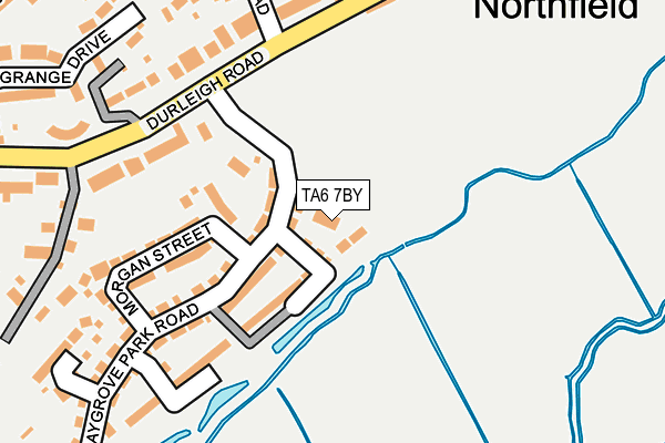
TA6 7BY is located in the Cannington electoral ward, within the unitary authority of Somerset and the English Parliamentary constituency of Bridgwater and West Somerset. The Sub Integrated Care Board (ICB) Location is NHS Somerset ICB - 11X and the police force is Avon and Somerset. This postcode has been in use since July 2017.


GetTheData
Source: OS OpenMap – Local (Ordnance Survey)
Source: OS VectorMap District (Ordnance Survey)
Licence: Open Government Licence (requires attribution)
| Easting | 328950 |
| Northing | 137743 |
| Latitude | 51.134530 |
| Longitude | -3.016854 |
GetTheData
Source: Open Postcode Geo
Licence: Open Government Licence
| Country | England |
| Postcode District | TA6 |
➜ See where TA6 is on a map | |
GetTheData
Source: Land Registry Price Paid Data
Licence: Open Government Licence
| Ward | Cannington |
| Constituency | Bridgwater And West Somerset |
GetTheData
Source: ONS Postcode Database
Licence: Open Government Licence
| Oak Apple Drive (Homberg Way) | Wembdon | 318m |
| Trinity Way (Homberg Way) | Chilton Trinity | 344m |
| Homberg Way (Trinity Way) | Bridgwater | 369m |
| Oak Apple Drive (Homberg Way) | Wembdon | 373m |
| Kendale Road (Kidsbury Road) | Bridgwater | 391m |
| Bridgwater Station | 2km |
GetTheData
Source: NaPTAN
Licence: Open Government Licence
GetTheData
Source: ONS Postcode Database
Licence: Open Government Licence


➜ Get more ratings from the Food Standards Agency
GetTheData
Source: Food Standards Agency
Licence: FSA terms & conditions
| Last Collection | |||
|---|---|---|---|
| Location | Mon-Fri | Sat | Distance |
| Wembdon Common | 17:30 | 12:00 | 202m |
| Wembdon Post Office | 17:30 | 12:00 | 552m |
| Wembdon Road | 17:15 | 12:00 | 612m |
GetTheData
Source: Dracos
Licence: Creative Commons Attribution-ShareAlike
| Risk of TA6 7BY flooding from rivers and sea | Medium |
| ➜ TA6 7BY flood map | |
GetTheData
Source: Open Flood Risk by Postcode
Licence: Open Government Licence
The below table lists the International Territorial Level (ITL) codes (formerly Nomenclature of Territorial Units for Statistics (NUTS) codes) and Local Administrative Units (LAU) codes for TA6 7BY:
| ITL 1 Code | Name |
|---|---|
| TLK | South West (England) |
| ITL 2 Code | Name |
| TLK2 | Dorset and Somerset |
| ITL 3 Code | Name |
| TLK23 | Somerset CC |
| LAU 1 Code | Name |
| E07000188 | Sedgemoor |
GetTheData
Source: ONS Postcode Directory
Licence: Open Government Licence
The below table lists the Census Output Area (OA), Lower Layer Super Output Area (LSOA), and Middle Layer Super Output Area (MSOA) for TA6 7BY:
| Code | Name | |
|---|---|---|
| OA | E00165974 | |
| LSOA | E01032631 | Sedgemoor 011E |
| MSOA | E02006071 | Sedgemoor 011 |
GetTheData
Source: ONS Postcode Directory
Licence: Open Government Licence
| TA6 3UE | Meadowlands Avenue | 139m |
| TA6 3UG | Meadowlands Avenue | 162m |
| TA6 7RE | Greenacre | 167m |
| TA6 7RF | Greenacre | 199m |
| TA6 3UJ | Eight Acre Meadow | 200m |
| TA6 7RW | Crossfield Close | 202m |
| TA6 3UP | Four Acre Meadow | 207m |
| TA6 3UQ | Meadowlands Avenue | 227m |
| TA6 3UL | Church Meadow | 231m |
| TA6 7RN | Crossacre | 245m |
GetTheData
Source: Open Postcode Geo; Land Registry Price Paid Data
Licence: Open Government Licence