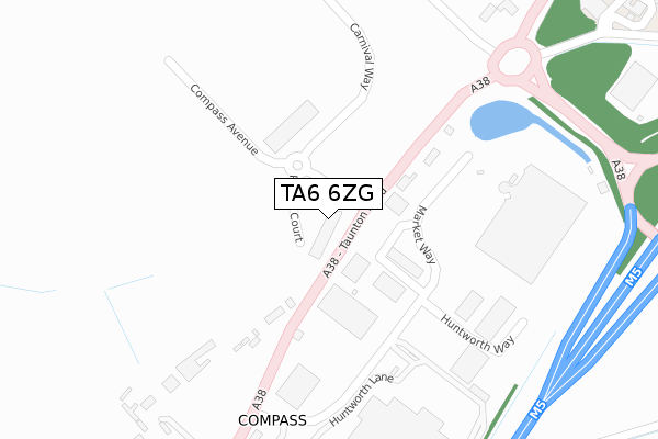
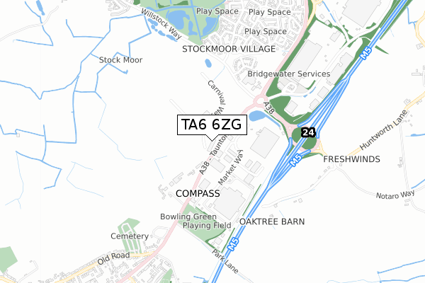
TA6 6ZG is located in the North Petherton electoral ward, within the unitary authority of Somerset and the English Parliamentary constituency of Bridgwater and West Somerset. The Sub Integrated Care Board (ICB) Location is NHS Somerset ICB - 11X and the police force is Avon and Somerset. This postcode has been in use since March 2019.


GetTheData
Source: OS Open Zoomstack (Ordnance Survey)
Licence: Open Government Licence (requires attribution)
Attribution: Contains OS data © Crown copyright and database right 2025
Source: Open Postcode Geo
Licence: Open Government Licence (requires attribution)
Attribution: Contains OS data © Crown copyright and database right 2025; Contains Royal Mail data © Royal Mail copyright and database right 2025; Source: Office for National Statistics licensed under the Open Government Licence v.3.0
| Easting | 329958 |
| Northing | 134065 |
| Latitude | 51.101584 |
| Longitude | -3.001734 |
GetTheData
Source: Open Postcode Geo
Licence: Open Government Licence
| Country | England |
| Postcode District | TA6 |
➜ See where TA6 is on a map ➜ Where is Compass? | |
GetTheData
Source: Land Registry Price Paid Data
Licence: Open Government Licence
| Ward | North Petherton |
| Constituency | Bridgwater And West Somerset |
GetTheData
Source: ONS Postcode Database
Licence: Open Government Licence
| Compass Inn (Taunton Road) | North Petherton | 222m |
| Compass Inn (Taunton Road) | North Petherton | 235m |
| Bridgwater Road Transport Caf (Taunton Road) | North Petherton | 287m |
| Bridgwater Road Transport Cafe (Taunton Road) | North Petherton | 294m |
| Charolais Drive | Bridgwater | 584m |
| Bridgwater Station | 3km |
GetTheData
Source: NaPTAN
Licence: Open Government Licence
GetTheData
Source: ONS Postcode Database
Licence: Open Government Licence


➜ Get more ratings from the Food Standards Agency
GetTheData
Source: Food Standards Agency
Licence: FSA terms & conditions
| Last Collection | |||
|---|---|---|---|
| Location | Mon-Fri | Sat | Distance |
| Compass Inn | 12:00 | 11:30 | 143m |
| Milestone Close | 12:00 | 11:00 | 1,017m |
| Broadlands Avenue | 12:00 | 11:00 | 1,178m |
GetTheData
Source: Dracos
Licence: Creative Commons Attribution-ShareAlike
The below table lists the International Territorial Level (ITL) codes (formerly Nomenclature of Territorial Units for Statistics (NUTS) codes) and Local Administrative Units (LAU) codes for TA6 6ZG:
| ITL 1 Code | Name |
|---|---|
| TLK | South West (England) |
| ITL 2 Code | Name |
| TLK2 | Dorset and Somerset |
| ITL 3 Code | Name |
| TLK23 | Somerset CC |
| LAU 1 Code | Name |
| E07000188 | Sedgemoor |
GetTheData
Source: ONS Postcode Directory
Licence: Open Government Licence
The below table lists the Census Output Area (OA), Lower Layer Super Output Area (LSOA), and Middle Layer Super Output Area (MSOA) for TA6 6ZG:
| Code | Name | |
|---|---|---|
| OA | E00148434 | |
| LSOA | E01032629 | Sedgemoor 014F |
| MSOA | E02006074 | Sedgemoor 014 |
GetTheData
Source: ONS Postcode Directory
Licence: Open Government Licence
| TA6 6PR | Bridgwater Road | 170m |
| TA6 6DF | Market Way | 245m |
| TA6 6PP | Taunton Road | 254m |
| TA6 6FA | Huntworth Way | 289m |
| TA6 6FL | Jutland Walk | 545m |
| TA6 6FF | Sandalwood Ride | 585m |
| TA6 6FB | Muscovy Drive | 600m |
| TA6 6EZ | Kerry Close | 613m |
| TA6 6EY | Cheviot Street | 617m |
| TA7 0DU | Huntworth Lane | 637m |
GetTheData
Source: Open Postcode Geo; Land Registry Price Paid Data
Licence: Open Government Licence