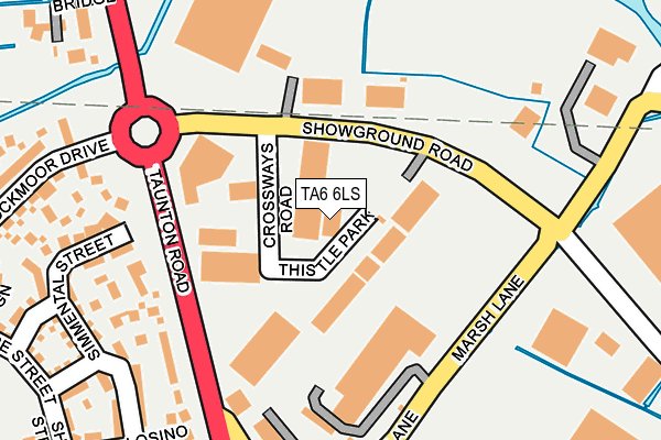
TA6 6LS is located in the North Petherton electoral ward, within the unitary authority of Somerset and the English Parliamentary constituency of Bridgwater and West Somerset. The Sub Integrated Care Board (ICB) Location is NHS Somerset ICB - 11X and the police force is Avon and Somerset. This postcode has been in use since December 1997.


GetTheData
Source: OS OpenMap – Local (Ordnance Survey)
Source: OS VectorMap District (Ordnance Survey)
Licence: Open Government Licence (requires attribution)
| Easting | 330599 |
| Northing | 135171 |
| Latitude | 51.111606 |
| Longitude | -2.992794 |
GetTheData
Source: Open Postcode Geo
Licence: Open Government Licence
| Country | England |
| Postcode District | TA6 |
➜ See where TA6 is on a map ➜ Where is Bridgwater? | |
GetTheData
Source: Land Registry Price Paid Data
Licence: Open Government Licence
Elevation or altitude of TA6 6LS as distance above sea level:
| Metres | Feet | |
|---|---|---|
| Elevation | 10m | 33ft |
Elevation is measured from the approximate centre of the postcode, to the nearest point on an OS contour line from OS Terrain 50, which has contour spacing of ten vertical metres.
➜ How high above sea level am I? Find the elevation of your current position using your device's GPS.
GetTheData
Source: Open Postcode Elevation
Licence: Open Government Licence
| Ward | North Petherton |
| Constituency | Bridgwater And West Somerset |
GetTheData
Source: ONS Postcode Database
Licence: Open Government Licence
| Kerland Clinic (Taunton Road) | Bridgwater | 182m |
| Kerland Clinic (Taunton Road) | Bridgwater | 187m |
| Sable Drive | Bridgwater | 371m |
| Taunton Road Car Centre (Taunton Road) | Bridgwater | 378m |
| Wills Road | Hamp | 494m |
| Bridgwater Station | 1.8km |
GetTheData
Source: NaPTAN
Licence: Open Government Licence
| Median download speed | 47.7Mbps |
| Average download speed | 47.3Mbps |
| Maximum download speed | 80.00Mbps |
| Median upload speed | 13.0Mbps |
| Average upload speed | 11.4Mbps |
| Maximum upload speed | 20.00Mbps |
GetTheData
Source: Ofcom
Licence: Ofcom Terms of Use (requires attribution)
Estimated total energy consumption in TA6 6LS by fuel type, 2015.
| Consumption (kWh) | 170,888 |
|---|---|
| Meter count | 9 |
| Mean (kWh/meter) | 18,988 |
| Median (kWh/meter) | 10,791 |
GetTheData
Source: Postcode level gas estimates: 2015 (experimental)
Source: Postcode level electricity estimates: 2015 (experimental)
Licence: Open Government Licence
GetTheData
Source: ONS Postcode Database
Licence: Open Government Licence


➜ Get more ratings from the Food Standards Agency
GetTheData
Source: Food Standards Agency
Licence: FSA terms & conditions
| Last Collection | |||
|---|---|---|---|
| Location | Mon-Fri | Sat | Distance |
| Ringwood Road | 17:00 | 12:00 | 546m |
| Dillons Post Office | 17:15 | 12:00 | 1,067m |
| Compass Inn | 12:00 | 11:30 | 1,166m |
GetTheData
Source: Dracos
Licence: Creative Commons Attribution-ShareAlike
| Risk of TA6 6LS flooding from rivers and sea | Medium |
| ➜ TA6 6LS flood map | |
GetTheData
Source: Open Flood Risk by Postcode
Licence: Open Government Licence
The below table lists the International Territorial Level (ITL) codes (formerly Nomenclature of Territorial Units for Statistics (NUTS) codes) and Local Administrative Units (LAU) codes for TA6 6LS:
| ITL 1 Code | Name |
|---|---|
| TLK | South West (England) |
| ITL 2 Code | Name |
| TLK2 | Dorset and Somerset |
| ITL 3 Code | Name |
| TLK23 | Somerset CC |
| LAU 1 Code | Name |
| E07000188 | Sedgemoor |
GetTheData
Source: ONS Postcode Directory
Licence: Open Government Licence
The below table lists the Census Output Area (OA), Lower Layer Super Output Area (LSOA), and Middle Layer Super Output Area (MSOA) for TA6 6LS:
| Code | Name | |
|---|---|---|
| OA | E00165966 | |
| LSOA | E01032630 | Sedgemoor 014G |
| MSOA | E02006074 | Sedgemoor 014 |
GetTheData
Source: ONS Postcode Directory
Licence: Open Government Licence
| TA6 6FZ | Charford Court | 192m |
| TA6 6FX | Faroe Walk | 198m |
| TA6 6FY | Breton Close | 207m |
| TA6 6LQ | 207m | |
| TA6 6GA | Shetland Court | 212m |
| TA6 6FR | Dexter Walk | 241m |
| TA6 6FW | Simmental Street | 246m |
| TA6 6GD | Hatton Court | 256m |
| TA6 6YN | Losino Close | 261m |
| TA6 6GB | Chillingham Drove | 267m |
GetTheData
Source: Open Postcode Geo; Land Registry Price Paid Data
Licence: Open Government Licence