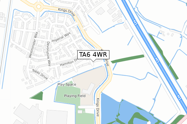
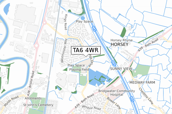
TA6 4WR is located in the Bridgwater East & Bawdrip electoral ward, within the unitary authority of Somerset and the English Parliamentary constituency of Bridgwater and West Somerset. The Sub Integrated Care Board (ICB) Location is NHS Somerset ICB - 11X and the police force is Avon and Somerset. This postcode has been in use since April 2018.


GetTheData
Source: OS Open Zoomstack (Ordnance Survey)
Licence: Open Government Licence (requires attribution)
Attribution: Contains OS data © Crown copyright and database right 2025
Source: Open Postcode Geo
Licence: Open Government Licence (requires attribution)
Attribution: Contains OS data © Crown copyright and database right 2025; Contains Royal Mail data © Royal Mail copyright and database right 2025; Source: Office for National Statistics licensed under the Open Government Licence v.3.0
| Easting | 331514 |
| Northing | 138912 |
| Latitude | 51.145352 |
| Longitude | -2.980437 |
GetTheData
Source: Open Postcode Geo
Licence: Open Government Licence
| Country | England |
| Postcode District | TA6 |
➜ See where TA6 is on a map ➜ Where is Bridgwater? | |
GetTheData
Source: Land Registry Price Paid Data
Licence: Open Government Licence
| Ward | Bridgwater East & Bawdrip |
| Constituency | Bridgwater And West Somerset |
GetTheData
Source: ONS Postcode Database
Licence: Open Government Licence
10, JADE CLOSE, BRIDGWATER, TA6 4WR 2024 27 SEP £282,000 |
2, JADE CLOSE, BRIDGWATER, TA6 4WR 2022 9 SEP £350,000 |
9, JADE CLOSE, BRIDGWATER, TA6 4WR 2021 27 AUG £275,000 |
1, JADE CLOSE, BRIDGWATER, TA6 4WR 2020 14 FEB £260,000 |
10, JADE CLOSE, BRIDGWATER, TA6 4WR 2018 29 JUN £232,995 |
9, JADE CLOSE, BRIDGWATER, TA6 4WR 2018 31 MAY £237,995 |
3, JADE CLOSE, BRIDGWATER, TA6 4WR 2018 31 MAY £237,995 |
1, JADE CLOSE, BRIDGWATER, TA6 4WR 2018 31 MAY £249,995 |
5, JADE CLOSE, BRIDGWATER, TA6 4WR 2018 31 MAY £199,995 |
7, JADE CLOSE, BRIDGWATER, TA6 4WR 2018 31 MAY £232,995 |
GetTheData
Source: HM Land Registry Price Paid Data
Licence: Contains HM Land Registry data © Crown copyright and database right 2025. This data is licensed under the Open Government Licence v3.0.
| Kings Road Roundabout (Kings Drive) | Bridgwater | 347m |
| Kings Road Roundabout (Kings Drive) | Bridgwater | 351m |
| Filling Station (Bath Road) | Bridgwater | 539m |
| Filling Station (Bath Road) | Bridgwater | 550m |
| Chedzoy Lane (Bath Road) | Horsey | 626m |
| Bridgwater Station | 2.1km |
GetTheData
Source: NaPTAN
Licence: Open Government Licence
| Percentage of properties with Next Generation Access | 100.0% |
| Percentage of properties with Superfast Broadband | 100.0% |
| Percentage of properties with Ultrafast Broadband | 100.0% |
| Percentage of properties with Full Fibre Broadband | 100.0% |
Superfast Broadband is between 30Mbps and 300Mbps
Ultrafast Broadband is > 300Mbps
| Median download speed | 360.0Mbps |
| Average download speed | 360.0Mbps |
| Maximum download speed | 360.00Mbps |
| Median upload speed | 360.0Mbps |
| Average upload speed | 360.0Mbps |
| Maximum upload speed | 360.00Mbps |
| Percentage of properties unable to receive 2Mbps | 0.0% |
| Percentage of properties unable to receive 5Mbps | 0.0% |
| Percentage of properties unable to receive 10Mbps | 0.0% |
| Percentage of properties unable to receive 30Mbps | 0.0% |
GetTheData
Source: Ofcom
Licence: Ofcom Terms of Use (requires attribution)
GetTheData
Source: ONS Postcode Database
Licence: Open Government Licence


➜ Get more ratings from the Food Standards Agency
GetTheData
Source: Food Standards Agency
Licence: FSA terms & conditions
| Last Collection | |||
|---|---|---|---|
| Location | Mon-Fri | Sat | Distance |
| Horsey | 12:00 | 11:15 | 1,127m |
| Coultings | 13:00 | 08:00 | 1,871m |
| Western Way | 17:30 | 12:00 | 1,940m |
GetTheData
Source: Dracos
Licence: Creative Commons Attribution-ShareAlike
| Risk of TA6 4WR flooding from rivers and sea | Low |
| ➜ TA6 4WR flood map | |
GetTheData
Source: Open Flood Risk by Postcode
Licence: Open Government Licence
The below table lists the International Territorial Level (ITL) codes (formerly Nomenclature of Territorial Units for Statistics (NUTS) codes) and Local Administrative Units (LAU) codes for TA6 4WR:
| ITL 1 Code | Name |
|---|---|
| TLK | South West (England) |
| ITL 2 Code | Name |
| TLK2 | Dorset and Somerset |
| ITL 3 Code | Name |
| TLK23 | Somerset CC |
| LAU 1 Code | Name |
| E07000188 | Sedgemoor |
GetTheData
Source: ONS Postcode Directory
Licence: Open Government Licence
The below table lists the Census Output Area (OA), Lower Layer Super Output Area (LSOA), and Middle Layer Super Output Area (MSOA) for TA6 4WR:
| Code | Name | |
|---|---|---|
| OA | E00148181 | |
| LSOA | E01029090 | Sedgemoor 010A |
| MSOA | E02006070 | Sedgemoor 010 |
GetTheData
Source: ONS Postcode Directory
Licence: Open Government Licence
| TA6 4GY | Emerald Way | 149m |
| TA6 4FP | Kings Drive | 179m |
| TA6 4FL | Regal Walk | 195m |
| TA6 4RW | Cambridge Grove | 215m |
| TA6 4GE | Devonshire Way | 245m |
| TA6 4FH | Imperial Way | 267m |
| TA6 4GD | Clarence Terrace | 296m |
| TA6 4FQ | Hampstead Drive | 320m |
| TA6 4GB | Westminster Way | 331m |
| TA6 4GL | Balmoral Drive | 351m |
GetTheData
Source: Open Postcode Geo; Land Registry Price Paid Data
Licence: Open Government Licence