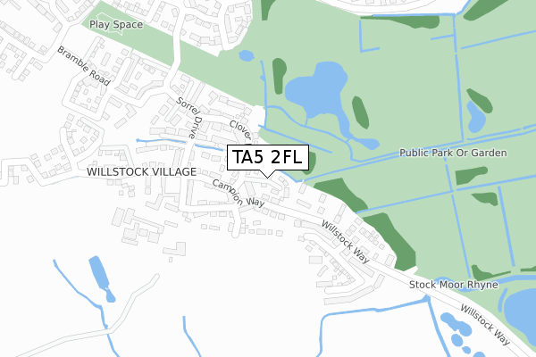
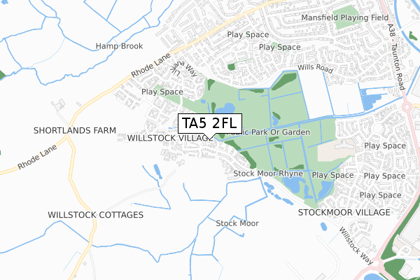
TA5 2FL is located in the North Petherton electoral ward, within the unitary authority of Somerset and the English Parliamentary constituency of Bridgwater and West Somerset. The Sub Integrated Care Board (ICB) Location is NHS Somerset ICB - 11X and the police force is Avon and Somerset. This postcode has been in use since August 2019.


GetTheData
Source: OS Open Zoomstack (Ordnance Survey)
Licence: Open Government Licence (requires attribution)
Attribution: Contains OS data © Crown copyright and database right 2025
Source: Open Postcode Geo
Licence: Open Government Licence (requires attribution)
Attribution: Contains OS data © Crown copyright and database right 2025; Contains Royal Mail data © Royal Mail copyright and database right 2025; Source: Office for National Statistics licensed under the Open Government Licence v.3.0
| Easting | 329257 |
| Northing | 135054 |
| Latitude | 51.110390 |
| Longitude | -3.011938 |
GetTheData
Source: Open Postcode Geo
Licence: Open Government Licence
| Country | England |
| Postcode District | TA5 |
➜ See where TA5 is on a map ➜ Where is Bridgwater? | |
GetTheData
Source: Land Registry Price Paid Data
Licence: Open Government Licence
| Ward | North Petherton |
| Constituency | Bridgwater And West Somerset |
GetTheData
Source: ONS Postcode Database
Licence: Open Government Licence
1, HONEYSUCKLE COURT, BRIDGWATER, TA5 2FL 2021 1 APR £232,000 |
7, HONEYSUCKLE COURT, BRIDGWATER, TA5 2FL 2019 14 NOV £266,995 |
1, HONEYSUCKLE COURT, BRIDGWATER, TA5 2FL 2019 30 JUL £235,995 |
GetTheData
Source: HM Land Registry Price Paid Data
Licence: Contains HM Land Registry data © Crown copyright and database right 2025. This data is licensed under the Open Government Licence v3.0.
| Allen Road (Wills Road) | Hamp | 437m |
| Bowerings Road (Wills Road) | Hamp | 444m |
| Frampton Road (Wills Road) | Hamp | 578m |
| Gibb House (Rhode Lane) | Bridgwater | 616m |
| Risemoor Road | Bridgwater | 623m |
| Bridgwater Station | 2.5km |
GetTheData
Source: NaPTAN
Licence: Open Government Licence
GetTheData
Source: ONS Postcode Database
Licence: Open Government Licence


➜ Get more ratings from the Food Standards Agency
GetTheData
Source: Food Standards Agency
Licence: FSA terms & conditions
| Last Collection | |||
|---|---|---|---|
| Location | Mon-Fri | Sat | Distance |
| Dillons Post Office | 17:15 | 12:00 | 473m |
| Ringwood Road | 17:00 | 12:00 | 1,239m |
| Compass Inn | 12:00 | 11:30 | 1,249m |
GetTheData
Source: Dracos
Licence: Creative Commons Attribution-ShareAlike
| Risk of TA5 2FL flooding from rivers and sea | Very Low |
| ➜ TA5 2FL flood map | |
GetTheData
Source: Open Flood Risk by Postcode
Licence: Open Government Licence
The below table lists the International Territorial Level (ITL) codes (formerly Nomenclature of Territorial Units for Statistics (NUTS) codes) and Local Administrative Units (LAU) codes for TA5 2FL:
| ITL 1 Code | Name |
|---|---|
| TLK | South West (England) |
| ITL 2 Code | Name |
| TLK2 | Dorset and Somerset |
| ITL 3 Code | Name |
| TLK23 | Somerset CC |
| LAU 1 Code | Name |
| E07000188 | Sedgemoor |
GetTheData
Source: ONS Postcode Directory
Licence: Open Government Licence
The below table lists the Census Output Area (OA), Lower Layer Super Output Area (LSOA), and Middle Layer Super Output Area (MSOA) for TA5 2FL:
| Code | Name | |
|---|---|---|
| OA | E00165963 | |
| LSOA | E01032629 | Sedgemoor 014F |
| MSOA | E02006074 | Sedgemoor 014 |
GetTheData
Source: ONS Postcode Directory
Licence: Open Government Licence
| TA5 2EZ | Campion Way | 42m |
| TA5 2EX | Orchid Way | 52m |
| TA5 2FA | Campion Way | 81m |
| TA5 2EY | Clover Way | 82m |
| TA5 2FP | Daisy Close | 108m |
| TA5 2FE | Larkspur Road | 123m |
| TA5 2DB | Bluebell Drive | 123m |
| TA5 2EU | Buttercup Walk | 144m |
| TA5 2BX | Sorrel Drive | 173m |
| TA5 2ES | Poppy Walk | 183m |
GetTheData
Source: Open Postcode Geo; Land Registry Price Paid Data
Licence: Open Government Licence