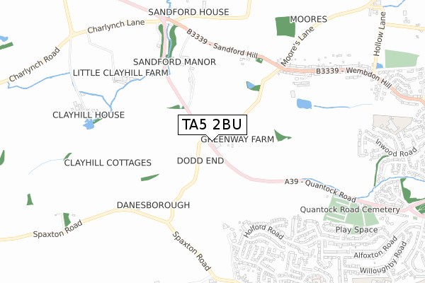
TA5 2BU is located in the Cannington electoral ward, within the unitary authority of Somerset and the English Parliamentary constituency of Bridgwater and West Somerset. The Sub Integrated Care Board (ICB) Location is NHS Somerset ICB - 11X and the police force is Avon and Somerset. This postcode has been in use since October 2019.


GetTheData
Source: OS Open Zoomstack (Ordnance Survey)
Licence: Open Government Licence (requires attribution)
Attribution: Contains OS data © Crown copyright and database right 2025
Source: Open Postcode Geo
Licence: Open Government Licence (requires attribution)
Attribution: Contains OS data © Crown copyright and database right 2025; Contains Royal Mail data © Royal Mail copyright and database right 2025; Source: Office for National Statistics licensed under the Open Government Licence v.3.0
| Easting | 327284 |
| Northing | 137424 |
| Latitude | 51.131452 |
| Longitude | -3.040597 |
GetTheData
Source: Open Postcode Geo
Licence: Open Government Licence
| Country | England |
| Postcode District | TA5 |
➜ See where TA5 is on a map | |
GetTheData
Source: Land Registry Price Paid Data
Licence: Open Government Licence
| Ward | Cannington |
| Constituency | Bridgwater And West Somerset |
GetTheData
Source: ONS Postcode Database
Licence: Open Government Licence
| Skimmerton Lane | Wembdon | 580m |
| Skimmerton Lane (Moore's Lane) | Wembdon | 591m |
| Merridge Close (Holford Road) | Durleigh | 599m |
| Merridge Close (Holford Road) | Durleigh | 604m |
| Heathcombe Road (Holford Road) | Durleigh | 689m |
| Bridgwater Station | 3.5km |
GetTheData
Source: NaPTAN
Licence: Open Government Licence
GetTheData
Source: ONS Postcode Database
Licence: Open Government Licence


➜ Get more ratings from the Food Standards Agency
GetTheData
Source: Food Standards Agency
Licence: FSA terms & conditions
| Last Collection | |||
|---|---|---|---|
| Location | Mon-Fri | Sat | Distance |
| Heathcombe Road | 17:15 | 12:00 | 706m |
| Wembdon Hill | 17:30 | 12:00 | 774m |
| Queenswood Road | 17:30 | 12:15 | 1,034m |
GetTheData
Source: Dracos
Licence: Creative Commons Attribution-ShareAlike
The below table lists the International Territorial Level (ITL) codes (formerly Nomenclature of Territorial Units for Statistics (NUTS) codes) and Local Administrative Units (LAU) codes for TA5 2BU:
| ITL 1 Code | Name |
|---|---|
| TLK | South West (England) |
| ITL 2 Code | Name |
| TLK2 | Dorset and Somerset |
| ITL 3 Code | Name |
| TLK23 | Somerset CC |
| LAU 1 Code | Name |
| E07000188 | Sedgemoor |
GetTheData
Source: ONS Postcode Directory
Licence: Open Government Licence
The below table lists the Census Output Area (OA), Lower Layer Super Output Area (LSOA), and Middle Layer Super Output Area (MSOA) for TA5 2BU:
| Code | Name | |
|---|---|---|
| OA | E00148463 | |
| LSOA | E01032632 | Sedgemoor 011F |
| MSOA | E02006071 | Sedgemoor 011 |
GetTheData
Source: ONS Postcode Directory
Licence: Open Government Licence
| TA6 7QW | Merridge Barton | 499m |
| TA5 2AY | Sandford Hill | 530m |
| TA6 7PA | Holford Road | 541m |
| TA6 7NY | Hestercombe Close | 557m |
| TA6 7PG | Merridge Close | 569m |
| TA5 2AU | Spaxton Road | 570m |
| TA6 7PE | Holford Road | 635m |
| TA6 7JW | Andersfield Close | 641m |
| TA6 7PF | Pyrland Walk | 642m |
| TA6 7PB | Tetton Close | 642m |
GetTheData
Source: Open Postcode Geo; Land Registry Price Paid Data
Licence: Open Government Licence