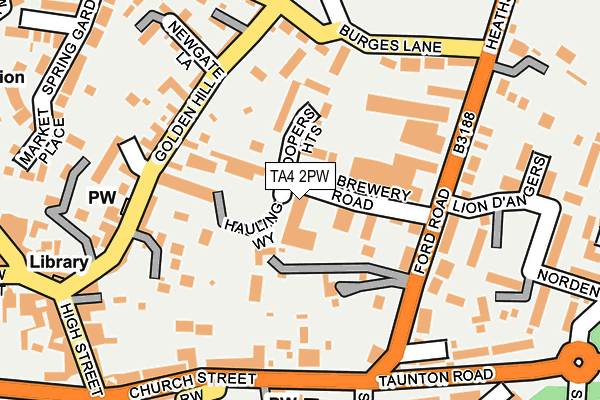
TA4 2PW is located in the Upper Tone electoral ward, within the unitary authority of Somerset and the English Parliamentary constituency of Taunton Deane. The Sub Integrated Care Board (ICB) Location is NHS Somerset ICB - 11X and the police force is Avon and Somerset. This postcode has been in use since July 1995.


GetTheData
Source: OS OpenMap – Local (Ordnance Survey)
Source: OS VectorMap District (Ordnance Survey)
Licence: Open Government Licence (requires attribution)
| Easting | 308366 |
| Northing | 127942 |
| Latitude | 51.043493 |
| Longitude | -3.308489 |
GetTheData
Source: Open Postcode Geo
Licence: Open Government Licence
| Country | England |
| Postcode District | TA4 |
➜ See where TA4 is on a map ➜ Where is Wiveliscombe? | |
GetTheData
Source: Land Registry Price Paid Data
Licence: Open Government Licence
Elevation or altitude of TA4 2PW as distance above sea level:
| Metres | Feet | |
|---|---|---|
| Elevation | 110m | 361ft |
Elevation is measured from the approximate centre of the postcode, to the nearest point on an OS contour line from OS Terrain 50, which has contour spacing of ten vertical metres.
➜ How high above sea level am I? Find the elevation of your current position using your device's GPS.
GetTheData
Source: Open Postcode Elevation
Licence: Open Government Licence
| Ward | Upper Tone |
| Constituency | Taunton Deane |
GetTheData
Source: ONS Postcode Database
Licence: Open Government Licence
| St Andrews Church (Church Street) | Wiveliscombe | 221m |
| Taunton Road Roundabout (Taunton Road) | Wiveliscombe | 243m |
| St Andrews Church (Church Street) | Wiveliscombe | 247m |
| Taunton Road Roundabout (Taunton Road) | Wiveliscombe | 253m |
| The Square | Wiveliscombe | 306m |
GetTheData
Source: NaPTAN
Licence: Open Government Licence
GetTheData
Source: ONS Postcode Database
Licence: Open Government Licence


➜ Get more ratings from the Food Standards Agency
GetTheData
Source: Food Standards Agency
Licence: FSA terms & conditions
| Last Collection | |||
|---|---|---|---|
| Location | Mon-Fri | Sat | Distance |
| The Square | 16:30 | 08:30 | 312m |
| Wiveliscombe Post Office | 16:45 | 12:30 | 555m |
| Langley Cross | 10:00 | 10:00 | 996m |
GetTheData
Source: Dracos
Licence: Creative Commons Attribution-ShareAlike
The below table lists the International Territorial Level (ITL) codes (formerly Nomenclature of Territorial Units for Statistics (NUTS) codes) and Local Administrative Units (LAU) codes for TA4 2PW:
| ITL 1 Code | Name |
|---|---|
| TLK | South West (England) |
| ITL 2 Code | Name |
| TLK2 | Dorset and Somerset |
| ITL 3 Code | Name |
| TLK23 | Somerset CC |
| LAU 1 Code | Name |
| E07000246 | Somerset West and Taunton |
GetTheData
Source: ONS Postcode Directory
Licence: Open Government Licence
The below table lists the Census Output Area (OA), Lower Layer Super Output Area (LSOA), and Middle Layer Super Output Area (MSOA) for TA4 2PW:
| Code | Name | |
|---|---|---|
| OA | E00149395 | |
| LSOA | E01029320 | Taunton Deane 003B |
| MSOA | E02006101 | Taunton Deane 003 |
GetTheData
Source: ONS Postcode Directory
Licence: Open Government Licence
| TA4 2YB | Coopers Heights | 32m |
| TA4 2PG | Burges Close | 92m |
| TA4 2NR | Durhams | 94m |
| TA4 2RE | Ford Road | 112m |
| TA4 2NS | Masons Square | 119m |
| TA4 2PP | Hauling Way | 135m |
| TA4 2NN | Mayfield Terrace | 138m |
| TA4 2NY | The Mews | 141m |
| TA4 2NU | Golden Hill | 142m |
| TA4 2NT | Golden Hill | 148m |
GetTheData
Source: Open Postcode Geo; Land Registry Price Paid Data
Licence: Open Government Licence