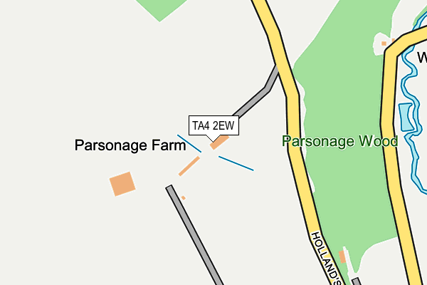
TA4 2EW is in Huish Champflower, Taunton. TA4 2EW is located in the Dulverton & Exmoor electoral ward, within the unitary authority of Somerset and the English Parliamentary constituency of Bridgwater and West Somerset. The Sub Integrated Care Board (ICB) Location is NHS Somerset ICB - 11X and the police force is Avon and Somerset. This postcode has been in use since January 1980.


GetTheData
Source: OS OpenMap – Local (Ordnance Survey)
Source: OS VectorMap District (Ordnance Survey)
Licence: Open Government Licence (requires attribution)
| Easting | 304482 |
| Northing | 130046 |
| Latitude | 51.061774 |
| Longitude | -3.364432 |
GetTheData
Source: Open Postcode Geo
Licence: Open Government Licence
| Locality | Huish Champflower |
| Town/City | Taunton |
| Country | England |
| Postcode District | TA4 |
➜ See where TA4 is on a map | |
GetTheData
Source: Land Registry Price Paid Data
Licence: Open Government Licence
Elevation or altitude of TA4 2EW as distance above sea level:
| Metres | Feet | |
|---|---|---|
| Elevation | 230m | 755ft |
Elevation is measured from the approximate centre of the postcode, to the nearest point on an OS contour line from OS Terrain 50, which has contour spacing of ten vertical metres.
➜ How high above sea level am I? Find the elevation of your current position using your device's GPS.
GetTheData
Source: Open Postcode Elevation
Licence: Open Government Licence
| Ward | Dulverton & Exmoor |
| Constituency | Bridgwater And West Somerset |
GetTheData
Source: ONS Postcode Database
Licence: Open Government Licence
| Percentage of properties with Next Generation Access | 66.7% |
| Percentage of properties with Superfast Broadband | 0.0% |
| Percentage of properties with Ultrafast Broadband | 0.0% |
| Percentage of properties with Full Fibre Broadband | 0.0% |
Superfast Broadband is between 30Mbps and 300Mbps
Ultrafast Broadband is > 300Mbps
| Percentage of properties unable to receive 2Mbps | 0.0% |
| Percentage of properties unable to receive 5Mbps | 0.0% |
| Percentage of properties unable to receive 10Mbps | 33.3% |
| Percentage of properties unable to receive 30Mbps | 66.7% |
GetTheData
Source: Ofcom
Licence: Ofcom Terms of Use (requires attribution)
GetTheData
Source: ONS Postcode Database
Licence: Open Government Licence
| Last Collection | |||
|---|---|---|---|
| Location | Mon-Fri | Sat | Distance |
| Clatworthy | 12:00 | 11:00 | 1,137m |
| Maundown | 10:00 | 10:00 | 1,989m |
| Langley Marsh | 10:00 | 10:00 | 3,091m |
GetTheData
Source: Dracos
Licence: Creative Commons Attribution-ShareAlike
The below table lists the International Territorial Level (ITL) codes (formerly Nomenclature of Territorial Units for Statistics (NUTS) codes) and Local Administrative Units (LAU) codes for TA4 2EW:
| ITL 1 Code | Name |
|---|---|
| TLK | South West (England) |
| ITL 2 Code | Name |
| TLK2 | Dorset and Somerset |
| ITL 3 Code | Name |
| TLK23 | Somerset CC |
| LAU 1 Code | Name |
| E07000246 | Somerset West and Taunton |
GetTheData
Source: ONS Postcode Directory
Licence: Open Government Licence
The below table lists the Census Output Area (OA), Lower Layer Super Output Area (LSOA), and Middle Layer Super Output Area (MSOA) for TA4 2EW:
| Code | Name | |
|---|---|---|
| OA | E00149417 | |
| LSOA | E01029327 | West Somerset 004A |
| MSOA | E02006116 | West Somerset 004 |
GetTheData
Source: ONS Postcode Directory
Licence: Open Government Licence
| TA4 2EE | 314m | |
| TA4 2EG | 681m | |
| TA4 2EA | Longmead | 694m |
| TA4 2BX | 773m | |
| TA4 2EX | 803m | |
| TA4 2EY | 1007m | |
| TA4 2HP | The Barton | 1021m |
| TA4 2HG | 1023m | |
| TA4 2EQ | 1156m | |
| TA4 2EH | 1324m |
GetTheData
Source: Open Postcode Geo; Land Registry Price Paid Data
Licence: Open Government Licence