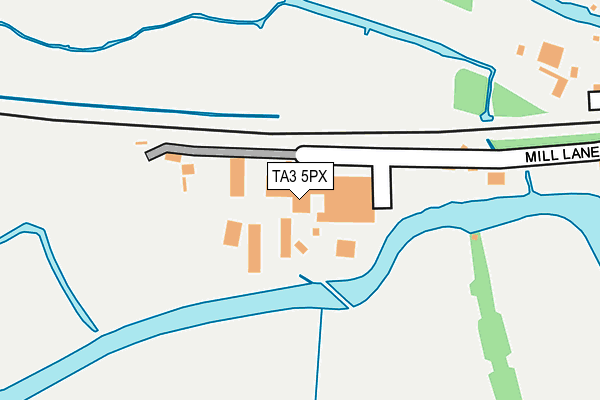
TA3 5PX is located in the Monkton & North Curry electoral ward, within the unitary authority of Somerset and the English Parliamentary constituency of Taunton Deane. The Sub Integrated Care Board (ICB) Location is NHS Somerset ICB - 11X and the police force is Avon and Somerset. This postcode has been in use since March 1988.


GetTheData
Source: OS OpenMap – Local (Ordnance Survey)
Source: OS VectorMap District (Ordnance Survey)
Licence: Open Government Licence (requires attribution)
| Easting | 326890 |
| Northing | 125357 |
| Latitude | 51.022916 |
| Longitude | -3.043774 |
GetTheData
Source: Open Postcode Geo
Licence: Open Government Licence
| Country | England |
| Postcode District | TA3 |
➜ See where TA3 is on a map ➜ Where is Creech St Michael? | |
GetTheData
Source: Land Registry Price Paid Data
Licence: Open Government Licence
Elevation or altitude of TA3 5PX as distance above sea level:
| Metres | Feet | |
|---|---|---|
| Elevation | 10m | 33ft |
Elevation is measured from the approximate centre of the postcode, to the nearest point on an OS contour line from OS Terrain 50, which has contour spacing of ten vertical metres.
➜ How high above sea level am I? Find the elevation of your current position using your device's GPS.
GetTheData
Source: Open Postcode Elevation
Licence: Open Government Licence
| Ward | Monkton & North Curry |
| Constituency | Taunton Deane |
GetTheData
Source: ONS Postcode Database
Licence: Open Government Licence
| Corner Cottage (St Michael Road) | Creech St Michael | 445m |
| Mill Lane (St Michael Road) | Creech St Michael | 454m |
| Lawn Meadow (Cheats Road) | Ruishton | 486m |
| Lawn Meadow (Cheats Road) | Ruishton | 492m |
| Arundells Way (Hyde Lane) | Creech St Michael | 553m |
| Taunton Station | 4.1km |
GetTheData
Source: NaPTAN
Licence: Open Government Licence
| Median download speed | 40.1Mbps |
| Average download speed | 36.6Mbps |
| Maximum download speed | 64.40Mbps |
| Median upload speed | 9.6Mbps |
| Average upload speed | 9.8Mbps |
| Maximum upload speed | 20.00Mbps |
GetTheData
Source: Ofcom
Licence: Ofcom Terms of Use (requires attribution)
GetTheData
Source: ONS Postcode Database
Licence: Open Government Licence


➜ Get more ratings from the Food Standards Agency
GetTheData
Source: Food Standards Agency
Licence: FSA terms & conditions
| Last Collection | |||
|---|---|---|---|
| Location | Mon-Fri | Sat | Distance |
| Arundels Way | 16:15 | 10:45 | 527m |
| Creech St Michael Post Office | 17:15 | 11:00 | 557m |
| Langaller | 10:00 | 09:00 | 1,547m |
GetTheData
Source: Dracos
Licence: Creative Commons Attribution-ShareAlike
| Risk of TA3 5PX flooding from rivers and sea | Very Low |
| ➜ TA3 5PX flood map | |
GetTheData
Source: Open Flood Risk by Postcode
Licence: Open Government Licence
The below table lists the International Territorial Level (ITL) codes (formerly Nomenclature of Territorial Units for Statistics (NUTS) codes) and Local Administrative Units (LAU) codes for TA3 5PX:
| ITL 1 Code | Name |
|---|---|
| TLK | South West (England) |
| ITL 2 Code | Name |
| TLK2 | Dorset and Somerset |
| ITL 3 Code | Name |
| TLK23 | Somerset CC |
| LAU 1 Code | Name |
| E07000246 | Somerset West and Taunton |
GetTheData
Source: ONS Postcode Directory
Licence: Open Government Licence
The below table lists the Census Output Area (OA), Lower Layer Super Output Area (LSOA), and Middle Layer Super Output Area (MSOA) for TA3 5PX:
| Code | Name | |
|---|---|---|
| OA | E00149141 | |
| LSOA | E01029273 | Taunton Deane 005B |
| MSOA | E02006103 | Taunton Deane 005 |
GetTheData
Source: ONS Postcode Directory
Licence: Open Government Licence
| TA3 5QZ | Crufts Meadow | 314m |
| TA3 5PT | 324m | |
| TA3 5QA | Laburnum Terrace | 332m |
| TA3 5PU | Mill Cottages | 345m |
| TA3 5QY | Queens Down | 359m |
| TA3 5RZ | Curvalion Road | 371m |
| TA3 5QX | Tristram Drive | 376m |
| TA3 5PZ | 380m | |
| TA3 5QG | Curvalion Gardens | 384m |
| TA3 5QU | Tristram Drive | 385m |
GetTheData
Source: Open Postcode Geo; Land Registry Price Paid Data
Licence: Open Government Licence