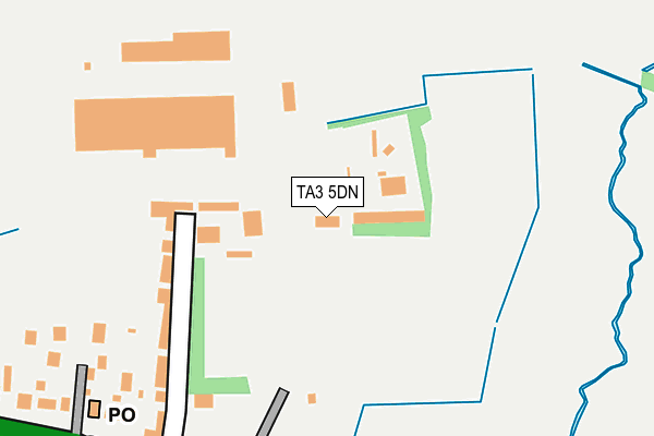
TA3 5DN is located in the Blackdown & Neroche electoral ward, within the unitary authority of Somerset and the English Parliamentary constituency of Taunton Deane. The Sub Integrated Care Board (ICB) Location is NHS Somerset ICB - 11X and the police force is Avon and Somerset. This postcode has been in use since July 2017.


GetTheData
Source: OS OpenMap – Local (Ordnance Survey)
Source: OS VectorMap District (Ordnance Survey)
Licence: Open Government Licence (requires attribution)
| Easting | 327410 |
| Northing | 124223 |
| Latitude | 51.012781 |
| Longitude | -3.036141 |
GetTheData
Source: Open Postcode Geo
Licence: Open Government Licence
| Country | England |
| Postcode District | TA3 |
➜ See where TA3 is on a map ➜ Where is Ruishton? | |
GetTheData
Source: Land Registry Price Paid Data
Licence: Open Government Licence
| Ward | Blackdown & Neroche |
| Constituency | Taunton Deane |
GetTheData
Source: ONS Postcode Database
Licence: Open Government Licence
| Falcon Hotel | Henlade | 396m |
| Henlade Cross (The Grove) | Henlade | 519m |
| Thornfalcon School | Thornfalcon | 529m |
| Thornfalcon School | Thornfalcon | 572m |
| Bushy Cross | Haydon | 841m |
| Taunton Station | 4.8km |
GetTheData
Source: NaPTAN
Licence: Open Government Licence
GetTheData
Source: ONS Postcode Database
Licence: Open Government Licence


➜ Get more ratings from the Food Standards Agency
GetTheData
Source: Food Standards Agency
Licence: FSA terms & conditions
| Last Collection | |||
|---|---|---|---|
| Location | Mon-Fri | Sat | Distance |
| Ham | 12:00 | 11:30 | 1,478m |
| Creech St Michael Post Office | 17:15 | 11:00 | 1,585m |
| Arundels Way | 16:15 | 10:45 | 1,615m |
GetTheData
Source: Dracos
Licence: Creative Commons Attribution-ShareAlike
The below table lists the International Territorial Level (ITL) codes (formerly Nomenclature of Territorial Units for Statistics (NUTS) codes) and Local Administrative Units (LAU) codes for TA3 5DN:
| ITL 1 Code | Name |
|---|---|
| TLK | South West (England) |
| ITL 2 Code | Name |
| TLK2 | Dorset and Somerset |
| ITL 3 Code | Name |
| TLK23 | Somerset CC |
| LAU 1 Code | Name |
| E07000246 | Somerset West and Taunton |
GetTheData
Source: ONS Postcode Directory
Licence: Open Government Licence
The below table lists the Census Output Area (OA), Lower Layer Super Output Area (LSOA), and Middle Layer Super Output Area (MSOA) for TA3 5DN:
| Code | Name | |
|---|---|---|
| OA | E00149146 | |
| LSOA | E01029275 | Taunton Deane 005D |
| MSOA | E02006103 | Taunton Deane 005 |
GetTheData
Source: ONS Postcode Directory
Licence: Open Government Licence
| TA3 5DL | Gravelands Lane | 173m |
| TA3 5DH | 277m | |
| TA3 5LQ | Knightstone | 397m |
| TA3 5NQ | 466m | |
| TA3 5HZ | Lipe Lane | 475m |
| TA3 5HY | The Grove | 477m |
| TA3 5JB | Steart Cottages | 532m |
| TA3 5HP | Laburnum Terrace | 542m |
| TA3 5LX | Stoke Road | 571m |
| TA3 5HS | 582m |
GetTheData
Source: Open Postcode Geo; Land Registry Price Paid Data
Licence: Open Government Licence