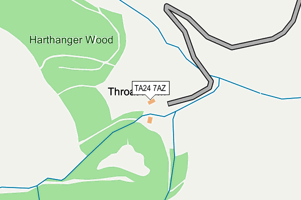
TA24 7AZ is located in the Dulverton & Exmoor electoral ward, within the unitary authority of Somerset and the English Parliamentary constituency of Bridgwater and West Somerset. The Sub Integrated Care Board (ICB) Location is NHS Somerset ICB - 11X and the police force is Avon and Somerset. This postcode has been in use since April 2017.


GetTheData
Source: OS OpenMap – Local (Ordnance Survey)
Source: OS VectorMap District (Ordnance Survey)
Licence: Open Government Licence (requires attribution)
| Easting | 296321 |
| Northing | 137868 |
| Latitude | 51.130670 |
| Longitude | -3.483100 |
GetTheData
Source: Open Postcode Geo
Licence: Open Government Licence
| Country | England |
| Postcode District | TA24 |
➜ See where TA24 is on a map | |
GetTheData
Source: Land Registry Price Paid Data
Licence: Open Government Licence
| Ward | Dulverton & Exmoor |
| Constituency | Bridgwater And West Somerset |
GetTheData
Source: ONS Postcode Database
Licence: Open Government Licence
| St Marys Church (Church Street) | Luxborough | 1,000m |
| St Marys Church (Church Street) | Luxborough | 1,006m |
GetTheData
Source: NaPTAN
Licence: Open Government Licence
| Percentage of properties with Next Generation Access | 0.0% |
| Percentage of properties with Superfast Broadband | 0.0% |
| Percentage of properties with Ultrafast Broadband | 0.0% |
| Percentage of properties with Full Fibre Broadband | 0.0% |
Superfast Broadband is between 30Mbps and 300Mbps
Ultrafast Broadband is > 300Mbps
| Percentage of properties unable to receive 2Mbps | 100.0% |
| Percentage of properties unable to receive 5Mbps | 100.0% |
| Percentage of properties unable to receive 10Mbps | 100.0% |
| Percentage of properties unable to receive 30Mbps | 100.0% |
GetTheData
Source: Ofcom
Licence: Ofcom Terms of Use (requires attribution)
GetTheData
Source: ONS Postcode Database
Licence: Open Government Licence
| Last Collection | |||
|---|---|---|---|
| Location | Mon-Fri | Sat | Distance |
| Wheddon Cross Post Office | 15:15 | 11:00 | 3,987m |
| Timberscombe | 15:30 | 11:00 | 4,305m |
| Cowbridge | 10:00 | 11:00 | 4,771m |
GetTheData
Source: Dracos
Licence: Creative Commons Attribution-ShareAlike
The below table lists the International Territorial Level (ITL) codes (formerly Nomenclature of Territorial Units for Statistics (NUTS) codes) and Local Administrative Units (LAU) codes for TA24 7AZ:
| ITL 1 Code | Name |
|---|---|
| TLK | South West (England) |
| ITL 2 Code | Name |
| TLK2 | Dorset and Somerset |
| ITL 3 Code | Name |
| TLK23 | Somerset CC |
| LAU 1 Code | Name |
| E07000246 | Somerset West and Taunton |
GetTheData
Source: ONS Postcode Directory
Licence: Open Government Licence
The below table lists the Census Output Area (OA), Lower Layer Super Output Area (LSOA), and Middle Layer Super Output Area (MSOA) for TA24 7AZ:
| Code | Name | |
|---|---|---|
| OA | E00149469 | |
| LSOA | E01029335 | West Somerset 004B |
| MSOA | E02006116 | West Somerset 004 |
GetTheData
Source: ONS Postcode Directory
Licence: Open Government Licence
| TA23 0ST | 813m | |
| TA24 7BT | 849m | |
| TA23 0SR | 962m | |
| TA24 7BJ | 1052m | |
| TA23 0SP | 1141m | |
| TA23 0SW | 1194m | |
| TA24 7BP | 1508m | |
| TA23 0SN | 1592m | |
| TA23 0SX | 1670m | |
| TA23 0SL | 2079m |
GetTheData
Source: Open Postcode Geo; Land Registry Price Paid Data
Licence: Open Government Licence