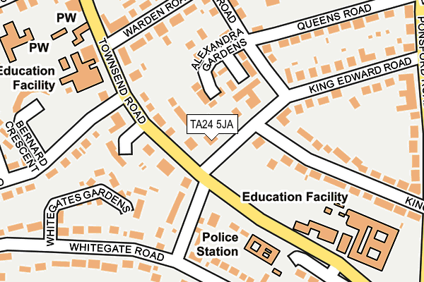
TA24 5JA is located in the Minehead electoral ward, within the unitary authority of Somerset and the English Parliamentary constituency of Bridgwater and West Somerset. The Sub Integrated Care Board (ICB) Location is NHS Somerset ICB - 11X and the police force is Avon and Somerset. This postcode has been in use since June 2002.


GetTheData
Source: OS OpenMap – Local (Ordnance Survey)
Source: OS VectorMap District (Ordnance Survey)
Licence: Open Government Licence (requires attribution)
| Easting | 297041 |
| Northing | 145763 |
| Latitude | 51.201771 |
| Longitude | -3.475062 |
GetTheData
Source: Open Postcode Geo
Licence: Open Government Licence
| Country | England |
| Postcode District | TA24 |
➜ See where TA24 is on a map ➜ Where is Minehead? | |
GetTheData
Source: Land Registry Price Paid Data
Licence: Open Government Licence
Elevation or altitude of TA24 5JA as distance above sea level:
| Metres | Feet | |
|---|---|---|
| Elevation | 20m | 66ft |
Elevation is measured from the approximate centre of the postcode, to the nearest point on an OS contour line from OS Terrain 50, which has contour spacing of ten vertical metres.
➜ How high above sea level am I? Find the elevation of your current position using your device's GPS.
GetTheData
Source: Open Postcode Elevation
Licence: Open Government Licence
| Ward | Minehead |
| Constituency | Bridgwater And West Somerset |
GetTheData
Source: ONS Postcode Database
Licence: Open Government Licence
| King Edward Road (Townsend Road) | Minehead | 35m |
| Minehead Hospital (Paganel Road) | Minehead | 151m |
| Minehead Middle School | Minehead | 197m |
| Minehead Middle School | Minehead | 202m |
| Roman Catholic Church (Townsend Road) | Minehead | 245m |
| Minehead (West Somerset Railway) | Minehead | 710m |
GetTheData
Source: NaPTAN
Licence: Open Government Licence
GetTheData
Source: ONS Postcode Database
Licence: Open Government Licence


➜ Get more ratings from the Food Standards Agency
GetTheData
Source: Food Standards Agency
Licence: FSA terms & conditions
| Last Collection | |||
|---|---|---|---|
| Location | Mon-Fri | Sat | Distance |
| The Avenue Post Office | 17:00 | 12:30 | 497m |
| Staunton Road | 16:30 | 12:15 | 613m |
| Church Street | 16:30 | 12:30 | 969m |
GetTheData
Source: Dracos
Licence: Creative Commons Attribution-ShareAlike
| Risk of TA24 5JA flooding from rivers and sea | Medium |
| ➜ TA24 5JA flood map | |
GetTheData
Source: Open Flood Risk by Postcode
Licence: Open Government Licence
The below table lists the International Territorial Level (ITL) codes (formerly Nomenclature of Territorial Units for Statistics (NUTS) codes) and Local Administrative Units (LAU) codes for TA24 5JA:
| ITL 1 Code | Name |
|---|---|
| TLK | South West (England) |
| ITL 2 Code | Name |
| TLK2 | Dorset and Somerset |
| ITL 3 Code | Name |
| TLK23 | Somerset CC |
| LAU 1 Code | Name |
| E07000246 | Somerset West and Taunton |
GetTheData
Source: ONS Postcode Directory
Licence: Open Government Licence
The below table lists the Census Output Area (OA), Lower Layer Super Output Area (LSOA), and Middle Layer Super Output Area (MSOA) for TA24 5JA:
| Code | Name | |
|---|---|---|
| OA | E00149452 | |
| LSOA | E01029329 | West Somerset 001C |
| MSOA | E02006113 | West Somerset 001 |
GetTheData
Source: ONS Postcode Directory
Licence: Open Government Licence
| TA24 5JB | King Edward Road | 51m |
| TA24 5RQ | Townsend Road | 78m |
| TA24 5LD | Alexandra Gardens | 100m |
| TA24 5RN | Kildare Gardens | 137m |
| TA24 5DR | Alexandra Road | 153m |
| TA24 5SR | Whitegate Road | 171m |
| TA24 5SP | Whitegate Road | 176m |
| TA24 5DS | Warden Road | 180m |
| TA24 5TJ | Whitegate Gardens | 182m |
| TA24 5JD | King George Road | 196m |
GetTheData
Source: Open Postcode Geo; Land Registry Price Paid Data
Licence: Open Government Licence