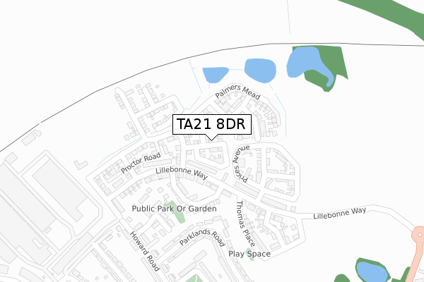
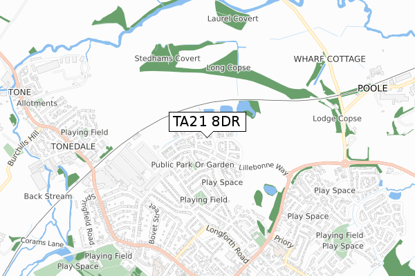
TA21 8DR is located in the Wellington electoral ward, within the unitary authority of Somerset and the English Parliamentary constituency of Taunton Deane. The Sub Integrated Care Board (ICB) Location is NHS Somerset ICB - 11X and the police force is Avon and Somerset. This postcode has been in use since June 2018.


GetTheData
Source: OS Open Zoomstack (Ordnance Survey)
Licence: Open Government Licence (requires attribution)
Attribution: Contains OS data © Crown copyright and database right 2024
Source: Open Postcode Geo
Licence: Open Government Licence (requires attribution)
Attribution: Contains OS data © Crown copyright and database right 2024; Contains Royal Mail data © Royal Mail copyright and database right 2024; Source: Office for National Statistics licensed under the Open Government Licence v.3.0
| Easting | 313787 |
| Northing | 121507 |
| Latitude | 50.986480 |
| Longitude | -3.229649 |
GetTheData
Source: Open Postcode Geo
Licence: Open Government Licence
| Country | England |
| Postcode District | TA21 |
➜ See where TA21 is on a map ➜ Where is Wellington? | |
GetTheData
Source: Land Registry Price Paid Data
Licence: Open Government Licence
| Ward | Wellington |
| Constituency | Taunton Deane |
GetTheData
Source: ONS Postcode Database
Licence: Open Government Licence
10, JOHN COLE CLOSE, WELLINGTON, TA21 8DR 2023 6 JAN £316,000 |
31, JOHN COLE CLOSE, WELLINGTON, TA21 8DR 2022 13 DEC £492,000 |
12, JOHN COLE CLOSE, WELLINGTON, TA21 8DR 2022 21 OCT £300,000 |
2, JOHN COLE CLOSE, WELLINGTON, TA21 8DR 2022 31 AUG £460,000 |
16, JOHN COLE CLOSE, WELLINGTON, TA21 8DR 2020 4 SEP £371,000 |
4, JOHN COLE CLOSE, WELLINGTON, TA21 8DR 2020 15 MAY £390,000 |
14, JOHN COLE CLOSE, WELLINGTON, TA21 8DR 2020 17 APR £313,000 |
6, JOHN COLE CLOSE, WELLINGTON, TA21 8DR 2020 31 MAR £339,950 |
2, JOHN COLE CLOSE, WELLINGTON, TA21 8DR 2020 31 JAN £424,950 |
12, JOHN COLE CLOSE, WELLINGTON, TA21 8DR 2019 20 DEC £239,950 |
GetTheData
Source: HM Land Registry Price Paid Data
Licence: Contains HM Land Registry data © Crown copyright and database right 2024. This data is licensed under the Open Government Licence v3.0.
| St John The Baptist Church (High Street) | Wellington | 721m |
| Police Station (Victoria Street) | Wellington | 728m |
| The Priory (Priory Gardens) | Wellington | 737m |
| Police Station (Victoria Street) | Wellington | 739m |
| Swallowfield Works (Station Road) | Wellington | 739m |
GetTheData
Source: NaPTAN
Licence: Open Government Licence
| Percentage of properties with Next Generation Access | 100.0% |
| Percentage of properties with Superfast Broadband | 100.0% |
| Percentage of properties with Ultrafast Broadband | 100.0% |
| Percentage of properties with Full Fibre Broadband | 100.0% |
Superfast Broadband is between 30Mbps and 300Mbps
Ultrafast Broadband is > 300Mbps
| Percentage of properties unable to receive 2Mbps | 0.0% |
| Percentage of properties unable to receive 5Mbps | 0.0% |
| Percentage of properties unable to receive 10Mbps | 0.0% |
| Percentage of properties unable to receive 30Mbps | 0.0% |
GetTheData
Source: Ofcom
Licence: Ofcom Terms of Use (requires attribution)
GetTheData
Source: ONS Postcode Database
Licence: Open Government Licence


➜ Get more ratings from the Food Standards Agency
GetTheData
Source: Food Standards Agency
Licence: FSA terms & conditions
| Last Collection | |||
|---|---|---|---|
| Location | Mon-Fri | Sat | Distance |
| Longforth Road | 16:30 | 12:30 | 451m |
| Rockwell Green Post Office | 17:00 | 11:30 | 1,756m |
| Oaken Ground | 16:15 | 12:00 | 1,771m |
GetTheData
Source: Dracos
Licence: Creative Commons Attribution-ShareAlike
The below table lists the International Territorial Level (ITL) codes (formerly Nomenclature of Territorial Units for Statistics (NUTS) codes) and Local Administrative Units (LAU) codes for TA21 8DR:
| ITL 1 Code | Name |
|---|---|
| TLK | South West (England) |
| ITL 2 Code | Name |
| TLK2 | Dorset and Somerset |
| ITL 3 Code | Name |
| TLK23 | Somerset CC |
| LAU 1 Code | Name |
| E07000246 | Somerset West and Taunton |
GetTheData
Source: ONS Postcode Directory
Licence: Open Government Licence
The below table lists the Census Output Area (OA), Lower Layer Super Output Area (LSOA), and Middle Layer Super Output Area (MSOA) for TA21 8DR:
| Code | Name | |
|---|---|---|
| OA | E00149341 | |
| LSOA | E01029311 | Taunton Deane 012B |
| MSOA | E02006110 | Taunton Deane 012 |
GetTheData
Source: ONS Postcode Directory
Licence: Open Government Licence
| TA21 8FD | Normandy Row | 102m |
| TA21 8FB | Gregorys Crescent | 147m |
| TA21 8DS | Prices Avenue | 151m |
| TA21 8SB | Stedhams Close | 195m |
| TA21 8SA | Parklands Road | 251m |
| TA21 8FA | Thomas Place | 262m |
| TA21 8RX | Howard Road | 309m |
| TA21 8RZ | Parklands Road | 316m |
| TA21 8RY | Howard Road | 328m |
| TA21 8RR | Quantock Road | 368m |
GetTheData
Source: Open Postcode Geo; Land Registry Price Paid Data
Licence: Open Government Licence