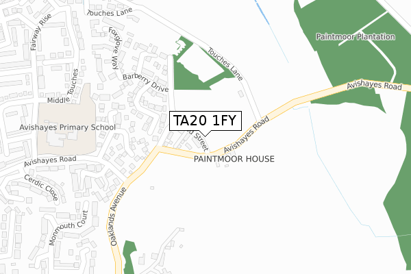
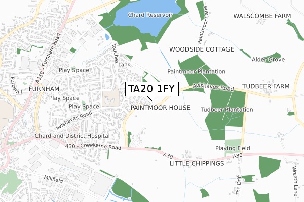
TA20 1FY is located in the Chard North electoral ward, within the unitary authority of Somerset and the English Parliamentary constituency of Yeovil. The Sub Integrated Care Board (ICB) Location is NHS Somerset ICB - 11X and the police force is Avon and Somerset. This postcode has been in use since September 2019.


GetTheData
Source: OS Open Zoomstack (Ordnance Survey)
Licence: Open Government Licence (requires attribution)
Attribution: Contains OS data © Crown copyright and database right 2025
Source: Open Postcode Geo
Licence: Open Government Licence (requires attribution)
Attribution: Contains OS data © Crown copyright and database right 2025; Contains Royal Mail data © Royal Mail copyright and database right 2025; Source: Office for National Statistics licensed under the Open Government Licence v.3.0
| Easting | 333736 |
| Northing | 109073 |
| Latitude | 50.877328 |
| Longitude | -2.943215 |
GetTheData
Source: Open Postcode Geo
Licence: Open Government Licence
| Country | England |
| Postcode District | TA20 |
➜ See where TA20 is on a map ➜ Where is Chard? | |
GetTheData
Source: Land Registry Price Paid Data
Licence: Open Government Licence
| Ward | Chard North |
| Constituency | Yeovil |
GetTheData
Source: ONS Postcode Database
Licence: Open Government Licence
18, BROAD STREET, CHARD, TA20 1FY 2019 31 OCT £174,000 |
GetTheData
Source: HM Land Registry Price Paid Data
Licence: Contains HM Land Registry data © Crown copyright and database right 2025. This data is licensed under the Open Government Licence v3.0.
| Caraway Close (Avishayes Road) | Chard | 229m |
| Caraway Close (Avishayes Road) | Chard | 233m |
| Avishayes Shops (Avishayes Road) | Chard | 500m |
| Henson Park (Avishayes Road) | Chard | 595m |
| Henson Park (Avishayes Road) | Chard | 617m |
GetTheData
Source: NaPTAN
Licence: Open Government Licence
GetTheData
Source: ONS Postcode Database
Licence: Open Government Licence


➜ Get more ratings from the Food Standards Agency
GetTheData
Source: Food Standards Agency
Licence: FSA terms & conditions
| Last Collection | |||
|---|---|---|---|
| Location | Mon-Fri | Sat | Distance |
| Glynswood | 16:30 | 12:00 | 1,104m |
| Thorndun Park | 16:30 | 12:00 | 1,149m |
| Chard Delivery Office | 17:30 | 12:45 | 1,293m |
GetTheData
Source: Dracos
Licence: Creative Commons Attribution-ShareAlike
The below table lists the International Territorial Level (ITL) codes (formerly Nomenclature of Territorial Units for Statistics (NUTS) codes) and Local Administrative Units (LAU) codes for TA20 1FY:
| ITL 1 Code | Name |
|---|---|
| TLK | South West (England) |
| ITL 2 Code | Name |
| TLK2 | Dorset and Somerset |
| ITL 3 Code | Name |
| TLK23 | Somerset CC |
| LAU 1 Code | Name |
| E07000189 | South Somerset |
GetTheData
Source: ONS Postcode Directory
Licence: Open Government Licence
The below table lists the Census Output Area (OA), Lower Layer Super Output Area (LSOA), and Middle Layer Super Output Area (MSOA) for TA20 1FY:
| Code | Name | |
|---|---|---|
| OA | E00148595 | |
| LSOA | E01029169 | South Somerset 022A |
| MSOA | E02006096 | South Somerset 022 |
GetTheData
Source: ONS Postcode Directory
Licence: Open Government Licence
| TA20 1HN | Oaklands Avenue | 88m |
| TA20 1HS | Bracken Way | 149m |
| TA20 1HP | Caraway Close | 192m |
| TA20 1HR | Barberry Drive | 214m |
| TA20 1HU | Cloudberry Close | 239m |
| TA20 1NA | Old Orchards | 279m |
| TA20 1HB | Oaklands | 306m |
| TA20 1HT | Foxglove Way | 313m |
| TA20 1NU | Middle Touches | 345m |
| TA20 1HQ | Monmouth Court | 406m |
GetTheData
Source: Open Postcode Geo; Land Registry Price Paid Data
Licence: Open Government Licence