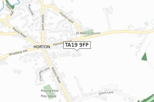
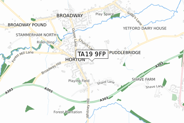
TA19 9FP is located in the Ilminster electoral ward, within the unitary authority of Somerset and the English Parliamentary constituency of Yeovil. The Sub Integrated Care Board (ICB) Location is NHS Somerset ICB - 11X and the police force is Avon and Somerset. This postcode has been in use since October 2018.


GetTheData
Source: OS Open Zoomstack (Ordnance Survey)
Licence: Open Government Licence (requires attribution)
Attribution: Contains OS data © Crown copyright and database right 2025
Source: Open Postcode Geo
Licence: Open Government Licence (requires attribution)
Attribution: Contains OS data © Crown copyright and database right 2025; Contains Royal Mail data © Royal Mail copyright and database right 2025; Source: Office for National Statistics licensed under the Open Government Licence v.3.0
| Easting | 332346 |
| Northing | 114804 |
| Latitude | 50.928695 |
| Longitude | -2.964035 |
GetTheData
Source: Open Postcode Geo
Licence: Open Government Licence
| Country | England |
| Postcode District | TA19 |
➜ See where TA19 is on a map | |
GetTheData
Source: Land Registry Price Paid Data
Licence: Open Government Licence
| Ward | Ilminster |
| Constituency | Yeovil |
GetTheData
Source: ONS Postcode Database
Licence: Open Government Licence
| Five Dials Inn (Hanning Road) | Horton | 165m |
| Garth Cottage (Hanning Road) | Horton | 196m |
| Goose Lane | Horton | 238m |
| Broadway Hill Junction | Horton | 250m |
| Goose Lane | Horton | 251m |
GetTheData
Source: NaPTAN
Licence: Open Government Licence
| Percentage of properties with Next Generation Access | 80.0% |
| Percentage of properties with Superfast Broadband | 80.0% |
| Percentage of properties with Ultrafast Broadband | 0.0% |
| Percentage of properties with Full Fibre Broadband | 0.0% |
Superfast Broadband is between 30Mbps and 300Mbps
Ultrafast Broadband is > 300Mbps
| Percentage of properties unable to receive 2Mbps | 0.0% |
| Percentage of properties unable to receive 5Mbps | 0.0% |
| Percentage of properties unable to receive 10Mbps | 0.0% |
| Percentage of properties unable to receive 30Mbps | 0.0% |
GetTheData
Source: Ofcom
Licence: Ofcom Terms of Use (requires attribution)
GetTheData
Source: ONS Postcode Database
Licence: Open Government Licence


➜ Get more ratings from the Food Standards Agency
GetTheData
Source: Food Standards Agency
Licence: FSA terms & conditions
| Last Collection | |||
|---|---|---|---|
| Location | Mon-Fri | Sat | Distance |
| Peasmarch | 12:00 | 08:00 | 2,890m |
| Canal Way | 16:15 | 11:45 | 2,921m |
| New Road | 16:45 | 12:00 | 3,305m |
GetTheData
Source: Dracos
Licence: Creative Commons Attribution-ShareAlike
The below table lists the International Territorial Level (ITL) codes (formerly Nomenclature of Territorial Units for Statistics (NUTS) codes) and Local Administrative Units (LAU) codes for TA19 9FP:
| ITL 1 Code | Name |
|---|---|
| TLK | South West (England) |
| ITL 2 Code | Name |
| TLK2 | Dorset and Somerset |
| ITL 3 Code | Name |
| TLK23 | Somerset CC |
| LAU 1 Code | Name |
| E07000189 | South Somerset |
GetTheData
Source: ONS Postcode Directory
Licence: Open Government Licence
The below table lists the Census Output Area (OA), Lower Layer Super Output Area (LSOA), and Middle Layer Super Output Area (MSOA) for TA19 9FP:
| Code | Name | |
|---|---|---|
| OA | E00148794 | |
| LSOA | E01029208 | South Somerset 019D |
| MSOA | E02006093 | South Somerset 019 |
GetTheData
Source: ONS Postcode Directory
Licence: Open Government Licence
| TA19 9SJ | Langworthy Orchard | 84m |
| TA19 9QE | Ewell Close | 86m |
| TA19 9QH | Hanning Road | 133m |
| TA19 9QB | Hanning Park | 149m |
| TA19 9FD | Church Court | 161m |
| TA19 9SQ | Slades Orchard | 183m |
| TA19 9QW | Pottery Road | 196m |
| TA19 9RW | St Peters Close | 209m |
| TA19 9RN | Church Lane | 251m |
| TA19 9QJ | The Lane | 263m |
GetTheData
Source: Open Postcode Geo; Land Registry Price Paid Data
Licence: Open Government Licence