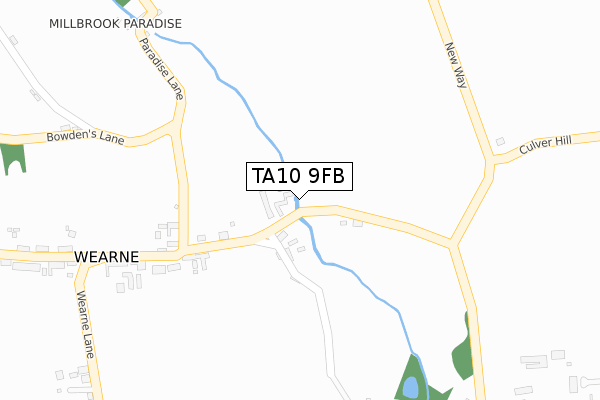
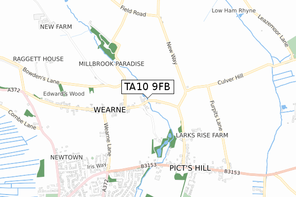
TA10 9FB is located in the Somerton electoral ward, within the unitary authority of Somerset and the English Parliamentary constituency of Somerton and Frome. The Sub Integrated Care Board (ICB) Location is NHS Somerset ICB - 11X and the police force is Avon and Somerset. This postcode has been in use since April 2019.


GetTheData
Source: OS Open Zoomstack (Ordnance Survey)
Licence: Open Government Licence (requires attribution)
Attribution: Contains OS data © Crown copyright and database right 2024
Source: Open Postcode Geo
Licence: Open Government Licence (requires attribution)
Attribution: Contains OS data © Crown copyright and database right 2024; Contains Royal Mail data © Royal Mail copyright and database right 2024; Source: Office for National Statistics licensed under the Open Government Licence v.3.0
| Easting | 345709 |
| Northing | 126260 |
| Latitude | 51.033118 |
| Longitude | -2.775625 |
GetTheData
Source: Open Postcode Geo
Licence: Open Government Licence
| Country | England |
| Postcode District | TA10 |
➜ See where TA10 is on a map | |
GetTheData
Source: Land Registry Price Paid Data
Licence: Open Government Licence
| Ward | Somerton |
| Constituency | Somerton And Frome |
GetTheData
Source: ONS Postcode Database
Licence: Open Government Licence
| Batts Lane (Vedal Drove) | Somerton Hill | 103m |
| Batts Lane (Vedal Drove) | Somerton Hill | 114m |
| Devonshire Arms (Cross Lane) | Long Sutton | 1,479m |
| Devonshire Arms (Cross Lane) | Long Sutton | 1,483m |
GetTheData
Source: NaPTAN
Licence: Open Government Licence
GetTheData
Source: ONS Postcode Database
Licence: Open Government Licence


➜ Get more ratings from the Food Standards Agency
GetTheData
Source: Food Standards Agency
Licence: FSA terms & conditions
| Last Collection | |||
|---|---|---|---|
| Location | Mon-Fri | Sat | Distance |
| Higher Muchelney | 16:15 | 07:00 | 3,090m |
| Poundpool | 17:15 | 09:00 | 3,651m |
| Somerton Post Office | 17:15 | 11:30 | 3,752m |
GetTheData
Source: Dracos
Licence: Creative Commons Attribution-ShareAlike
| Risk of TA10 9FB flooding from rivers and sea | Medium |
| ➜ TA10 9FB flood map | |
GetTheData
Source: Open Flood Risk by Postcode
Licence: Open Government Licence
The below table lists the International Territorial Level (ITL) codes (formerly Nomenclature of Territorial Units for Statistics (NUTS) codes) and Local Administrative Units (LAU) codes for TA10 9FB:
| ITL 1 Code | Name |
|---|---|
| TLK | South West (England) |
| ITL 2 Code | Name |
| TLK2 | Dorset and Somerset |
| ITL 3 Code | Name |
| TLK23 | Somerset CC |
| LAU 1 Code | Name |
| E07000189 | South Somerset |
GetTheData
Source: ONS Postcode Directory
Licence: Open Government Licence
The below table lists the Census Output Area (OA), Lower Layer Super Output Area (LSOA), and Middle Layer Super Output Area (MSOA) for TA10 9FB:
| Code | Name | |
|---|---|---|
| OA | E00148860 | |
| LSOA | E01029223 | South Somerset 004D |
| MSOA | E02006078 | South Somerset 004 |
GetTheData
Source: ONS Postcode Directory
Licence: Open Government Licence
| TA10 9NJ | 132m | |
| TA10 9EQ | Batts Lane | 217m |
| TA10 9NL | Upton | 258m |
| TA10 9NQ | Langport Road | 379m |
| TA10 9NH | Long Furlong Lane | 527m |
| TA10 9NS | Littlefield Lane | 549m |
| TA10 9ND | Langport Road | 678m |
| TA10 9NN | Upton | 772m |
| TA10 9NW | Hermitage Road | 808m |
| TA10 9NE | Langport Road | 903m |
GetTheData
Source: Open Postcode Geo; Land Registry Price Paid Data
Licence: Open Government Licence