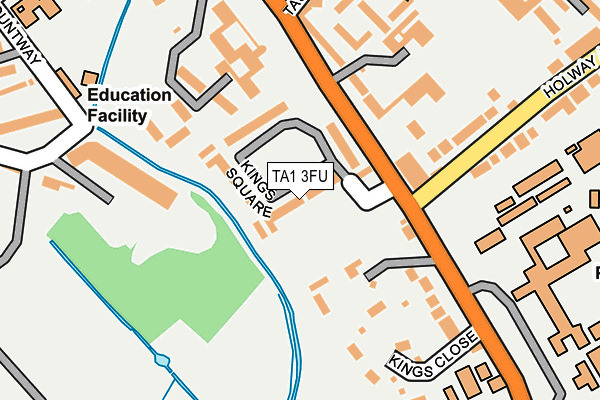
TA1 3FU is located in the Taunton South electoral ward, within the unitary authority of Somerset and the English Parliamentary constituency of Taunton Deane. The Sub Integrated Care Board (ICB) Location is NHS Somerset ICB - 11X and the police force is Avon and Somerset. This postcode has been in use since June 2017.


GetTheData
Source: OS OpenMap – Local (Ordnance Survey)
Source: OS VectorMap District (Ordnance Survey)
Licence: Open Government Licence (requires attribution)
| Easting | 323369 |
| Northing | 122774 |
| Latitude | 50.999229 |
| Longitude | -3.093429 |
GetTheData
Source: Open Postcode Geo
Licence: Open Government Licence
| Country | England |
| Postcode District | TA1 |
➜ See where TA1 is on a map ➜ Where is Taunton? | |
GetTheData
Source: Land Registry Price Paid Data
Licence: Open Government Licence
| Ward | Taunton South |
| Constituency | Taunton Deane |
GetTheData
Source: ONS Postcode Database
Licence: Open Government Licence
| Killams Drive (Shoreditch Road) | Taunton | 483m |
| Killams Drive (Shoreditch Road) | Taunton | 496m |
| Fullands Road | Taunton | 517m |
| Fullands Road (Shoreditch Road) | Taunton | 538m |
| Chestnut Drive (Shoreditch Road) | Taunton | 637m |
| Taunton Station | 2.8km |
GetTheData
Source: NaPTAN
Licence: Open Government Licence
| Percentage of properties with Next Generation Access | 100.0% |
| Percentage of properties with Superfast Broadband | 97.0% |
| Percentage of properties with Ultrafast Broadband | 0.0% |
| Percentage of properties with Full Fibre Broadband | 0.0% |
Superfast Broadband is between 30Mbps and 300Mbps
Ultrafast Broadband is > 300Mbps
| Median download speed | 25.1Mbps |
| Average download speed | 22.3Mbps |
| Maximum download speed | 39.70Mbps |
| Median upload speed | 5.8Mbps |
| Average upload speed | 4.7Mbps |
| Maximum upload speed | 8.57Mbps |
| Percentage of properties unable to receive 2Mbps | 0.0% |
| Percentage of properties unable to receive 5Mbps | 0.0% |
| Percentage of properties unable to receive 10Mbps | 0.0% |
| Percentage of properties unable to receive 30Mbps | 3.0% |
GetTheData
Source: Ofcom
Licence: Ofcom Terms of Use (requires attribution)
GetTheData
Source: ONS Postcode Database
Licence: Open Government Licence


➜ Get more ratings from the Food Standards Agency
GetTheData
Source: Food Standards Agency
Licence: FSA terms & conditions
| Last Collection | |||
|---|---|---|---|
| Location | Mon-Fri | Sat | Distance |
| Killiams Avenue | 17:00 | 12:00 | 367m |
| Shoreditch Road | 17:00 | 12:00 | 571m |
| Mountfields Post Office | 17:15 | 12:00 | 755m |
GetTheData
Source: Dracos
Licence: Creative Commons Attribution-ShareAlike
The below table lists the International Territorial Level (ITL) codes (formerly Nomenclature of Territorial Units for Statistics (NUTS) codes) and Local Administrative Units (LAU) codes for TA1 3FU:
| ITL 1 Code | Name |
|---|---|
| TLK | South West (England) |
| ITL 2 Code | Name |
| TLK2 | Dorset and Somerset |
| ITL 3 Code | Name |
| TLK23 | Somerset CC |
| LAU 1 Code | Name |
| E07000246 | Somerset West and Taunton |
GetTheData
Source: ONS Postcode Directory
Licence: Open Government Licence
The below table lists the Census Output Area (OA), Lower Layer Super Output Area (LSOA), and Middle Layer Super Output Area (MSOA) for TA1 3FU:
| Code | Name | |
|---|---|---|
| OA | E00149254 | |
| LSOA | E01029296 | Taunton Deane 014D |
| MSOA | E02006112 | Taunton Deane 014 |
GetTheData
Source: ONS Postcode Directory
Licence: Open Government Licence
| TA1 3YE | Killams Avenue | 259m |
| TA1 3YD | Kingsway | 298m |
| TA1 3DG | Mountfields Road | 384m |
| TA1 3YB | Killams Crescent | 401m |
| TA1 3YQ | Killams Green | 419m |
| TA1 3YF | Kingsway | 425m |
| TA1 3DA | Gordons Close | 461m |
| TA1 3BN | Mountfields Avenue | 476m |
| TA1 3BW | Mountfields Avenue | 478m |
| TA1 3YA | Killams Lane | 488m |
GetTheData
Source: Open Postcode Geo; Land Registry Price Paid Data
Licence: Open Government Licence