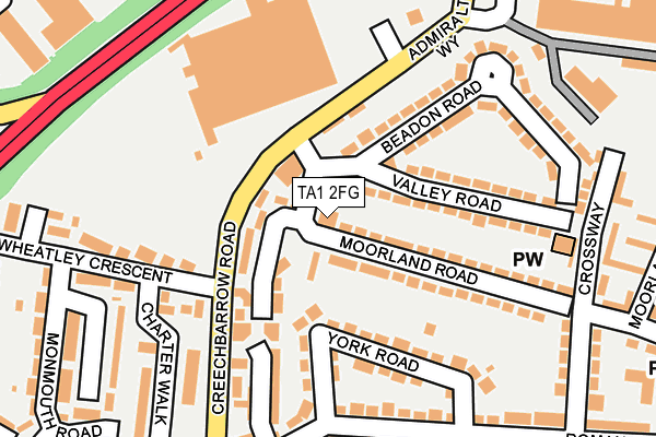
TA1 2FG is located in the Taunton East electoral ward, within the unitary authority of Somerset and the English Parliamentary constituency of Taunton Deane. The Sub Integrated Care Board (ICB) Location is NHS Somerset ICB - 11X and the police force is Avon and Somerset. This postcode has been in use since July 2017.


GetTheData
Source: OS OpenMap – Local (Ordnance Survey)
Source: OS VectorMap District (Ordnance Survey)
Licence: Open Government Licence (requires attribution)
| Easting | 324182 |
| Northing | 125267 |
| Latitude | 51.021751 |
| Longitude | -3.082367 |
GetTheData
Source: Open Postcode Geo
Licence: Open Government Licence
| Country | England |
| Postcode District | TA1 |
➜ See where TA1 is on a map ➜ Where is Taunton? | |
GetTheData
Source: Land Registry Price Paid Data
Licence: Open Government Licence
| Ward | Taunton East |
| Constituency | Taunton Deane |
GetTheData
Source: ONS Postcode Database
Licence: Open Government Licence
| Charter Walk (Wheatley Crescent) | Taunton | 149m |
| Charter Walk (Wheatley Crescent) | Taunton | 158m |
| Asda Superstore | Taunton | 177m |
| York Road (Roman Road) | Taunton | 204m |
| York Road (Roman Road) | Taunton | 204m |
| Taunton Station | 1.4km |
GetTheData
Source: NaPTAN
Licence: Open Government Licence
| Percentage of properties with Next Generation Access | 100.0% |
| Percentage of properties with Superfast Broadband | 100.0% |
| Percentage of properties with Ultrafast Broadband | 0.0% |
| Percentage of properties with Full Fibre Broadband | 0.0% |
Superfast Broadband is between 30Mbps and 300Mbps
Ultrafast Broadband is > 300Mbps
| Percentage of properties unable to receive 2Mbps | 0.0% |
| Percentage of properties unable to receive 5Mbps | 0.0% |
| Percentage of properties unable to receive 10Mbps | 0.0% |
| Percentage of properties unable to receive 30Mbps | 0.0% |
GetTheData
Source: Ofcom
Licence: Ofcom Terms of Use (requires attribution)
GetTheData
Source: ONS Postcode Database
Licence: Open Government Licence


➜ Get more ratings from the Food Standards Agency
GetTheData
Source: Food Standards Agency
Licence: FSA terms & conditions
| Last Collection | |||
|---|---|---|---|
| Location | Mon-Fri | Sat | Distance |
| Crown Industrial Estate | 16:00 | 11:45 | 764m |
| Draycott Avenue | 17:00 | 11:45 | 996m |
| Waterleaze | 17:00 | 11:45 | 999m |
GetTheData
Source: Dracos
Licence: Creative Commons Attribution-ShareAlike
The below table lists the International Territorial Level (ITL) codes (formerly Nomenclature of Territorial Units for Statistics (NUTS) codes) and Local Administrative Units (LAU) codes for TA1 2FG:
| ITL 1 Code | Name |
|---|---|
| TLK | South West (England) |
| ITL 2 Code | Name |
| TLK2 | Dorset and Somerset |
| ITL 3 Code | Name |
| TLK23 | Somerset CC |
| LAU 1 Code | Name |
| E07000246 | Somerset West and Taunton |
GetTheData
Source: ONS Postcode Directory
Licence: Open Government Licence
The below table lists the Census Output Area (OA), Lower Layer Super Output Area (LSOA), and Middle Layer Super Output Area (MSOA) for TA1 2FG:
| Code | Name | |
|---|---|---|
| OA | E00149229 | |
| LSOA | E01029293 | Taunton Deane 009E |
| MSOA | E02006107 | Taunton Deane 009 |
GetTheData
Source: ONS Postcode Directory
Licence: Open Government Licence
| TA1 2DH | Valley Road | 107m |
| TA1 2DA | Moorland Road | 118m |
| TA1 2AR | Creechbarrow Road | 121m |
| TA1 2DB | Moorland Road | 123m |
| TA1 2DJ | Beadon Road | 135m |
| TA1 2BE | York Road | 141m |
| TA1 2AT | Wheatley Crescent | 193m |
| TA1 2BG | Roman Road | 208m |
| TA1 2AY | Charter Walk | 219m |
| TA1 2DL | Beadon Road | 226m |
GetTheData
Source: Open Postcode Geo; Land Registry Price Paid Data
Licence: Open Government Licence