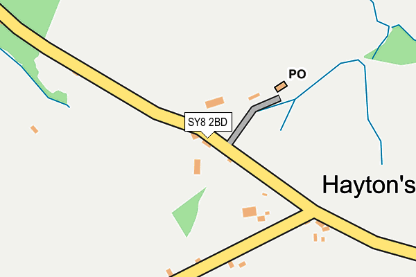
SY8 2BD is in Haytons Bent, Ludlow. SY8 2BD is located in the Corvedale electoral ward, within the unitary authority of Shropshire and the English Parliamentary constituency of Ludlow. The Sub Integrated Care Board (ICB) Location is NHS Shropshire, Telford and Wrekin ICB - M2L0M and the police force is West Mercia. This postcode has been in use since January 1980.


GetTheData
Source: OS OpenMap – Local (Ordnance Survey)
Source: OS VectorMap District (Ordnance Survey)
Licence: Open Government Licence (requires attribution)
| Easting | 351987 |
| Northing | 280852 |
| Latitude | 52.423550 |
| Longitude | -2.707474 |
GetTheData
Source: Open Postcode Geo
Licence: Open Government Licence
| Locality | Haytons Bent |
| Town/City | Ludlow |
| Country | England |
| Postcode District | SY8 |
➜ See where SY8 is on a map ➜ Where is Hayton's Bent? | |
GetTheData
Source: Land Registry Price Paid Data
Licence: Open Government Licence
Elevation or altitude of SY8 2BD as distance above sea level:
| Metres | Feet | |
|---|---|---|
| Elevation | 220m | 722ft |
Elevation is measured from the approximate centre of the postcode, to the nearest point on an OS contour line from OS Terrain 50, which has contour spacing of ten vertical metres.
➜ How high above sea level am I? Find the elevation of your current position using your device's GPS.
GetTheData
Source: Open Postcode Elevation
Licence: Open Government Licence
| Ward | Corvedale |
| Constituency | Ludlow |
GetTheData
Source: ONS Postcode Database
Licence: Open Government Licence
| Junction (Main Road) | Hayton's Bent | 171m |
| Junction (Main Road) | Hayton's Bent | 184m |
| White House (Main Road) | Upper Hayton | 750m |
| White House (Main Road) | Upper Hayton | 768m |
GetTheData
Source: NaPTAN
Licence: Open Government Licence
| Percentage of properties with Next Generation Access | 0.0% |
| Percentage of properties with Superfast Broadband | 0.0% |
| Percentage of properties with Ultrafast Broadband | 0.0% |
| Percentage of properties with Full Fibre Broadband | 0.0% |
Superfast Broadband is between 30Mbps and 300Mbps
Ultrafast Broadband is > 300Mbps
| Percentage of properties unable to receive 2Mbps | 100.0% |
| Percentage of properties unable to receive 5Mbps | 100.0% |
| Percentage of properties unable to receive 10Mbps | 100.0% |
| Percentage of properties unable to receive 30Mbps | 100.0% |
GetTheData
Source: Ofcom
Licence: Ofcom Terms of Use (requires attribution)
GetTheData
Source: ONS Postcode Database
Licence: Open Government Licence
| Last Collection | |||
|---|---|---|---|
| Location | Mon-Fri | Sat | Distance |
| Stanton Lacy Post Office | 09:00 | 09:00 | 2,973m |
| Bromfield Post Office | 17:00 | 10:15 | 5,323m |
| Clee St Margarets | 11:00 | 11:00 | 5,809m |
GetTheData
Source: Dracos
Licence: Creative Commons Attribution-ShareAlike
The below table lists the International Territorial Level (ITL) codes (formerly Nomenclature of Territorial Units for Statistics (NUTS) codes) and Local Administrative Units (LAU) codes for SY8 2BD:
| ITL 1 Code | Name |
|---|---|
| TLG | West Midlands (England) |
| ITL 2 Code | Name |
| TLG2 | Shropshire and Staffordshire |
| ITL 3 Code | Name |
| TLG22 | Shropshire |
| LAU 1 Code | Name |
| E06000051 | Shropshire |
GetTheData
Source: ONS Postcode Directory
Licence: Open Government Licence
The below table lists the Census Output Area (OA), Lower Layer Super Output Area (LSOA), and Middle Layer Super Output Area (MSOA) for SY8 2BD:
| Code | Name | |
|---|---|---|
| OA | E00147715 | |
| LSOA | E01029004 | Shropshire 036B |
| MSOA | E02006043 | Shropshire 036 |
GetTheData
Source: ONS Postcode Directory
Licence: Open Government Licence
| SY8 2AT | 182m | |
| SY8 2AX | Bull Ring | 506m |
| SY8 2BB | 546m | |
| SY8 2AU | Thriftwicket Lane | 620m |
| SY8 2AS | 889m | |
| SY8 2BG | 976m | |
| SY8 2AY | 1011m | |
| SY8 2BE | 1058m | |
| SY8 2AZ | 1476m | |
| SY8 2AQ | 1599m |
GetTheData
Source: Open Postcode Geo; Land Registry Price Paid Data
Licence: Open Government Licence