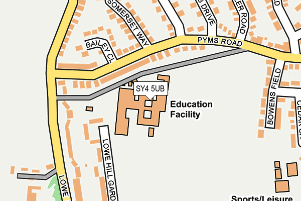
SY4 5UB is located in the Wem electoral ward, within the unitary authority of Shropshire and the English Parliamentary constituency of North Shropshire. The Sub Integrated Care Board (ICB) Location is NHS Shropshire, Telford and Wrekin ICB - M2L0M and the police force is West Mercia. This postcode has been in use since September 1981.


GetTheData
Source: OS OpenMap – Local (Ordnance Survey)
Source: OS VectorMap District (Ordnance Survey)
Licence: Open Government Licence (requires attribution)
| Easting | 350954 |
| Northing | 329315 |
| Latitude | 52.859092 |
| Longitude | -2.729880 |
GetTheData
Source: Open Postcode Geo
Licence: Open Government Licence
| Country | England |
| Postcode District | SY4 |
➜ See where SY4 is on a map ➜ Where is Wem? | |
GetTheData
Source: Land Registry Price Paid Data
Licence: Open Government Licence
Elevation or altitude of SY4 5UB as distance above sea level:
| Metres | Feet | |
|---|---|---|
| Elevation | 80m | 262ft |
Elevation is measured from the approximate centre of the postcode, to the nearest point on an OS contour line from OS Terrain 50, which has contour spacing of ten vertical metres.
➜ How high above sea level am I? Find the elevation of your current position using your device's GPS.
GetTheData
Source: Open Postcode Elevation
Licence: Open Government Licence
| Ward | Wem |
| Constituency | North Shropshire |
GetTheData
Source: ONS Postcode Database
Licence: Open Government Licence
| Bailey Close Jct (Pyms Road) | Wem | 83m |
| Bailey Close Jct (Pyms Road) | Wem | 98m |
| Adams School (Pyms Road) | Wem | 166m |
| Adams School (Pyms Road) | Wem | 181m |
| Pyms Road Jct (Lowe Hill Road) | Wem | 196m |
| Wem Station | 0.9km |
| Prees Station | 5.2km |
GetTheData
Source: NaPTAN
Licence: Open Government Licence
GetTheData
Source: ONS Postcode Database
Licence: Open Government Licence


➜ Get more ratings from the Food Standards Agency
GetTheData
Source: Food Standards Agency
Licence: FSA terms & conditions
| Last Collection | |||
|---|---|---|---|
| Location | Mon-Fri | Sat | Distance |
| Edstaston | 16:15 | 10:00 | 2,964m |
| Lee Bridge | 16:15 | 10:00 | 4,607m |
GetTheData
Source: Dracos
Licence: Creative Commons Attribution-ShareAlike
The below table lists the International Territorial Level (ITL) codes (formerly Nomenclature of Territorial Units for Statistics (NUTS) codes) and Local Administrative Units (LAU) codes for SY4 5UB:
| ITL 1 Code | Name |
|---|---|
| TLG | West Midlands (England) |
| ITL 2 Code | Name |
| TLG2 | Shropshire and Staffordshire |
| ITL 3 Code | Name |
| TLG22 | Shropshire |
| LAU 1 Code | Name |
| E06000051 | Shropshire |
GetTheData
Source: ONS Postcode Directory
Licence: Open Government Licence
The below table lists the Census Output Area (OA), Lower Layer Super Output Area (LSOA), and Middle Layer Super Output Area (MSOA) for SY4 5UB:
| Code | Name | |
|---|---|---|
| OA | E00147127 | |
| LSOA | E01028889 | Shropshire 008C |
| MSOA | E02006019 | Shropshire 008 |
GetTheData
Source: ONS Postcode Directory
Licence: Open Government Licence
| SY4 5UU | Pyms Road | 67m |
| SY4 5UR | Bailey Close | 134m |
| SY4 5UW | Somerset Way | 170m |
| SY4 5TZ | Lowe Hill Gardens | 177m |
| SY4 5TW | Somerset Way | 200m |
| SY4 5YN | Pyms Road | 200m |
| SY4 5UA | Lowe Hill Road | 210m |
| SY4 5YW | Davies Drive | 213m |
| SY4 5UT | Lowe Hill Road | 227m |
| SY4 5AP | Bowens Field | 232m |
GetTheData
Source: Open Postcode Geo; Land Registry Price Paid Data
Licence: Open Government Licence